

10 Hidden Gems on Iceland's South Coast
Iceland's South Coast is famous for a handful of spots everyone hits: Seljalandsfoss, Skógafoss, Reynisfjara. But there's a lot more hiding between them. Here are 10 places that show a different side of the region, from a canyon you actually walk through to a cave shaped like Yoda.
Some of these are quick stops right off the road. Others take a few hours, decent weather, and real hiking boots. A couple have also gotten popular enough that "hidden" is more about their location than an actual lack of people. One thing to clear up first: Foss á Síðu and Dverghamrar are two different places, even though they sit close together and get mixed up all the time online.
1. Nauthúsagil Ravine
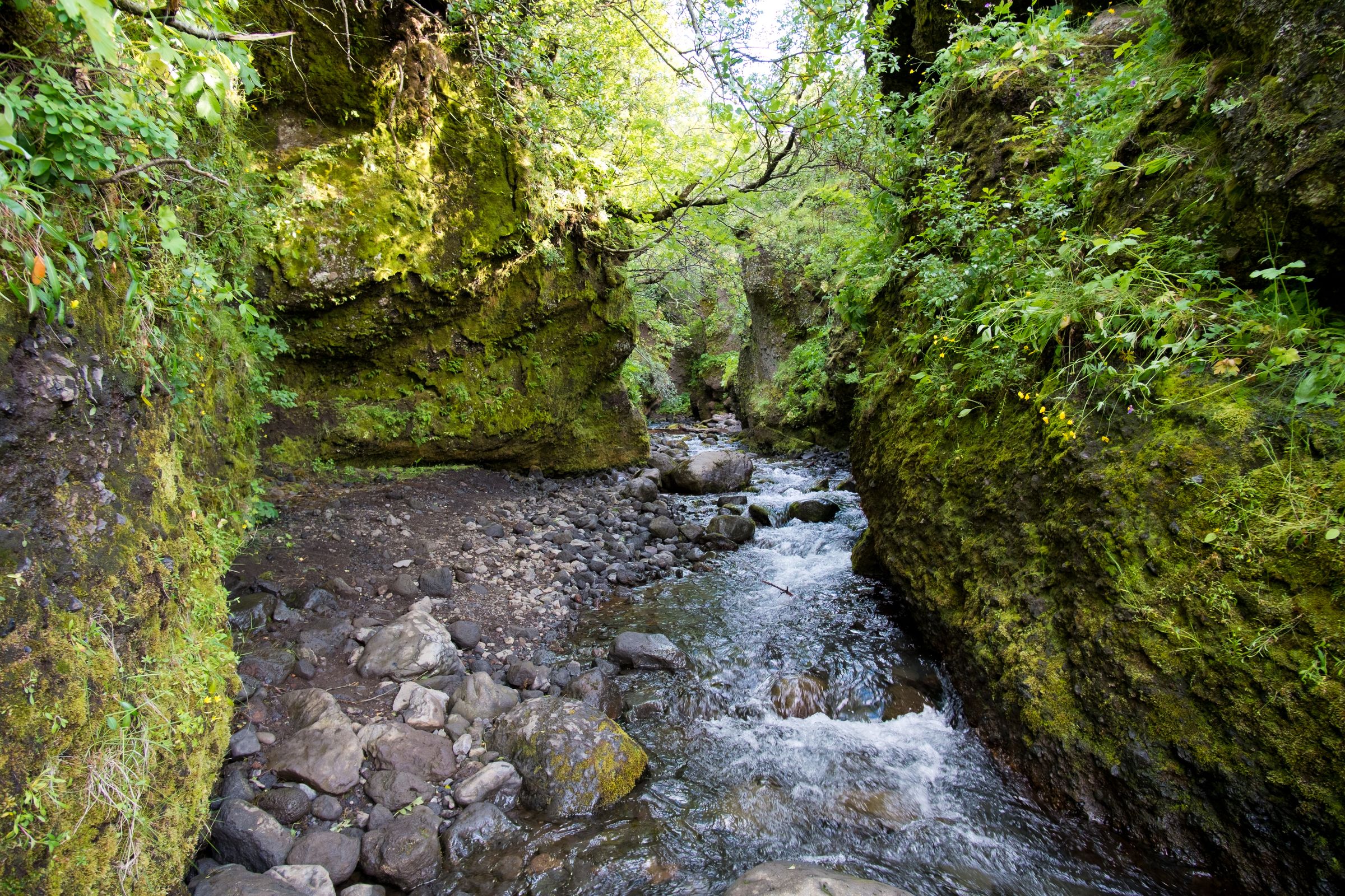
Nauthúsagil is a narrow canyon near Seljalandsfoss, covered in moss, with a waterfall tucked at the very end of it. The fun part isn't really the waterfall. It's getting there.
What to expect
You start off on an easy path, then the canyon tightens up and you'll cross the stream a few times over stepping stones, using chains bolted into the rock in one spot. I'd call this moderate, not easy. It's short, but wet rocks and cold water make it trickier than the distance suggests.
- Time needed: 45–90 minutes
- Difficulty: Moderate, with a chain-assisted scramble near the end
- Best season: Late spring through early autumn (winter ice makes this a bad idea)
- Good to know: Wear waterproof boots. Your feet might get wet anyway. And skip the jeans; they get heavy and cold once soaked.
Getting there
Nauthúsagil is inland off Route 1, near the turn toward Þórsmörk. Just search "Nauthúsagil" in your maps app instead of "hidden waterfall," and park at the recognized lot instead of pushing further toward the bigger river crossings.
Nearby: Seljalandsfoss, Gljúfrabúi, Eyjafjallajökull
2. Þakgil (Thakgil)
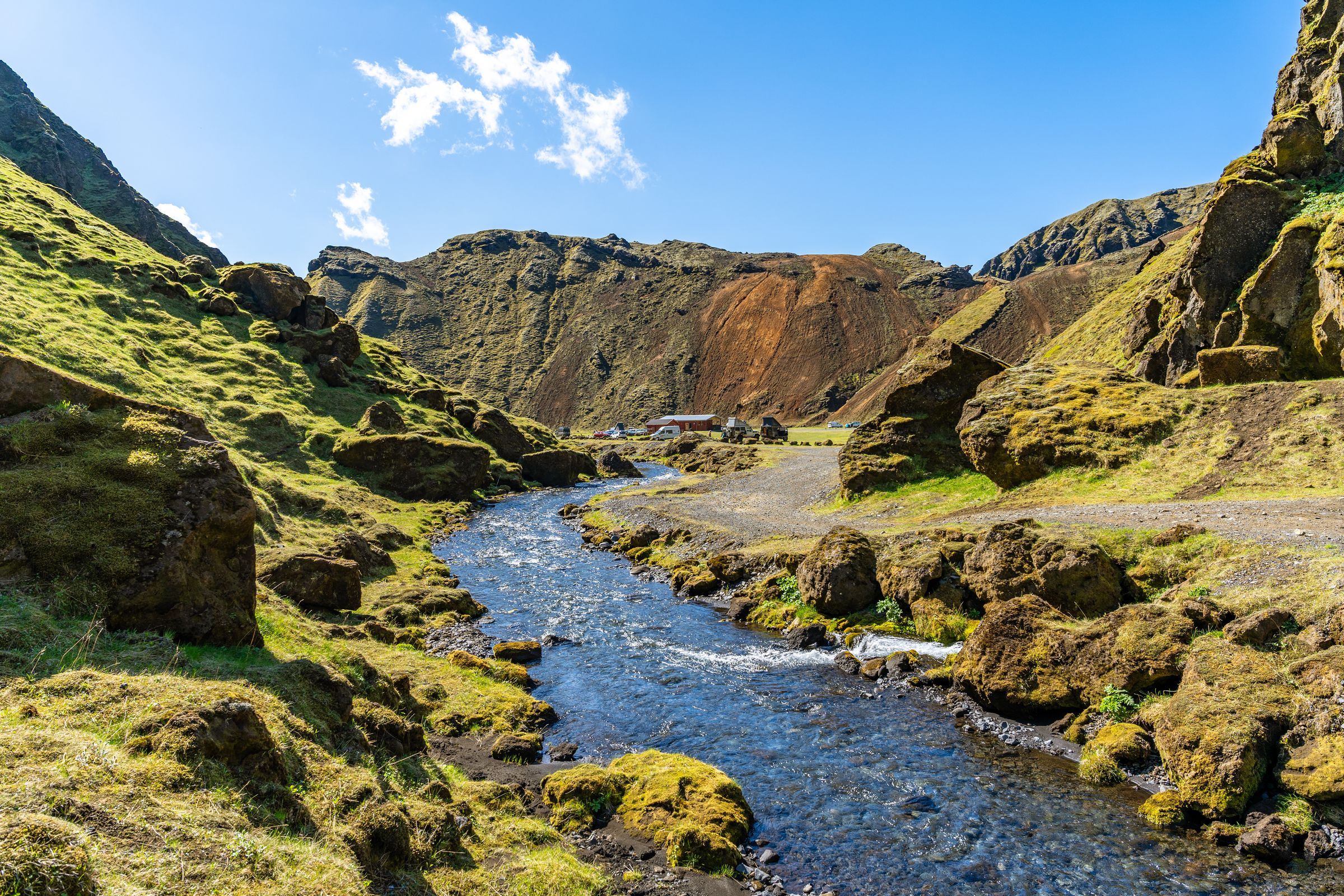
Þakgil is a green, sheltered valley northeast of Vík, right up against the edge of Mýrdalsjökull. It honestly feels like a different country compared to the black sand plains nearby.
Why it's worth the detour
Instead of open coastline, you get grassy ridges, small rivers, and a campsite people genuinely remember, complete with a cave used as a dining spot. If I had extra time on a South Coast trip, I'd carve out at least half a day for this one.
- Getting there: Road 214 from near Vík, about 20 km of gravel [ADMIN: verify current road opening dates]
- Time needed: Half a day for a short hike, up to two days if you camp
- Best season: June to September, since the road shuts down in winter
Things to do
- Camp at one of the most scenic campgrounds in Iceland
- Hike the marked trails toward Mælifell or Rjúpnagilsbrún
- Poke around the small caves and ravines
- Eat dinner in the cave shelter
A regular car can usually handle the road in good summer weather, but double-check your rental agreement first. It's still bumpy, narrow gravel.
Nearby: Vík, Reynisfjara, Dyrhólaey, Hjörleifshöfði, Yoda Cave
3. Múlagljúfur Canyon
Múlagljúfur is a deep canyon east of Skaftafell, and honestly, it might be one of the best hikes on the whole South Coast. It's just not talked about as much as it should be.
What makes it special
Think green gorge, a river winding way below you, waterfalls (Hangandifoss is the big one), and glacier views from Vatnajökull's outlet glaciers behind it all. You don't get the payoff from the road. You earn it by climbing above the canyon first.
- Distance: Roughly 5–8 km return
- Time needed: 2–3 hours
- Difficulty: Moderate, steep in spots, with canyon edges that have no barriers
- Best season: Late spring through early autumn
Practical tips
- The turnoff from the Ring Road (Route 1) is easy to blow past, search "Múlagljúfur Canyon parking"
- The parking costs 1000 ISK and it’s paid via the Parka app
- Bring hiking poles, the muddy and loose sections are no joke
- Stay well back from the edge. That outer lip can be soft or undercut without warning
Nearby: Fjallsárlón, Jökulsárlón, Diamond Beach, Skaftafell

4. Stjórnarfoss
Stjórnarfoss is a small, two-tiered waterfall near Kirkjubæjarklaustur. It's nowhere close to the height of Skógafoss, but the rounded, horseshoe shape and quiet setting make it worth the short stop anyway.
- Time needed: 15–45 minutes
- Difficulty: Easy, short walk from the lot
- Best season: Year-round, though winter ice can make the path slick
- Best light: Overcast days or early morning. Direct sun throws hard shadows on the dark rock
The pool looks tempting for a dip, but I wouldn't. Cold water, slippery rocks, and nobody watching make it more of a look-don't-touch spot.
Nearby: Kirkjubæjarklaustur, Systrafoss, Fjaðrárgljúfur, Foss á Síðu

5. Foss á Síðu
Foss á Síðu is a tall waterfall dropping off cliffs above a historic farm, about 10 km east of Kirkjubæjarklaustur. You'll see it called "Dverghamrarfoss" in a lot of places online, but that's not actually its name. Dverghamrar is a separate spot nearby.
What makes it different
Strong South Coast winds sometimes grab the falling water and blast it sideways, or even up. People call it a "reverse waterfall." It doesn't happen every time, so you might get lucky, or you might just see a regular waterfall.
- Time needed: 10–30 minutes for a roadside look
- Access: Visible right from Route 1, no official trail up top
- Best season: After rain or snowmelt, when there's more water flowing
The land below is a working farm, so use the pull-off and don't wander into the fields chasing a better photo.
Nearby: Dverghamrar, Stjórnarfoss, Kirkjubæjarklaustur

6. Dverghamrar (Dwarf Cliffs)
Dverghamrar is a small cluster of columnar basalt just east of Foss á Síðu. The name means "Dwarf Cliffs," and it's one of the better roadside examples of this kind of rock, without the crowds you'd find at the bigger sites.
The geology and the legend
The columns formed as cooling lava cracked and contracted, mostly into six-sided shapes, though not every column plays by that rule. Icelandic folklore links the site to dwarfs and hidden people, which is a fun detail to know, even if it's tradition rather than fact.
- Time needed: 20–45 minutes
- Difficulty: Easy, short path from the parking area
- Good to know: It's protected, so stay off the columns and stick to the path
Nearby: Foss á Síðu, Stjórnarfoss, Kirkjubæjarklaustur

7. Hjörleifshöfði
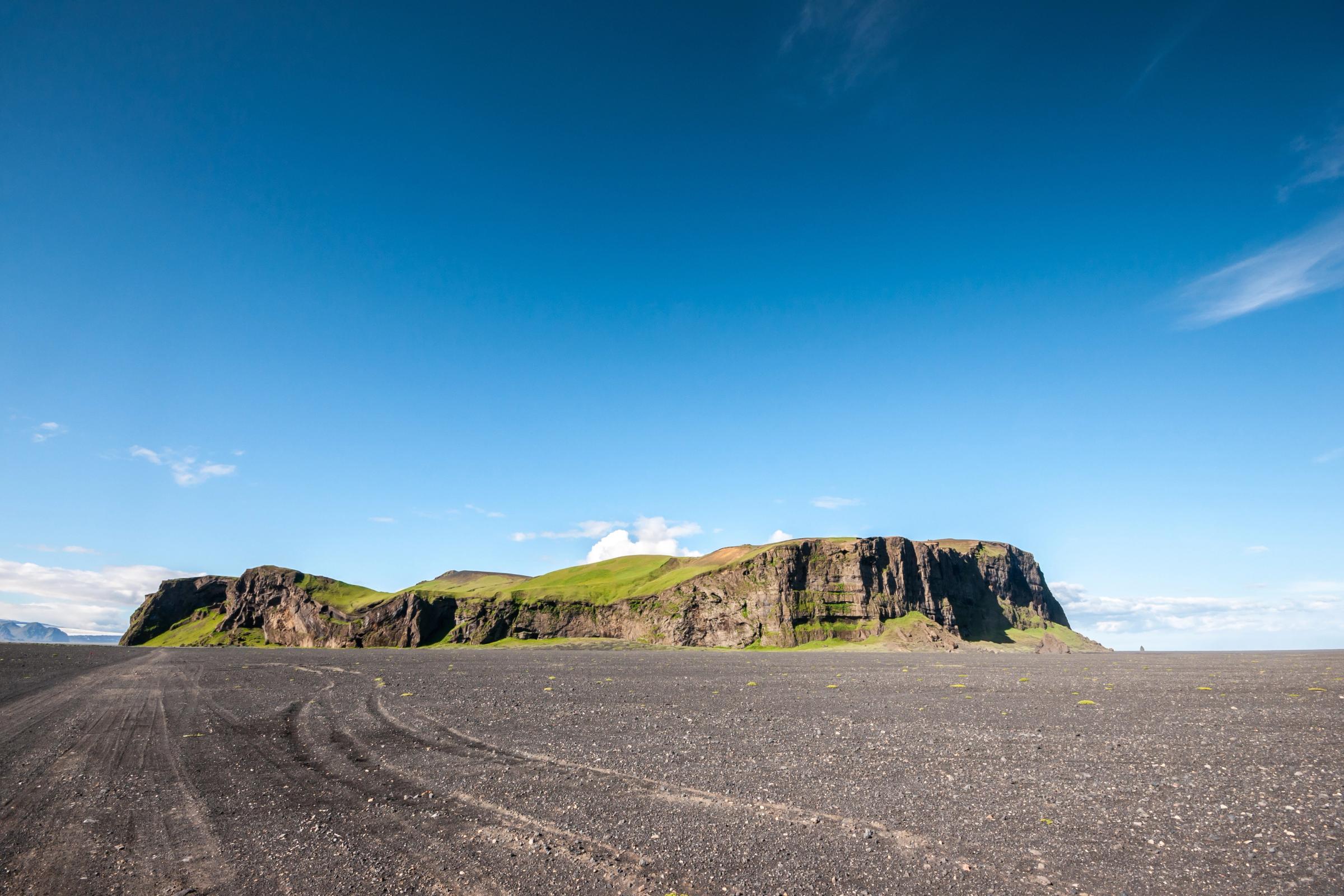
Hjörleifshöfði is a 221-metre volcanic headland sticking out of the black sands of Mýrdalssandur, east of Vík. It used to sit right by the sea before volcanic floods built up the plain around it.
History and the hike
The headland is named after Hjörleifur Hróðmarsson, a Norse settler and companion of Ingólfur Arnarson. According to the Book of Settlements, he was killed here, and his burial mound is supposedly on the summit. Can't say how accurate that story really is after all these centuries, but it's a good bit of context while you climb.
- Time needed: 2–4 hours
- Difficulty: Easy to moderate, a steady climb with an exposed summit
- Best season: Spring through autumn
- Watch for: Strong wind up top, the slopes are exposed
The views from the summit, over Mýrdalssandur and toward Mýrdalsjökull, are worth the climb on their own, in my opinion.
Nearby: Yoda Cave, Vík, Reynisfjara, Þakgil
8. Yoda Cave (Gígjagjá)
Gígjagjá sits at the base of Hjörleifshöfði, and it got its nickname from a strange little optical trick: stand inside and look back at the entrance, and it looks exactly like Yoda's head, ears and all.
Getting the shot
You've got to move around a bit to find the exact spot where it clicks. It's completely natural too, the cave wasn't shaped for any movie, even though the area around it is tied to Rogue One.
- Time needed: 30–60 minutes
- Access: Gravel track around Hjörleifshöfði, rougher toward the end
- Best time: Morning or evening for softer light and fewer people around
It's more of a quick stop than a destination by itself, so pair it with Hjörleifshöfði or Vík instead of driving out just for the cave alone.
Nearby: Hjörleifshöfði, Reynisfjara, Vík, Dyrhólaey

9. Sólheimasandur Plane Wreck
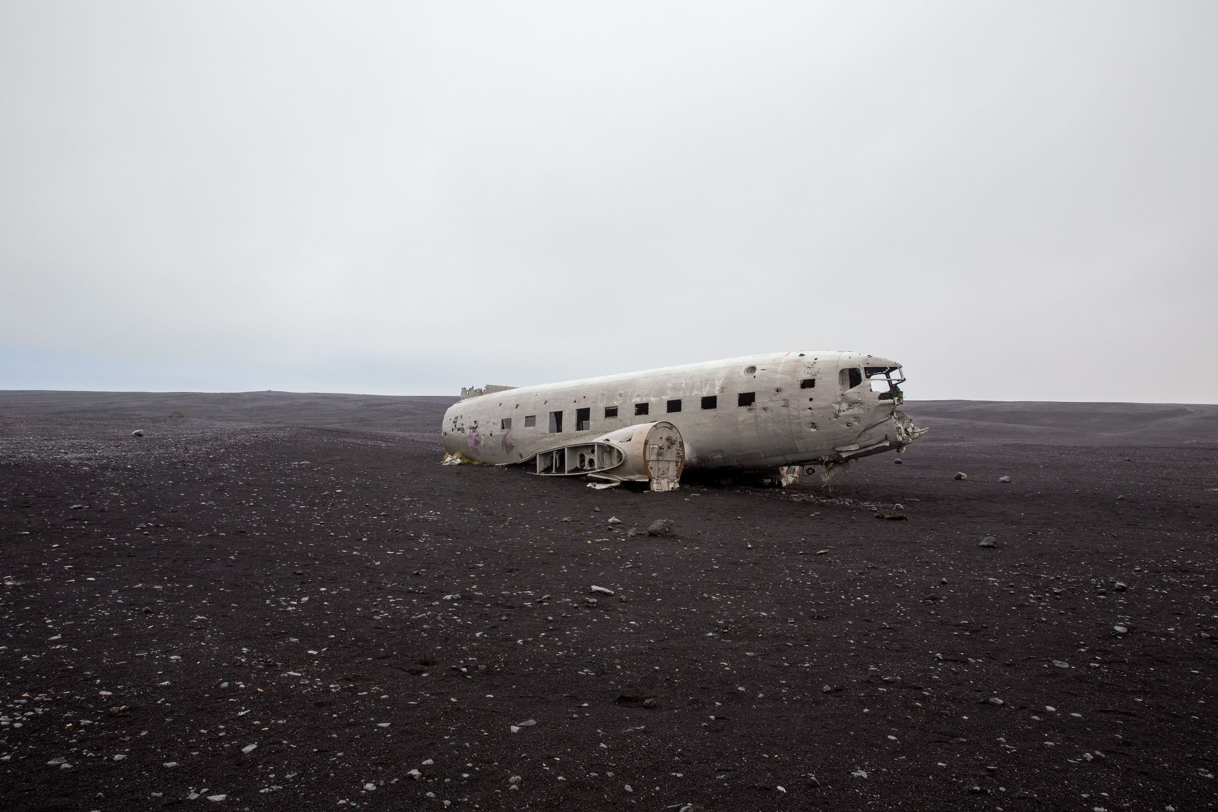
This is what's left of a US Navy Douglas C-117D, part of the DC-3 family, that made an emergency landing on the black sand plain back in 1973. Everyone on board walked away fine, and the stripped fuselage has just been sitting there since.
Getting to the wreck
You can't drive up to it anymore. You can either walk about 4 km each way, or hop the shuttle from the parking lot.
- Time needed: 1–3 hours walking, or around an hour with the shuttle
- Difficulty: Easy underfoot, but exposed with barely any shelter from the wind
- Best time: Early morning or late evening to dodge the crowds, as long as you've still got daylight for the walk back
Dress warm even in summer. There's nothing to block the wind out there. And please, don't climb on the wreck. The metal's old and weak, and every climb just speeds up the damage.
Nearby: Skógafoss, Kvernufoss, Sólheimajökull, Dyrhólaey
10. Loftsalahellir Cave
Loftsalahellir is a shallow tuff cave on Geitafjall, near Dyrhólaey. Unlike Yoda Cave, this one isn't really about the cave itself, it's about the view it frames.
What you'll see
From inside, the opening frames Dyrhólaey, the Dyrhólaós wetlands, and the Atlantic coastline like a natural window. Locally, it's said farmers once used it as a gathering spot to talk over community matters, which adds a nice bit of history to the stop.
- Time needed: 45–90 minutes round trip
- Difficulty: Short but uphill, grassy and sometimes muddy
- Best time: Sunrise or sunset
Since Dyrhólaey is an important bird area, keep the noise down and stick to the path, especially during nesting season.
Nearby: Dyrhólaey, Reynisfjara, Vík, Reynisdrangar

Final thoughts
These 10 spots give you a different side of the South Coast than the postcard version most people see. You've got canyons, a volcanic headland, quiet waterfalls, and one very famous plane wreck, all without fighting the same crowds as Skógafoss or Reynisfjara. My advice: don't try to cram all 10 into one rushed day. Pick the ones that fit your energy and the weather you're handed, and leave room to change plans if a road or trail turns out rougher than you expected.
