Dverghamrar: Iceland's Dwarf Cliffs
Dverghamrar is a small stop in South Iceland with big basalt columns, good folklore, and a loop trail you can do in 20 minutes. Here's everything you need to know before you get there.
Key Takeaways
- Dverghamrar is a quick stop with big basalt columns and a short walking loop. Most people spend about 20 to 30 minutes here.
- It’s easy to reach from Route 1. You don’t need a 4x4, and the parking area is right by the trail.
- The rock formations are the main reason to stop. You can clearly see the tall basalt columns below and the rougher rock sitting above them.
- There are no toilets, food, or other facilities at the site. Use Kirkjubæjarklaustur for fuel, food, and bathrooms.
- It’s best added to a wider South Coast route. Foss á Síðu, Fossálar, Kirkjugólf, Stjórnarfoss, and Skaftafell are all easy to combine with it.
What Is Dverghamrar: Is It Worth the Stop?
From the road, Dverghamrar doesn't look like much. You see a bit of dark rock sticking up out of flat farmland, and if you're not paying attention, you'll drive right past it.
Don't.
Once you walk between the formations, you're looking at large basalt columns up to a meter wide, with a completely different type of rock sitting above them. Two textures, one lava flow, frozen in place. It's small, it's free, and it takes 20 minutes. It's one of the easiest geology stops on the whole South Iceland stretch of Route 1.
What Makes It Stand Out
Dverghamrar has been a protected natural monument since 1987. What makes it worth stopping isn't the size. It's how easy it is to actually see what happened here. There are two things that make this stop worth your time:
- The geology: You can see exactly how different parts of a lava flow cool at different rates, and the result is right in front of you, close enough to touch.
- The folklore: The name means "Dwarf Cliffs" in Icelandic, and people have been telling stories about supernatural beings living in these rocks for a long time. One story from 1904 involves a girl who heard singing coming from the formation with no one in sight. That tends to stick with you even if geology isn't your thing.
Who This Stop Is Best For
Dverghamrar is a good fit if you're into volcanic rocks, landscape photography, or Icelandic folklore. It also works as a simple driving break. It's not the right stop if you want a long hike, a big canyon, or proper visitor facilities.

Dverghamrar at a Glance
Dverghamrar is in the Síða district of South Iceland, in the municipality of Skaftárhreppur, right beside the Ring Road (Route 1). It sits roughly 10–15 km east of Kirkjubæjarklaustur, just past the waterfall Foss á Síðu. The protected area covers 2.14 hectares.
- Icelandic name: Dverghamrar
- Translation: Dwarf Cliffs / Dwarf Rocks
- Location: South Iceland, Síða district, beside Route 1
- Distance from Kirkjubæjarklaustur: Approx. 13 km (8 miles) east
- Protected since: 1987
- Protected area: 2.14 hectares
- Typical visit: 20–30 minutes
- Access: Short loop from the parking area, no F-road required
- Entrance fee: No fee
- Best combined with: Foss á Síðu, Fossálar, Kirkjubæjarklaustur
How to Get to Dverghamrar
Getting here is easy. It's one of the most straightforward stops on this stretch of Route 1.
Driving Directions
From Kirkjubæjarklaustur, head east on Route 1. After about 13 km (8 miles), you'll pass the Foss á Síðu farm and waterfall on your left. Dverghamrar is just east of that. Look for the marked parking area on the south side of the road.
Don't slow down suddenly on Route 1 or try to pull off anywhere other than the proper entrance. The road gets regular traffic including rental cars and coaches, and stopping in the lane is dangerous.
Parking and Road Access
There's a parking area right at the site. You don't need a 4x4 or any special vehicle. No F-road, no river crossing, nothing like that. Any regular car works. The turnoff from Route 1 is short and easy to navigate.
Nearby Towns and Services
Kirkjubæjarklaustur is the closest town and your best bet for anything you need: fuel, restaurants, places to stay, groceries, and public toilets. I'd sort all of that before heading to Dverghamrar, because the site itself has none of it.
Winter Driving Considerations
Route 1 is a main road, but it still gets icy in winter and visibility can drop fast. If conditions are rough when you reach this area, skip Dverghamrar and come back later. The parking area can be icy and the path to the rocks can be slippery. Check road.is before you leave.

What to See and Do
You won't be here for hours. But there's more to look at than you'd expect for a place this size.
Walk Around the Basalt Cliffs
The short loop from the parking area takes you through and around the formation. As you walk between the two main outcrops, the columns gradually come into view. From the parking side, the rocks can look like a low grassy mound. Once you get inside, the columns open up around you.
Examine the Basalt Columns Up Close
This is where it gets genuinely interesting. Individual columns here can reach about a meter across, which is unusually wide for this type of rock. You can walk right up to them and see the joints clearly.
Not every column is a perfect hexagon, by the way. You'll see 5-, 6-, and 7-sided columns in the same wall, with irregular joints mixed in. That's just how it works. It's not a flaw. It's the geological record.
See the Contrasting Upper Rock
Look up at the top of the cliffs. The rock there looks totally different from the columns below: more broken, irregular, blocky. In Icelandic it's called kubbaberg, which translates roughly to hackly jointed or cube-jointed basalt. It formed because the upper part of the lava flow cooled faster and less evenly than the inside. So you get two completely different textures from the same lava body. Dverghamrar is one of the clearest places to see this from a roadside in Iceland.
Photograph the Formation and Landscape
If you position yourself inside the formation, you can frame Foss á Síðu in the distance between the basalt walls. The dark rock against the surrounding farmland makes for a good photo, especially in summer when the grass is green or in winter when snow lines the columns.
Practical Visitor Information
It's a simple site to visit, but a few things are worth knowing before you show up.
Trail Length and Difficulty
The loop starts at the parking area and takes most people 15–25 minutes at a normal pace. There's no real elevation gain and no hiking involved.
That said, the ground isn't perfectly smooth. Expect some mix of:
- Compacted gravel and grass
- Uneven ground and exposed stones
- Mud after rain
- Snow or ice in winter
Terrain and Footwear
Solid, waterproof shoes are the way to go. You don't need hiking boots, but I wouldn't show up in flat sneakers either, especially after rain or in winter when grip really matters.
Accessibility
According to the management plan for 2019–2028, Dverghamrar was not wheelchair accessible at the time it was written.
You can get a partial view of the columns from near the parking area, but to see them properly you need to follow the path in.
Facilities, Toilets, and Food
There are no permanent toilets, no café, no visitor center, and no drinking water at the site. The management plan mentioned possible facilities outside the protected area, but a plan isn't the same as something that's been built. Don't count on anything. Use Kirkjubæjarklaustur.
Entrance and Parking Fees
No entrance fee is advertised right now. Parking is generally described as free in current sources, but that can change. Check the signs when you arrive.
Rules for Drones, Climbing, and Rock Removal
A few things that actually matter here:
- Drones: You need permission from Iceland's nature conservation authority to fly a drone inside the protected area. Don't assume it's okay just because the site is small and open.
- Climbing: Don't climb the columns. The basalt has natural cracks and can have loose sections. It can also cause real damage to a protected site.
- Rock removal: Don't take rocks. It's a protected natural monument.
- Paths: Stay on the marked route. The surrounding land is private farmland, and the protected area has grassland with its own conservation value.
Best Time to Visit
You can visit any time of year, but what you'll experience changes quite a bit by season.
Summer Conditions and Daylight
Summer is the easiest time to go. The grass is green, there's daylight almost around the clock, and the paths are easy to walk. You'll get the sharpest contrast between the dark basalt and the landscape around it. The downside is that it's the busiest time on the South Coast, though Dverghamrar never gets anywhere near the crowds you'd see at Seljalandsfoss or Skógafoss.
Spring and Autumn Advantages
Both spring and autumn give you softer light and fewer people on the road. If you ask me, late summer or early autumn is the best time for this kind of stop. The lower sun angle adds a lot of texture to the column faces. Just know that spring ground can be soft and muddy after the thaw, and autumn gets wetter and windier fairly quickly.
Winter Access and Safety
Snow can make the columns look really good. The dark basalt shows up well against white. But the parking area can be icy, path edges get buried under snow, and daylight is short. If you're on a winter Ring Road trip and conditions look okay, it's worth a quick stop. If the weather is rough, just move on.

Best Time of Day for Photography and Fewer Visitors
Overcast days are actually great for shooting dark basalt. The soft light gets into the column joints and shows the texture without harsh shadows. Personally, I'd aim for morning or evening if you want more directional light and stronger texture on the column faces. Midday in summer is when you're most likely to share the parking area with other people.
Geology and Folklore
This is a place where the geology and the local stories feed into each other, and both are worth knowing about before you visit.
How Cooling Lava Formed the Basalt Columns
The process is called columnar jointing. It's worth knowing because it's literally what you're looking at when you stand there. Here's how it works:
- Basaltic lava was erupted across the area and started to harden
- As the solid rock kept losing heat, it shrank
- Pressure built up until cracks formed and spread through the cooling rock
- Those cracks divided the basalt into long, many-sided columns
- The columns grew at a right angle to the cooling surface, which is why they stand upright in a flat lava flow
The inside of the flow cooled more slowly, which is what produced the neat, regular columns you see in the lower section. The top of the same flow cooled faster and less evenly, producing the irregular, blocky kubbaberg above. One lava flow, two cooling zones, two completely different looks.
When the last Ice Age ended, sea levels were higher relative to this part of Iceland than they are today. Waves came in and reshaped the cliffs. The sea didn't make the columns. The cooling did. But the wave erosion helped expose them and gave the cliffs the shape they have now.
Why the Columns Are Often Hexagonal
When shrinkage cracks spread through cooling rock, they tend to meet at roughly 120-degree angles. That pattern spreads stress evenly and tends to produce six-sided columns. You'll also find five- and seven-sided ones in the same formation. Natural basalt isn't a factory product. The variation is completely normal.
How Glacial and Marine Erosion Shaped the Cliffs
The end of the last ice age was a complicated time for this part of Iceland. Two things happened at once:
- Melting ice added water to the oceans, raising sea levels
- The land that had been pushed down by heavy glaciers started bouncing back up
For a while, sea level was higher here than it is today. Waves wore down the weaker rock, exposed the tougher columnar sections, and shaped the cliff faces into the curved, partly enclosed formation you see now. Dverghamrar isn't just a volcanic formation. It has fire, ice, and ocean all written into it.
What "Dverghamrar" Means
The name combines dvergur (dwarf) and hamrar (cliffs or crags). The most common translations are "Dwarf Cliffs" or "Dwarf Rocks," and the plural form refers to the whole group of outcrops, not a single rock.
Stories About Dwarfs and Mysterious Singing
Local folklore says dwarfs live inside the rocks, and the name says it too. The best-known story involves a girl who, in 1904, heard singing coming from the formation while tending sheep nearby. No one was visible. The song was described as a Christian hymn.
Details vary depending on who's telling the story, and it's folklore rather than documented history. But it's worth knowing that in Icelandic tradition, dwarfs and elves aren't the same thing, even though a lot of travel writing uses them interchangeably. The name Dverghamrar specifically points to dwarfs.

Nearby Attractions
One good thing about Dverghamrar is how easily it fits into a South Iceland day. A few solid stops are close by and can be combined without much extra time.
Foss á Síðu
Foss á Síðu is just west of Dverghamrar. You'll actually pass it on the way there. It's a waterfall that drops from a long line of cliffs above the Foss farm, fed by the lake Þórutjörn. In strong wind, it can get pushed sideways or even appear to blow upward, which is worth watching if it happens. The farm is private land, so stick to the roadside or designated stopping spots.

Fossálar
Fossálar is another small waterfall and river area close to Dverghamrar. Iceland's site management plan groups Foss á Síðu, Fossálar, and Dverghamrar together as a natural cluster of nearby stops. Each one is quick, but together they make for a satisfying short stretch of the drive.

Kirkjubæjarklaustur and Kirkjugólf
Kirkjubæjarklaustur is the nearest town with services, and it also has a few good things to see. Kirkjugólf is probably the best one to pair with Dverghamrar. There, erosion has exposed the tops of basalt columns at ground level, creating a pattern that looks too neat to be natural, but it actually is. Together, the two sites show the same columnar structure from different angles: Kirkjugólf shows you the tops, Dverghamrar shows you the sides.
Other things to see in and around Kirkjubæjarklaustur:
- Systrafoss waterfall
- Systravatn lake
- Systrastapi rock formation
- Stjórnarfoss waterfall


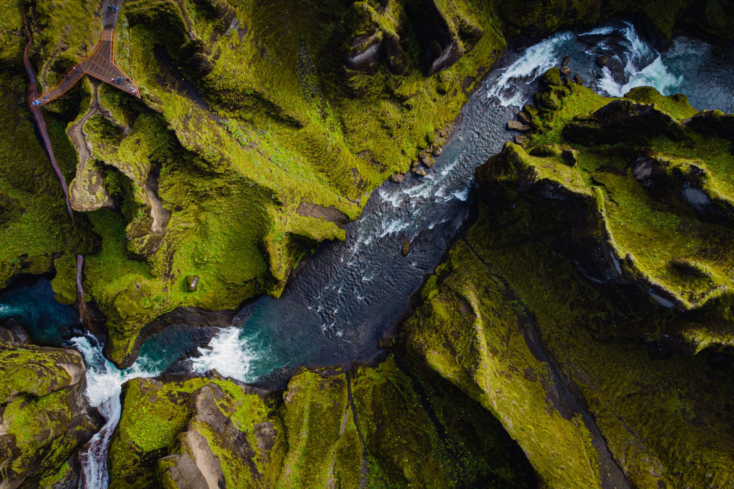
Fjaðrárgljúfur Canyon
Fjaðrárgljúfur is about 21 km (13 miles) west and is a much bigger, busier stop. It's a deep river canyon with viewpoints along the top and a longer walk involved. If you could only do one, I'd go with Fjaðrárgljúfur for the bigger visual payoff. But Dverghamrar is quieter and gets you much closer to the actual rock.
Eldhraun Lava Field
Eldhraun was created during the Laki eruption of 1783–1784, one of the biggest volcanic events in Icelandic history. It's not right next to Dverghamrar, but it's part of the same broader volcanic landscape tied to the Laki volcanic system. Both sites show basaltic volcanism in South Iceland, just from different eruptions and different time periods.

Skaftafell and Svartifoss
Skaftafell is roughly 56 km (35 miles) east and has been part of Vatnajökull National Park since 2008. There's a much bigger trail network there, including routes to Svartifoss, a waterfall framed by dark hanging basalt columns that look a lot like what you see at Dverghamrar. If you're heading east toward Jökulsárlón or Höfn, Dverghamrar makes a natural quick stop before you reach Skaftafell.

Essential Travel Tips
A few things worth knowing before you head out.
Check road conditions before you leave. Road.is is the official source for Route 1 and Iceland road closures. Always check it before heading out, especially in winter or shoulder season.
- Check weather and road conditions: South Iceland is exposed. Strong winds and fast-changing weather are normal. A clear morning can turn wet and windy by afternoon.
- Stay on marked paths: The site is protected and the land around it is private farmland. Going off the trail can damage grassland that has its own conservation value, and you could end up on someone's property.
- Leave everything as you found it: Don't build cairns, remove rocks, carve anything, or cut across soft ground. Icelandic soil is thin and slow to recover.
- Allow extra time in winter: Ice on the parking area, hidden path edges, and short daylight can all slow things down. Give yourself buffer time and be ready to skip the stop if conditions look bad.
- Pair it with nearby stops: Dverghamrar is a 20–30 minute stop. It's not a full-day destination on its own. I'd combine it with Foss á Síðu, Kirkjugólf, and Fossálar for a good local cluster.
- Don't stop on Route 1: Use the entrance and parking area. The road carries regular traffic and stopping in the lane is dangerous.
Conclusion
Dverghamrar isn't going to be the thing you tell everyone about when you get home from Iceland. It's not Jökulsárlón. It's not Seljalandsfoss. It's a 20–30 minute stop beside Route 1 that shows you up close how basalt forms, cools, and gets reshaped over thousands of years.
The geology is easy to read here in a way it isn't at bigger sites where scale gets in the way. The folklore is interesting. And the combination of wide columns, contrasting upper rock, and a framed waterfall view in the distance makes it more worth stopping for than it looks from the road.
If I were building a South Coast driving day, Dverghamrar would be on the list. Not as the headline stop, but it earns its place. Pair it with Foss á Síðu and Kirkjugólf, stay on the path, and you'll leave with a better sense of the volcanic landscape you've been driving through all day.
Frequently Asked Questions