

Stjórnarfoss Waterfall: Complete Visitor Guide
Stjórnarfoss is one of South Iceland's most rewarding short stops. It's a compact, two-tier waterfall on the Stjórn River near Kirkjubæjarklaustur, and it takes about 20 to 40 minutes to visit.
This guide covers everything you need to know: how to get there, what to expect, when to go, and which nearby attractions are worth combining into the same day.
Key Takeaways
- Stjórnarfoss is a small waterfall near Kirkjubæjarklaustur that only takes about 20 to 40 minutes to visit.
- The walk from the parking area is very short, but the ground can be wet, muddy, or slippery, especially in winter.
- You usually don’t need a 4x4 for the lower access road, but check the road conditions before driving farther inland.
- There are no proper facilities at the waterfall. Use the toilets, buy food, and fill up with fuel in Kirkjubæjarklaustur before you go.
- It’s best added to a wider South Coast route, together with places like Fjaðrárgljúfur, Kirkjugólf, Systrafoss, Foss á Síðu, or Dverghamrar
Planning Your Visit
Stjórnarfoss doesn't need a lot of planning, but a few basics will make your stop much smoother. Here's what you need to know before you go.
Stjórnarfoss at a Glance
Here are the key facts. Some details, like admission and facilities, can change, so it's worth double-checking before you travel.
- What it is: A compact, two-stage waterfall on the Stjórn River
- Location: Beside Kleifar, roughly 2 to 2.5 km north of Kirkjubæjarklaustur, South Iceland
- Municipality: Skaftárhreppur
- Coordinates: Approximately 63.7999° N, 18.0613° W
- Access road: Geirlandsvegur, Road 203
- Approximate height: Around 10 to 15 meters, depending on how the tiers are measured
- Walk from parking: Roughly 100 to 200 meters
- Typical visit: 20 to 40 minutes
- Admission: Free
- Toilets: Possibly available at the nearby seasonal Kleifar campsite, not confirmed year-round
- 4x4 required: Not normally for the short lower approach, but check current road conditions

Best Time to Visit
There's no single best month. It really depends on what you're after.
Summer (June to August) is the most practical window. Daylight lasts almost around the clock, the vegetation is green, and the path is at its easiest. The Kleifar campsite is also most likely to be open, which means facilities are nearby. You may see other visitors, but nothing like the crowds at Skógafoss or Seljalandsfoss.
Autumn (September to October) brings softer light and fewer people. Days get shorter fast, and rain and wind become more of a factor, but the mood around the waterfall can feel more dramatic.
Spring (May to early June) can bring stronger water flow from snowmelt. Paths may still be wet or icy though, and some facilities may not have opened for the season yet.
Winter (November to March) is the trickiest period. Snow and ice can make the approach slippery, daylight is short, and the access road may not be maintained as well as the main Ring Road. It can look great in winter, but you need to check conditions before going. Always consult the Icelandic Meteorological Office and SafeTravel Iceland before a winter visit.
Overcast days are often better for photographing Stjórnarfoss than bright, sunny ones. The canyon walls cast deep shadows in direct sunlight, making it harder to capture the waterfall evenly. On cloudy days, the light is softer and more even, bringing out the colors of the water and the dark basalt without the harsh contrast.

How Long to Spend
For most people, 20 to 40 minutes is plenty. That gives you time to walk to the main viewpoint, take some photos, and enjoy the spot before heading back to the Ring Road.
If you're into photography and want to play around with long exposures or wait for the light to change, plan for closer to an hour. If you want to really take your time, scout out different spots, set up a tripod, and wait for people to clear the frame, give yourself 45 to 90 minutes.
What to Pack
The walk is short, but conditions near the river can catch you off guard.
- Waterproof jacket and an extra warm layer
- Footwear with solid grip, not smooth-soled street shoes
- Lens cloth and rain cover if you're bringing a camera
- Traction aids in winter
- Everything you need for the day, since there's no food or shop at the site
Location and How to Get to Stjórnarfoss
Stjórnarfoss sits beside Kleifar, just north of Kirkjubæjarklaustur in South Iceland, sometimes also described as part of the Southeast Iceland corridor. The village, often shortened to Klaustur, sits directly on Route 1, Iceland's Ring Road. The waterfall isn't visible from the main road, so you reach it by a short side trip.
Driving Directions
Getting there is straightforward. Here's the sequence:
- Reach Kirkjubæjarklaustur on Route 1, roughly 260 km (161 miles) east of Reykjavík and about 70 km (43.5 miles) east of Vík
- Turn north onto Geirlandsvegur, the road toward Geirland and Kleifar
- Drive approximately 2 km (1.25 miles)
- Park near the Kleifar campsite or the established access area, without blocking the road, a gate, or any farm access
- Walk about 100 to 200 metres to the lower viewpoint
The drive from central Kirkjubæjarklaustur takes around five minutes. If you're staying in the village, you can also walk the whole way in about 25 to 35 minutes each way.
Road 203 or F203?
This is one of the more confusing things about Stjórnarfoss. Local tourism information labels Geirlandsvegur as F203, while many travel sites call it simply Road 203. Normally, Icelandic F-roads are mountain roads that need a 4x4. For the short lower section leading to the waterfall, most visitors in ordinary rental cars have no issues.
That said, the road continues farther inland beyond the waterfall, and conditions there can be more demanding. I'd check the official Icelandic road-condition service on your travel date rather than relying on what a blog post says. The easy stretch near the village tells you nothing about what the road is like farther up.
Parking
Parking near Stjórnarfoss is small and informal. Visitors generally leave their car near the Kleifar campsite, the bridge, or a pull-off in the established access area. There's no big paved car park like you'd find at Gullfoss or Seljalandsfoss.
Use an obvious, established spot. Don't park on soft vegetation, block the road, or stop in a way that prevents farm or campsite traffic from getting through.

What to See and Do
Stjórnarfoss isn't a full-day destination, but there's more to it than a quick photo and a walk back to the car.
The Waterfall Itself
Stjórnarfoss has two distinct stages. The upper section comes down through a narrow channel between steep rock formations. The lower section is the one you'll see in every photo: the water spreads across a curved rock ledge and fans out into a broad, even curtain before falling into the pool below.
What makes it stand out isn't height. It's shape. The water wraps around the rounded volcanic rock face and splits into dozens of thin streams, creating an almost symmetrical look that photographs really well. The surrounding cliffs form a small natural amphitheatre, with dark volcanic rock and moss making for strong contrast against the white water.
A few things worth knowing about the two-tier structure:
- The upper tier is hard to see from the standard lower viewpoint. Most classic photographs show only the lower fall.
- Aerial images reveal more of the complete two-stage descent.
- This also explains why published height figures range from about 10 to 15 metres depending on what's being measured.
The Pool and Swimming
Below the lower cascade, the Stjórn River forms a clear pool framed by gravel and rounded stones. Local tourism information for the Kleifar area says bathing may be possible during warm summer weather, and some visitors do swim here.
That said, this is not a geothermal pool. The water is cold. Even on a sunny summer day, only the very surface or the shallow edges warm up noticeably. If you're thinking about a dip, check the conditions yourself on the day: look at the flow, check the temperature, find a safe entry and exit point, and don't go in alone.
Cold-water shock is a real risk. Don't swim in these conditions:
- The river is visibly high
- Heavy rain has fallen recently
- The water is carrying debris or looks discolored
- You can't find a clear, safe exit point
- You're alone
There's no lifeguard, no designated swimming area, and no controlled access.
Photography
Personally, I'd say Stjórnarfoss is one of the better short-stop photography spots for waterfall lovers on the South Coast. The natural framing from the cliff walls does a lot of the compositional work for you.
Here's a quick breakdown of what works well:
Composition
- The standard shot frames the lower cascade centrally using the river or stony bank as a foreground
- A wide-angle lens (16-35 mm) captures the full amphitheatre
- A longer lens (70-200 mm) lets you isolate individual streams or details in the rock
Filters
- A neutral-density filter gives you the silky water effect in daylight during longer exposures
- A circular polarizer helps cut glare on the pool and reveals the stones beneath the surface
One thing worth knowing: those smooth, silky waterfall images you see online are a photographic effect from a slower shutter speed. That's not what the water actually looks like to the eye. The real waterfall is white and textured, which is equally worth shooting.

Nearby Attractions
Stjórnarfoss works best as part of a broader stop in the Kirkjubæjarklaustur area. The village and its surroundings have a good number of interesting spots within easy reach.
A practical sequence worth considering: start at Fjaðrárgljúfur, then move on to Kirkjugólf, then Systrafoss, then Stjórnarfoss, and then head east toward Foss á Síðu and Dverghamrar before continuing toward Skaftafell.
Systrafoss
Systrafoss is a separate waterfall directly above Kirkjubæjarklaustur, fed by the river Fossá flowing down from the lake Systravatn. Its name means "Sisters' Waterfall" and ties into the former convent history of the village. It usually appears as two narrow streams coming down from the plateau, but its flow can vary a lot. During dry periods it can look pretty weak.
Don't mix it up with Stjórnarfoss. They're different waterfalls, on different rivers, in different settings entirely.

Kirkjugólf
Kirkjugólf, which translates as "Church Floor," is a protected natural feature made up of the exposed tops of basalt columns. From above, the regular pattern looks so even that it's easy to think it's man-made paving. It isn't. It's a great five-minute stop just outside the village.

Fjaðrárgljúfur
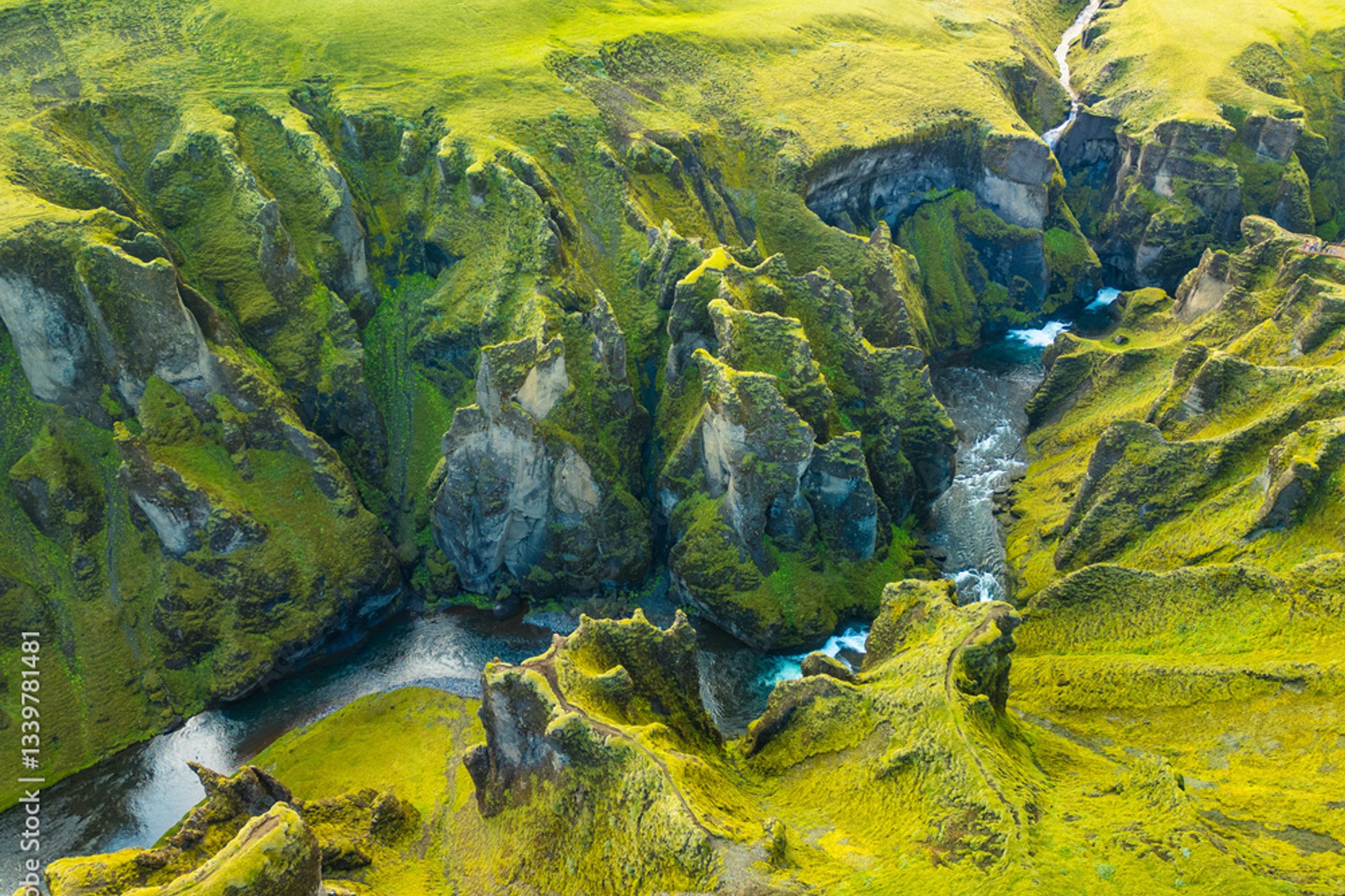
This is a dramatic canyon west of Kirkjubæjarklaustur that pairs naturally with a Stjórnarfoss visit. It has viewpoints and walking paths, but access can be restricted due to erosion, weather, or conservation work. Check current conditions before going.
Foss á Síðu
A tall, narrow waterfall farther east along Route 1. It's mainly a roadside feature you view from a respectful distance, since the land around it is private. Still worth a stop on an eastbound drive.

Dverghamrar
A small basalt-column formation whose name means "Dwarf Cliffs." It's worth a quick stop because it shows the region's volcanic geology in a completely different form from Kirkjugólf. Icelandic folklore connects the site to hidden people.

Eldhraun Lava Field
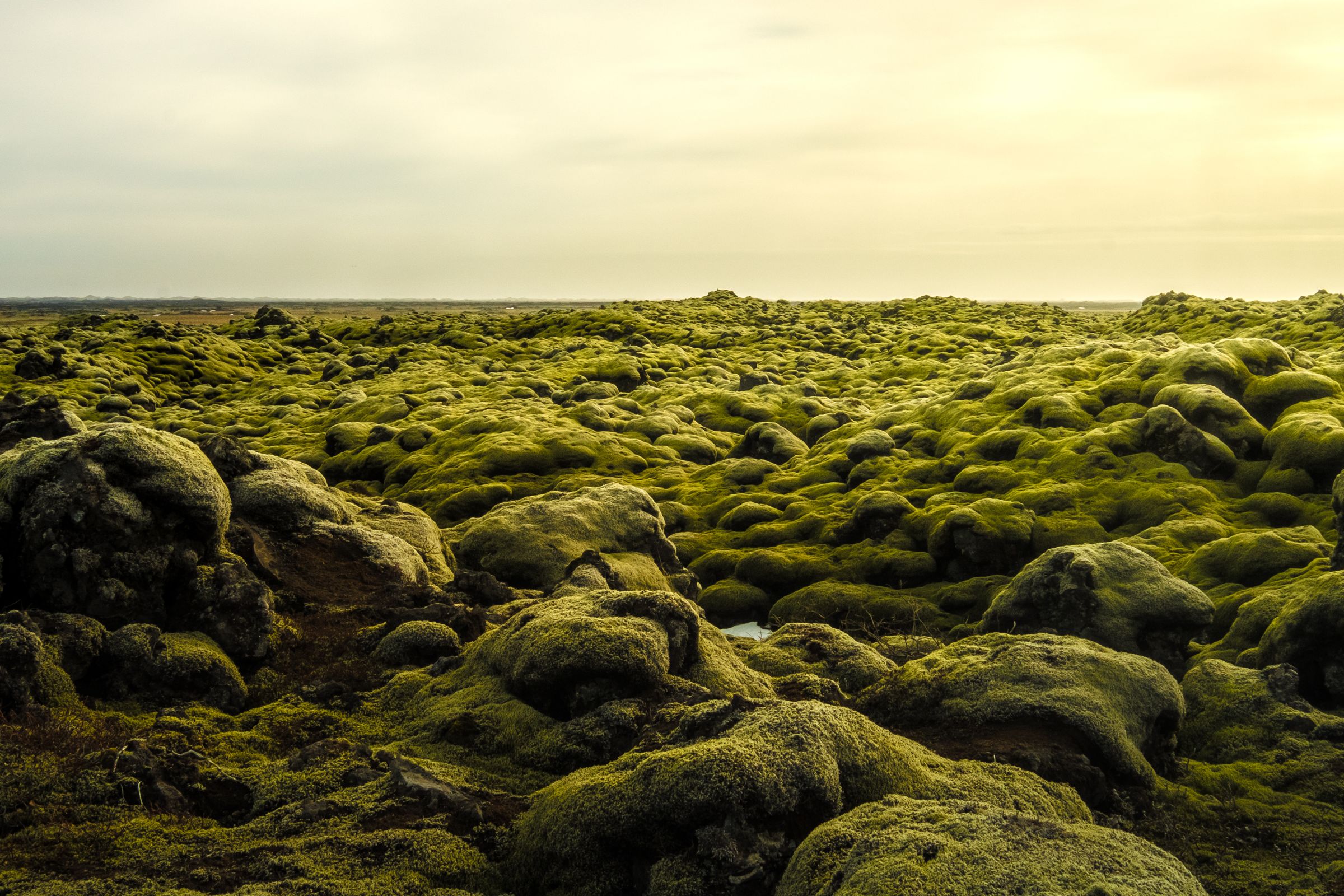
The Eldhraun and Skaftáreldahraun lava fields dominate the landscape around Kirkjubæjarklaustur. They were produced by the 1783 to 1784 Laki eruption, one of the most significant volcanic events in Iceland's recorded history. Driving through this moss-covered lava landscape gives you real context for the whole area.
Skaftafell and Vatnajökull National Park
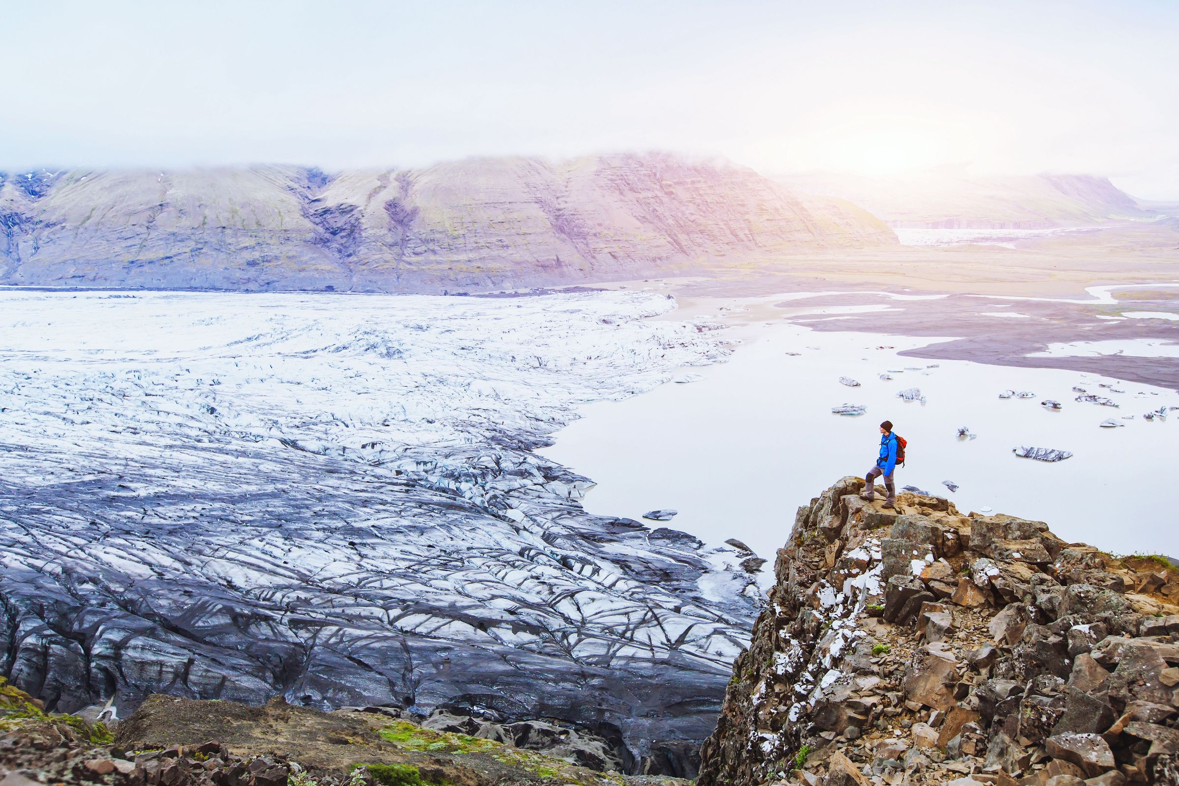
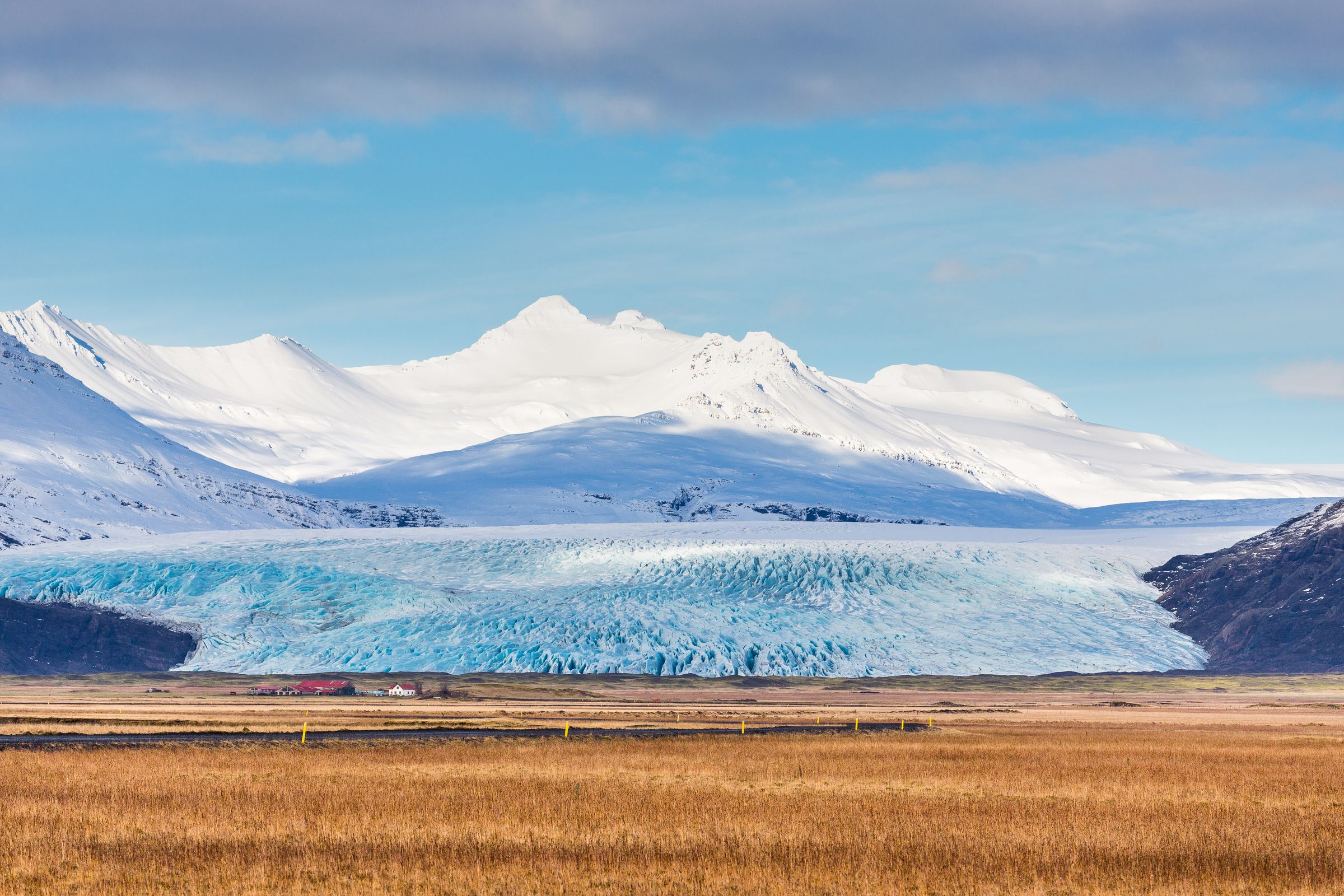
Skaftafell is a major hiking area within Vatnajökull National Park, about 120 km east of Kirkjubæjarklaustur. It needs several hours at minimum, so I'd treat it as a dedicated stop rather than something you squeeze in after a full waterfall day.
Jökulsárlón
The glacier lagoon is farther east still and is one of the biggest draws in Southeast Iceland. Plan it as its own stop on an eastbound itinerary rather than an afterthought at the end of a long day.

Local History and Nature
Stjórnarfoss takes its name directly from the Stjórn River. In Icelandic, "foss" means waterfall, so the name simply means "the waterfall of the Stjórn." The river starts inland around the Geirlandshraun area and flows south through Kleifar toward the lowlands near Kirkjubæjarklaustur.
You'll sometimes see it translated as "Government Falls" online, because the Icelandic word stjórn can relate to management or government in other contexts. That translation is misleading here. The waterfall is named after the river, not any political concept.
Kleifar and the Old Assembly Site
Most guides skip this completely, but Stjórnarfoss stands beside Kleifar, which local historical sources identify as an ancient regional assembly site, or þingstaður. In medieval Iceland, local assemblies were where communities came together to resolve disputes, share information, and handle local matters. The best-known example is Alþingi at Þingvellir, but smaller regional assemblies existed all over the country.
This gives the valley a cultural layer that most waterfall articles leave out. The Stjórn River and the land around it weren't just a natural landscape. They were part of an organized, inhabited community for centuries.
Geology
Stjórnarfoss flows through a volcanic landscape, and the exposed rock is generally described as basaltic, which fits with Iceland's overwhelmingly volcanic bedrock. The distinctive rounded shape of the lower fall most likely formed through differential erosion: the river wore away softer or more fractured rock downstream while a more resistant ledge stayed in place, gradually creating the curved lip that water now spills over. Freeze-thaw cycles, abrasion from river sediment, and the force of the water itself have all shaped it over time.
One thing worth being careful about: most travel pages confidently call it basalt without citing a geological source. Calling it volcanic rock is the more honest description until something more specific is confirmed.

Safety and Responsible Travel
The walk to Stjórnarfoss is short, but the main risks here aren't about distance.
On-Site Hazards
Here's what to actually watch out for:
- Slippery rock, especially wet volcanic surfaces, mud, and algae near the river
- Unstable or undercut riverbanks that look solid but aren't
- Cold-water shock if you enter the pool
- Loose stones and eroding slopes around the waterfall
- Ice forming around the cascade and pool in colder months
- Rockfall from freeze-thaw weathering on the cliff walls
- Strong wind affecting your balance on wet rock
Keep children within reach near the pool and river at all times. Don't let anyone stand on or near the waterfall lip. If the path is icy or the river is running high, it's completely fine to skip it or cut the visit short.
In an emergency, call 112. The SafeTravel app, run by ICE-SAR, lets you share your GPS location with emergency services, which is genuinely useful in a rural spot like this.
Before any winter visit, check road and weather conditions through the Icelandic Meteorological Office and SafeTravel Iceland. Conditions can change fast.
Responsible Visiting
Stjórnarfoss doesn't have much visitor infrastructure, which means your behavior here matters more than it would at a heavily managed site.
- Stay on existing paths and durable surfaces
- Don't walk on moss; it recovers very slowly in Iceland's climate
- Don't build cairns or move rocks
- Pack out all rubbish, including food waste
- Don't block road or campsite access when parking
- Check drone rules before flying: Icelandic aviation law, landowner permission, and wildlife considerations all apply [ADMIN: confirm whether Stjórnarfoss or surrounding land has any specific drone restriction]
- Respect campsite guests and nearby residents
Travel Tips
Before you go, a few practical things worth knowing that most guides don't bother mentioning. None of this is complicated, but it'll save you a headache on the day.
Crowds and Timing
Stjórnarfoss is much quieter than the big South Coast waterfalls. That said, it's well listed on mapping platforms, photography sites, and Ring Road itineraries, so calling it undiscovered isn't really accurate anymore. Going early in the morning or later in the evening gives you the best shot at having the lower viewpoint to yourself.
The site is small, so even a handful of people can make it feel busy, especially if a tour group shows up at the same time.
Food, Fuel, and Services
There's nothing at Stjórnarfoss itself: no café, no shop, no visitor center. Kirkjubæjarklaustur is the place to sort all of that out before you go. The village has fuel, food, and accommodation, and it's one of the most useful service stops on the long stretch between Vík and Skaftafell.
If I were you, I'd use the toilets in Kirkjubæjarklaustur before heading to the waterfall. Don't count on finding open facilities at the site outside of summer campsite season.
Mobile Coverage and Maps
No reliable mobile signal data was found for the exact waterfall location. Download offline maps before leaving Kirkjubæjarklaustur. It's also worth downloading the SafeTravel app and saving the Icelandic road-condition map before you lose signal.
Common Mistakes to Avoid
- Continuing farther up Road 203 beyond the waterfall without checking road classification and conditions first
- Assuming the pool is warm or geothermal (it isn't)
- Using a waterfall coordinate pin for navigation instead of following the road to the Kleifar parking area
- Squeezing too many minor stops into a day that already includes Skaftafell or Jökulsárlón
- Walking on moss to get a higher angle for photos
Conclusion
Stjórnarfoss isn't trying to compete with Iceland's big-name waterfalls. It's small, it's quiet, and it takes less than an hour to visit. What it does offer is a genuinely distinctive lower cascade, a clear river pool framed by dark volcanic rock and moss, and almost no hiking commitment.
If I were planning a South Coast drive between Vík and Skaftafell, I'd build Stjórnarfoss into the itinerary without hesitation. It works naturally alongside Kirkjugólf, Systrafoss, and Fjaðrárgljúfur as part of a couple of hours around Kirkjubæjarklaustur, or as a quick morning stop before pushing east toward Vatnajökull National Park and Jökulsárlón.
The key is treating it for what it is: a rewarding short stop in a part of Iceland that already has a lot going for it, not a major standalone destination.
Frequently Asked Questions About Stjórnarfoss
