

Yoda Cave, Iceland: Complete Guide to Gígjagjá and Hjörleifshöfði
Iceland's South Coast has plenty of places worth stopping for, but Yoda Cave, officially called Gígjagjá, is one of the more unusual ones. It's a natural cave at the base of Hjörleifshöfði, a steep volcanic headland rising from the black sands east of Vík, and its entrance looks exactly like Yoda's face when you're standing inside.
Here's everything you need to know to visit it properly.
Key Takeaways
- Yoda Cave is a small cave about 15 to 20 minutes east of Vík. The Yoda shape only shows up when you stand inside and look back at the entrance.
- It’s a quick and easy stop. The walk from the parking area is short, and most people spend around 20 to 40 minutes there.
- A regular 2WD is usually fine in dry summer weather. After rain, snow, or strong wind, the gravel road can get rough, so check the conditions first.
- There are no toilets, food, or other facilities. Bring what you need and use Vík for fuel, snacks, and bathrooms.
- It’s easy to fit into a South Coast trip. You can also hike Hjörleifshöfði, but that takes much longer and depends a lot more on the weather.
What Is Yoda Cave?
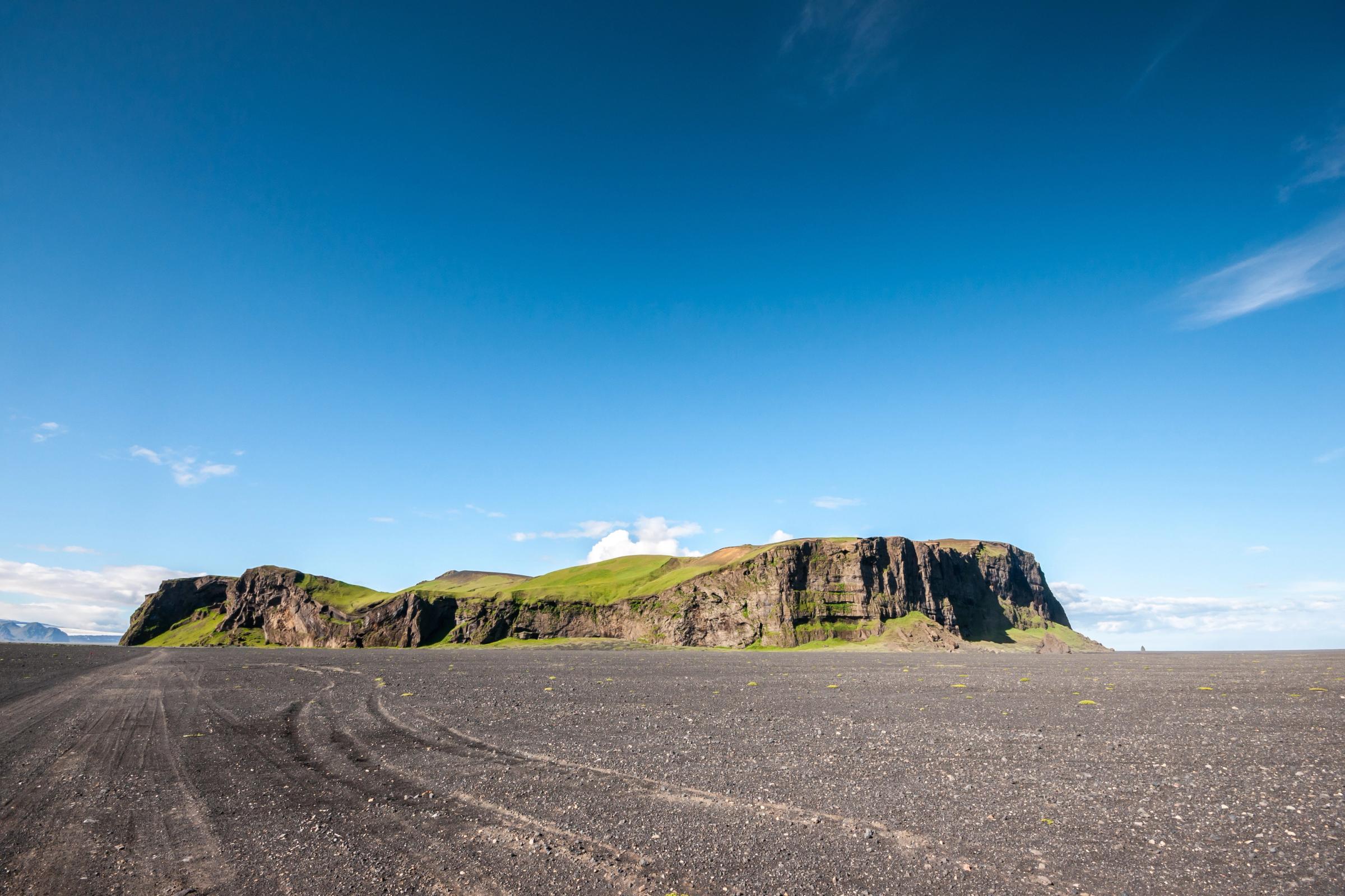
Yoda Cave is a shallow natural cave on the southern side of Hjörleifshöfði, a 221-meter volcanic headland on Iceland's South Coast. Its Icelandic name is Gígjagjá, sometimes spelled Gýgagjá or Gigjagja online. In Icelandic, "gjá" means a fissure or rocky cleft.
The cave isn't deep or hard to get around in. What makes it famous is one specific thing: when you stand inside and look toward the entrance, two openings divided by a horizontal strip of rock create a silhouette that looks like Yoda's head, pointed ears and all. The effect only works from inside at the right angle, which catches a lot of visitors off guard when they show up expecting to see it from outside.
Yoda Cave is a quick scenic and photography stop, not a full cave system. Go in knowing that and you'll love it. Expect a deep underground adventure, and you'll be let down.

Where Is Yoda Cave and How Do You Get There?
Gígjagjá sits on the south side of Hjörleifshöfði, about 14 to 16 km east of Vík on the Ring Road. From Reykjavík, it's roughly 200 km, or about 2.5 to 3 hours of driving without stops. Most people doing the South Coast take a lot longer once you add in waterfalls, beaches, and food.
One thing to clear up before you go: Yoda Cave is east of Vík, not west. Quite a few travel sites have this wrong, and it matters when you're planning your day.
Driving from Vík
Head east on Route 1. After about 12 to 14 km, you'll see the turnoff toward Hjörleifshöfði and Viking Park. The road starts paved and turns to gravel as you get closer to the headland. There are two separate parking areas, one for the summit trail and one closer to the cave. The drive from Vík takes around 15 to 20 minutes in normal conditions.
Driving from Reykjavík
Follow Route 1 east through Hveragerði, Selfoss, Hella, Hvolsvöllur, the Seljalandsfoss area, Skógar, and Vík. Then keep going east. If you're also stopping at Seljalandsfoss, Skógafoss, or Reynisfjara on the way, give yourself a full day.
Do You Need a 4x4?
There's no simple yes or no here. It depends on when you're going and what the road looks like that day.
In dry summer weather, a normal 2WD rental can usually reach the parking area without any problems. The road isn't classified as an F-road, so there's no legal requirement for a 4x4. The surface can still be bumpy, potholed, muddy, or covered in loose volcanic sand depending on recent weather, though.
A 4x4 makes more sense when:
- You're visiting in winter, spring, or after heavy rain
- The road has visible ruts or soft sandy patches
- Your rental is low-clearance
- Your rental agreement restricts travel on minor gravel roads
- Conditions are getting worse while you're already out there
And don't leave the established track to drive onto the open black sand. It looks solid and often isn't, and off-road driving is illegal in Iceland on top of being damaging to the environment.

What to See and Do at Yoda Cave
The visit itself is pretty relaxed. You park, walk a short distance over black sand and gravel, and step into a broad, shallow chamber. The walk from the parking area takes just a few minutes.
Getting the Yoda Shot
This is why most people come, and it takes a little patience to get right. Don't stop at the entrance and wonder why it doesn't look like Yoda yet. Walk into the chamber, turn toward the opening, and move backward slowly until both side openings line up like ears and the central rock bridge forms the brow. Small shifts in position make a big difference.
Here's what works:
- Stand near the center or back of the chamber, not right at the entrance
- Set your exposure for the bright sky outside, not the dark cave walls
- Keep the horizontal rock bridge roughly centred in your frame
- Put a person near the opening to show how big the cave actually is
- Try both vertical and horizontal orientations
On a phone, tap the bright sky to reduce overexposure. On a camera, a 16 to 28 mm lens gives the most natural-looking result. Ultra-wide lenses tend to stretch the ears and make the shape harder to read.
Exploring the Surroundings
Personally, I'd spend at least a few minutes walking around the base of Hjörleifshöfði rather than just grabbing the shot and heading back. The contrast between the dark volcanic cliffs, the greenish slopes above, and the enormous flat black plain of Mýrdalssandur is worth taking in.
The cave itself takes 20 to 40 minutes for most people. Add another 30 minutes if you want to walk around the base a bit.

Hiking Hjörleifshöfði
Most visitors stop at the cave and miss what a lot of people consider the better part of the stop: hiking to the top of Hjörleifshöfði. These are two separate things. The summit involves a real climb, not the short flat walk to the cave.
The Route
The summit loop is roughly 3.2 km with about 200 to 220 metres of elevation gain. Plan on 2 to 3 hours depending on your pace and how long you spend at the top. The terrain includes steep grass, volcanic soil, loose sections, and open exposed slopes. It's a moderate hike in good conditions, but wind, mud, or ice make it a lot harder.
There are two trailheads on the Viking Park property. Check the trail map on-site rather than trusting a distance estimate from a travel app.
What You'll See from the Top
The summit is where the whole landscape starts to make sense. On a clear day you can see:
- The full expanse of Mýrdalssandur in every direction
- Mýrdalsjökull and the Katla volcanic system to the north
- The Atlantic coastline and Kötlutangi to the south
- The isolated form of Hafursey rising from the black plain
- Old flood channels and river deltas carved out by Katla's eruptions
You'll also reach Hjörleifshaugur, the mound traditionally identified as the burial site of Hjörleifur Hróðmarsson, one of Iceland's earliest Norse settlers. More on him in the history section below.
Should You Hike or Just Visit the Cave?
If I were you and the weather was good, I'd do both. The cave gives you the photo. The hike gives you the context. Just visiting the cave is a bit like going to a great museum and only looking at one thing near the front door.
Skip the summit when wind makes walking unstable, when cloud is sitting on the headland, when the trail is icy, or when you're short on time.
Best Time to Visit Yoda Cave
Gígjagjá is reachable year-round on paper, but conditions vary a lot between seasons.
Summer (June to August)
This is the easiest time to go. Daylight is long, the access road is least likely to be icy, and you have the most flexibility for pairing the cave with the summit hike. Midday light in peak summer is pretty flat for photos, and the site gets more visitors than in the shoulder months. It's still far quieter than Reynisfjara or Skógafoss though.
Spring and Autumn
Good seasons for photography. The light is lower and softer, crowds are smaller, and the landscape tends to look more dramatic. Spring (April and May) can bring meltwater, mud, and patches of frost on the trail. Autumn (September and October) usually offers a better balance overall, though storms roll in faster than most people expect.
Winter (November to March)
A winter visit can look incredible, but keep it in the optional column. The access road can be icy, snow-covered, or soft enough to trap a vehicle even when Route 1 is clear. The cave floor may be frozen. Daylight is short. Check Vegagerðin and the Icelandic Met Office before you go, and be ready to skip it if conditions aren't cooperating.
Best Time of Day
The classic photo looks outward from a dark interior, so the quality of light outside matters more than chasing golden hour. Overcast skies often work better than direct sunshine because they soften the contrast between the dark cave walls and the bright opening. Early morning usually means fewer people and more room to find your angle.


Safety, Facilities, and Accessibility
Gígjagjá is an unmanaged natural rock formation. No railings, no paved paths, no staff. That's fine, but it means you're using your own judgment in there.
Key Hazards
None of the hazards here are extreme, but a few of them catch people off guard. Here's what to actually watch out for.
- Rockfall is probably the biggest risk, and the one people think about the least. The rock here is palagonite tuff, which can crumble without much warning, especially after freeze-thaw cycles or heavy rain. Don't stand directly under any overhang that looks cracked or loose, and don't climb the cave walls for a better photo angle.
- Slippery ground inside the cave is common. Water pools on the floor, and wet volcanic rock or mud can send you down fast. Waterproof shoes with real grip make a big difference here.
- Wind across Mýrdalssandur can be surprisingly strong. Hold car doors firmly when you open them. Strong gusts can knock adults off balance on the open sand plain, and blowing volcanic sand isn't great for cameras or eyes.
- Soft sand around the headland can trap vehicles. Stay on the established road, and that's one less problem to worry about.
Visiting with Children
The short walk makes this doable for families, but it's not a purpose-built family attraction. No barriers, no paved paths, nobody watching the site. Keep kids close, especially near the cliff face and inside the cave. Strollers won't work on loose sand and rock. Older kids who know their Star Wars tend to get a real kick out of spotting the Yoda silhouette, though.
Facilities
Assume there's nothing there. Depending on how Viking Park manages the property, you might find picnic tables and an information sign. Don't count on:
- Toilets
- Drinking water
- Food or snacks
- Reliable shelter
- Waste bins
Sort all of that in Vík before you drive out. It's the nearest town with fuel, food, restrooms, and places to stay.
Accessibility
The cave isn't wheelchair accessible. The walk is short, but the surface is unpaved, uneven, and changes after every storm. Visitors with limited mobility may be able to see the cliff and cave entrance from near the parking area when it's dry, but there's no flat or smooth route to get there.
Travel Tips for Visiting Yoda Cave
A few practical things that make a real difference here.
What to Wear and Bring
For a basic summer visit:
- A waterproof jacket and shoes with real grip
- Your phone with offline maps downloaded before you leave Vík
- A camera or phone, a lens cloth, and something to protect your gear from blowing sand
- Water and snacks since there's nothing on-site
- A payment method for parking
For winter or the summit hike, add warm base layers, insulated gloves, a hat, hiking boots, and a headlamp. Leave the umbrella in the car. South Coast wind will destroy it almost immediately.
Parking and Fees
Hjörleifshöfði is privately managed as part of Viking Park. Parking fees apply, with one payment covering both the cave and hiking parking areas for the day. Last time I went the fee was ISK 1,000 for a regular car, payable via EasyPark or a QR code on-site.
Some older travel sites still say it's free, which is where the confusion comes from. Trust the signs when you arrive and pay what's posted. Don't try to get around gates or barriers.
Navigation
The Route 1 turnoff is easy to miss. Save "Gígjagjá" or "Yoda Cave" as an offline destination on your maps app before you leave Vík. Mobile signal is generally fine along the South Coast but isn't reliable everywhere around the headland.
Before You Go
Check road conditions on Vegagerðin (vegagerdin.is) and the weather on the Icelandic Met Office website, especially in winter or shoulder season. A clear forecast in Vík doesn't always mean the same conditions out on the open Mýrdalssandur plain.
Geology, History, and the Star Wars Connection
Understanding what you're actually standing in makes the whole stop more interesting. Here's the short version of a story that goes back a long way.
How Hjörleifshöfði Was Formed
Hjörleifshöfði is a tuya, a type of flat-topped volcano that formed when magma erupted beneath a thick glacier during the last Ice Age. As the lava pushed up through the ice, it broke apart on contact with meltwater and built up layers of volcanic ash and glass that hardened into palagonite tuff over time. That's the soft yellowish-brown rock you can see in the cliffs.
A few key facts about its formation:
- The Katla UNESCO Global Geopark identifies it as a 221-meter tuff formation created by a subglacial eruption during the later part of the last glacial period
- Tuff erodes faster than solid basalt, which is why the cliffs look layered and how the cave formed there in the first place
- Hjörleifshöfði was almost certainly an island or coastal headland for a long time
The surrounding black-sand plain of Mýrdalssandur was built up gradually by repeated jökulhlaups, which are sudden glacial floods caused by volcanic heat from the Katla system beneath Mýrdalsjökull. Each flood carried enormous amounts of sediment down from the glacier and spread it across the lowland, eventually surrounding the headland on all sides. The 1918 Katla eruption alone dumped enough material to form Kötlutangi and temporarily push Iceland's southernmost coastal point further east.
Is Yoda Cave a Lava Cave?
A lot of travel sites call it one, but it isn't. A lava tube forms when flowing lava drains from beneath a hardened surface crust and leaves a hollow tunnel behind. Gígjagjá is an erosion cave in a tuff formation, shaped over time by a mix of marine erosion from when the headland sat on the coast, freeze-thaw action, water, and the gradual breakdown of softer rock layers. The short version: it's a natural cave in a subglacial volcanic headland, not a lava tube.
The Settlement History
Hjörleifshöfði is named after Hjörleifur Hróðmarsson, one of the figures recorded in Landnámabók, Iceland's medieval Book of Settlements. Here's the short version of what happened:
- Hjörleifur came to Iceland alongside Ingólfur Arnarson, traditionally considered the first permanent Norse settler, in the late ninth century
- He settled near this headland and was later killed by enslaved Irish men who had traveled with his group
- Ingólfur pursued them to the islands off Iceland's south coast, which became known as the Vestmannaeyjar
A mound near the summit is traditionally identified as Hjörleifshaugur, his burial mound. Regional sources say he is "considered" to be buried there, which is about as certain as the record gets. Landnámabók was written down centuries after the events it describes and blends genealogy, oral tradition, and place-name stories. It's historically important, but it's not a verified modern record.
The headland was farmed and lived on until 1936. Katla's 1721 eruption destroyed an older farm, after which settlement shifted to the southern side. That's centuries of human history that most visitors walk straight past without knowing.
The mound at the top of Hjörleifshöfði is traditionally identified as Hjörleifur's burial site. Don't walk over it, dig into it, or move any stones. It's a culturally significant place, not a photo prop.
The Rogue One Connection
The wider Hjörleifshöfði and Mýrdalssandur area was used during filming of Rogue One: A Star Wars Story, specifically for the opening sequences set on the remote planet Lah'mu. Here's how it all breaks down:
- The production used Hjörleifshöfði and Mýrdalssandur for the Lah'mu landscape sequences at the start of the film
- Reynisfjara and Hafursey were also used for other landscape shots
- Several location databases identify Gígjagjá as the specific spot where young Jyn Erso hides
- That's widely repeated and plausible given how the cave looks, though the exact interior shots used in the final film aren't definitively confirmed by production documentation
The key thing to know: the name "Yoda Cave" has nothing to do with Yoda being filmed here. Yoda isn't in Rogue One at all. The nickname comes entirely from what the entrance looks like from inside. The cave wasn't built or modified for the film. It's a natural formation that happened to fit perfectly into a landscape standing in for another planet.
Common misconception: Yoda Cave wasn't named because some of Yoda’s scenes were filmed here. The character doesn't appear in Rogue One. The name is purely about what the entrance looks like from inside.
Nearby Attractions and Suggested Itinerary Stops
Yoda Cave is easy to pair with other South Coast stops since it's right off Route 1. Here's what's nearby and worth knowing.
Vík
About 15 km (9.3 miles) west, Vík is your base for everything. Fuel, food, accommodation, grocery stores, and good views of Reynisdrangar from the town beach. The hilltop Víkurkirkja church is worth a quick stop for the views over the coastline. Stock up on everything you need in Vík before heading out to the cave.

Reynisfjara
About 25 km (15.5 miles) west by road, Reynisfjara is one of Iceland's most photographed beaches, with basalt column formations and the cave Hálsanefshellir. One really important difference from Yoda Cave: Reynisfjara has extremely dangerous sneaker waves. Don't approach the waterline, cross safety barriers, or turn your back on the ocean there. The relaxed approach that works at Gígjagjá will get you into serious trouble at Reynisfjara.

Dyrhólaey
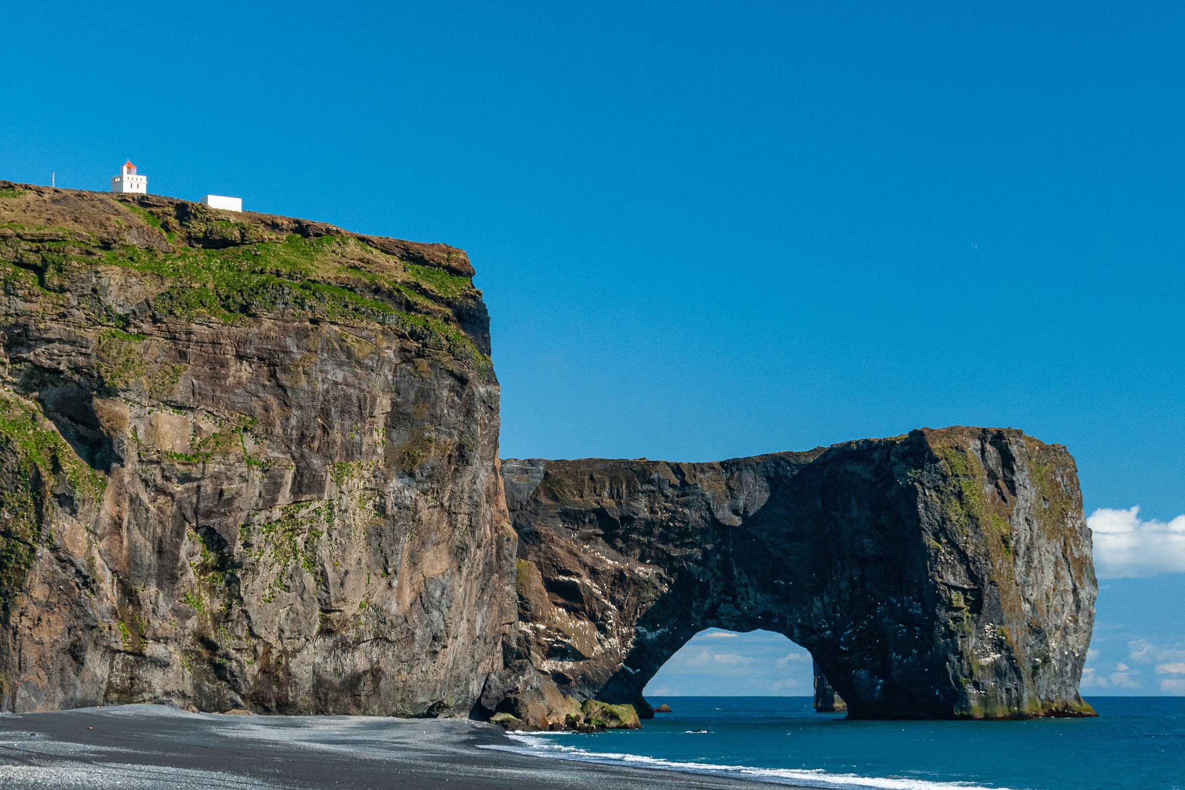
About 31 km (19.2 miles) west. The sea arch, the lighthouse, and the coastal views toward Reynisfjara make it worth the stop. Parts of the area close seasonally for puffin nesting from May to June.
Þakgil
North of Vík, reached by a rough seasonal gravel road. Þakgil is a sheltered canyon with good hiking trails and a summer campsite. It's a separate half-day excursion, not a quick add-on, and you'll need to check road conditions before you go.

Fjaðrárgljúfur
Farther east near Kirkjubæjarklaustur, this canyon works well for anyone continuing along Route 1 on a multi-day trip. Too far to combine with Yoda Cave as part of the same short stop, but it fits naturally into a two or three-day South Coast itinerary.

Is Yoda Cave Worth Visiting?
For most South Coast travelers, yes. With the right expectations, it's a stop you'll remember.
It's worth the detour when you:
- Are already staying in or near Vík
- Want a photography stop that isn't packed with tour groups
- Have any interest in Star Wars filming locations
- Plan to hike Hjörleifshöfði anyway
- Want to get a better feel for the geology and history of the South Coast
It's easier to skip when:
- You only have one day from Reykjavík, and the schedule is already full
- Road or weather conditions are questionable
- You're expecting a dramatic cave system with tunnels and chambers
- Your rental vehicle isn't suited to the gravel access road
Frequently Asked Questions
