
Sólheimajökull Glacier: Guide to Iceland's Most Accessible Glacier
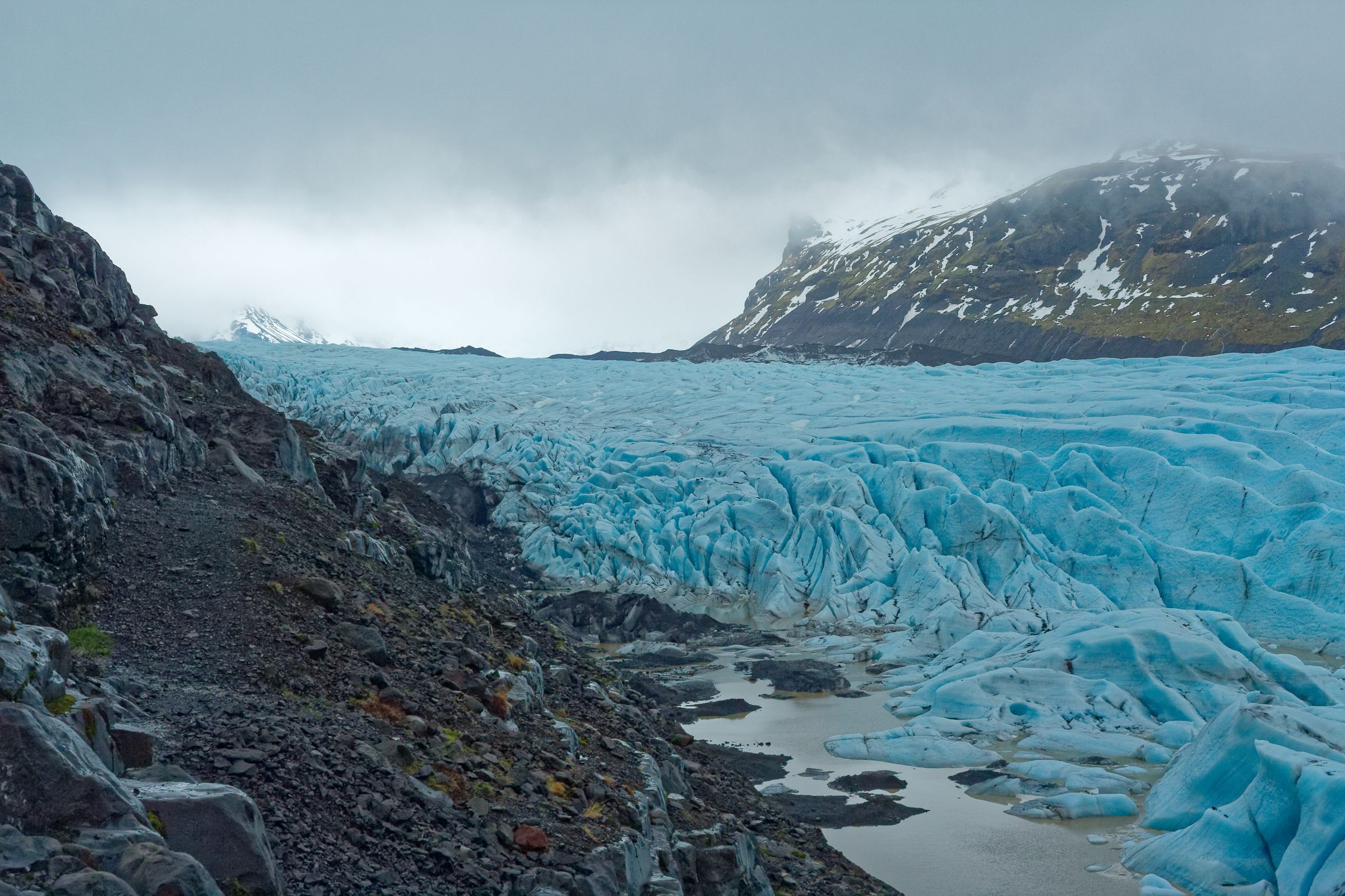
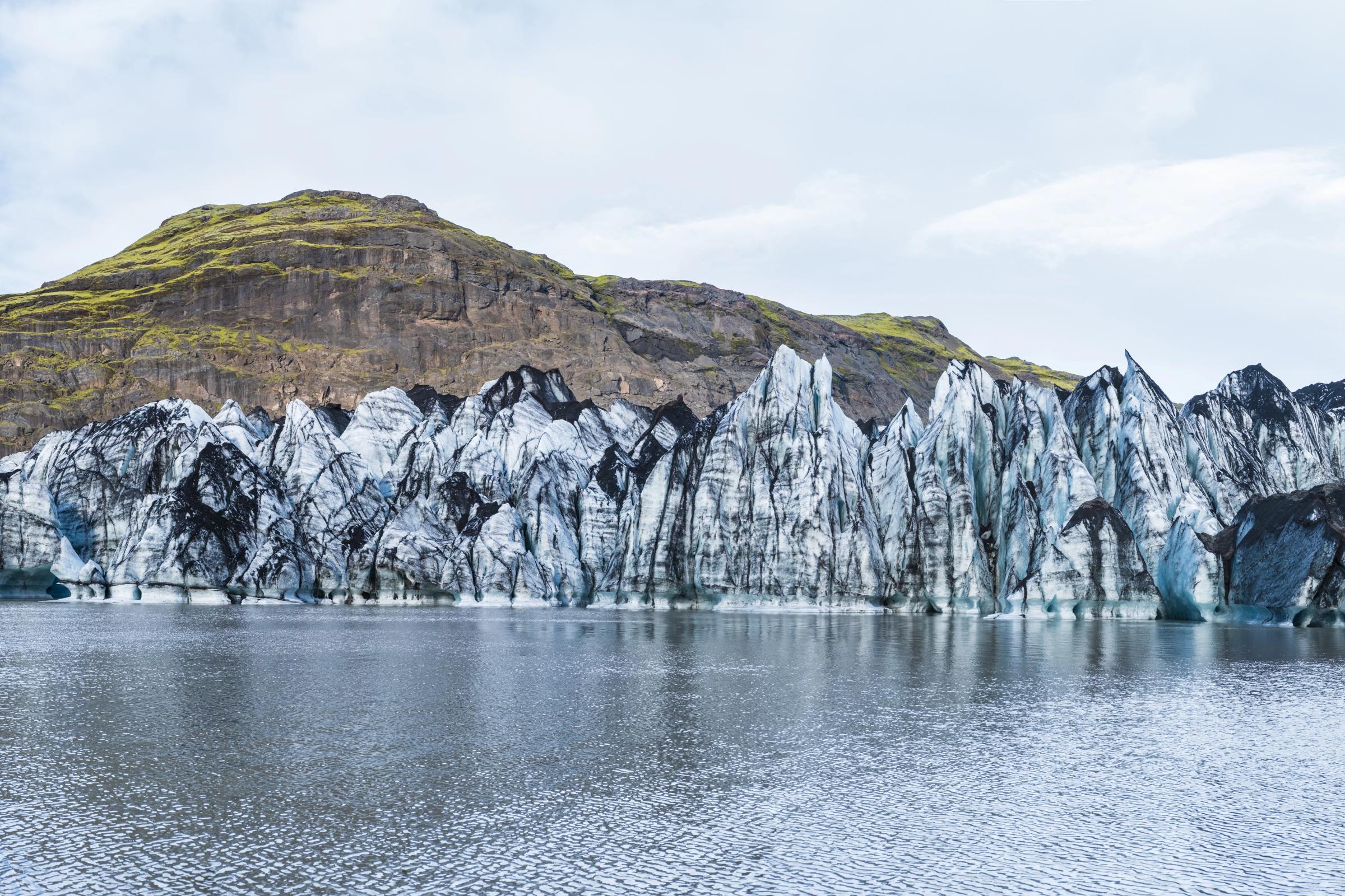
Sólheimajökull is one of Iceland's most dramatic natural sites, a glacier streaked with black volcanic ash, cracked by deep crevasses, and slowly retreating into an expanding lagoon.
Here's everything you need to plan your visit.
Key Takeaways
- Sólheimajökull is one of the easiest glaciers to visit in Iceland. It's just off the Ring Road, and the walk from the parking area to the viewpoint takes about 15 to 20 minutes.
- If you want the full experience, book a guided glacier hike. You can visit the viewpoint on your own, but you shouldn't walk onto the ice without a certified guide.
- Give yourself a few hours if you're planning to hike the glacier. Most tours take around 3 to 4 hours, so it's best not to cram too many other stops into the same day.
- Check the weather and local safety advice before you go. The glacier is changing quickly, and you should stay away from the ice edge and the lagoon unless you're with a guide.
- It's an easy stop to fit into a South Coast road trip. Skógafoss, Seljalandsfoss, Reynisfjara, Dyrhólaey, and Vík are all close enough to visit on the same day.
Sólheimajökull at a Glance
Sólheimajökull is an outlet glacier that flows southwest from the Mýrdalsjökull ice cap on Iceland's South Coast. It sits inside Katla UNESCO Global Geopark, about 165 km east of Reykjavík, and it's one of the easiest glaciers in the country to actually get to. A short side road off the Ring Road takes you to the parking area, and the ice is roughly a 15 to 20 minute walk from there.
What makes it worth a stop is how much is happening in one place:
- Deep blue crevasses cutting through the glacier surface
- Thick bands of black volcanic ash running through the ice, the result of eruptions over centuries
- A growing proglacial lagoon forming at the glacier's retreating front
- Katla volcano lying beneath the parent ice cap, making this one of the few places in Iceland where you can see ice and volcanic activity together
It's also changing quickly. The glacier has pulled back hundreds of meters since the mid-1990s, and as of July 2026, experts are warning against stepping onto the glacier because conditions at the margin have become unsafe. Read the safety section before you book anything.
Safety update (July 2026): SafeTravel Iceland is currently advising against going onto Sólheimajökull. A new lagoon, rockfall risk, and an unstable ice ridge have made the normal glacier approach dangerous. Some tour operators have paused trips while safer routes are assessed. Check safetravel.is and confirm directly with your operator before you visit. [/callout]
Here's a quick overview of the key facts:
- Location: South Iceland, between Skógar and Vík í Mýrdal
- Glacier type: Temperate outlet glacier
- Parent glacier: Mýrdalsjökull ice cap
- Nearby town: Vík í Mýrdal (about 25 to 30 km away)
- Road access: Road 221 off Iceland's Ring Road (Route 1)
- Best activities: Guided glacier hiking, ice climbing, photography, geology tours
- Visit duration: 1 to 1.5 hours for the viewpoint; 3 to 4 hours for a guided hike
- Guided tours: Required to step onto the ice
- UNESCO status: Located within Katla UNESCO Global Geopark (not a UNESCO World Heritage Site)
- National park: Not part of any Icelandic national park
- Coordinates: Approximately 63.53° N, 19.37° W
- Approximate size: About 11 km long, 1 to 2 km wide
- Latest recorded retreat: 93 metres (western tongue, 2024 to 2025)
Is Sólheimajökull Worth Visiting?
Yes, for most people. But what you get out of it really depends on how you approach it.
Who Will Enjoy It Most
You don't need to be a serious hiker or know anything about geology to find this place interesting. It works for a lot of different types of travelers.
It's a good fit if you:
- Want to walk on a glacier for the first time without doing anything too intense
- Are driving the South Coast and want more than just waterfall stops
- Are curious about climate change, volcanism, or how glaciers actually work
- Want good photography opportunities without heading deep into the highlands
- Are traveling with older teenagers looking for something more hands-on
It's probably not worth it if you're hoping for a quick roadside look. The glacier has retreated far enough that you need a proper walk to see much, and the experience is significantly better with a guided hike on the ice.
What Makes It Different From Other Icelandic Glaciers
Most Icelandic glaciers are hard to reach. Sólheimajökull is right off the Ring Road and the approach is easy. But that's not the only thing that sets it apart.
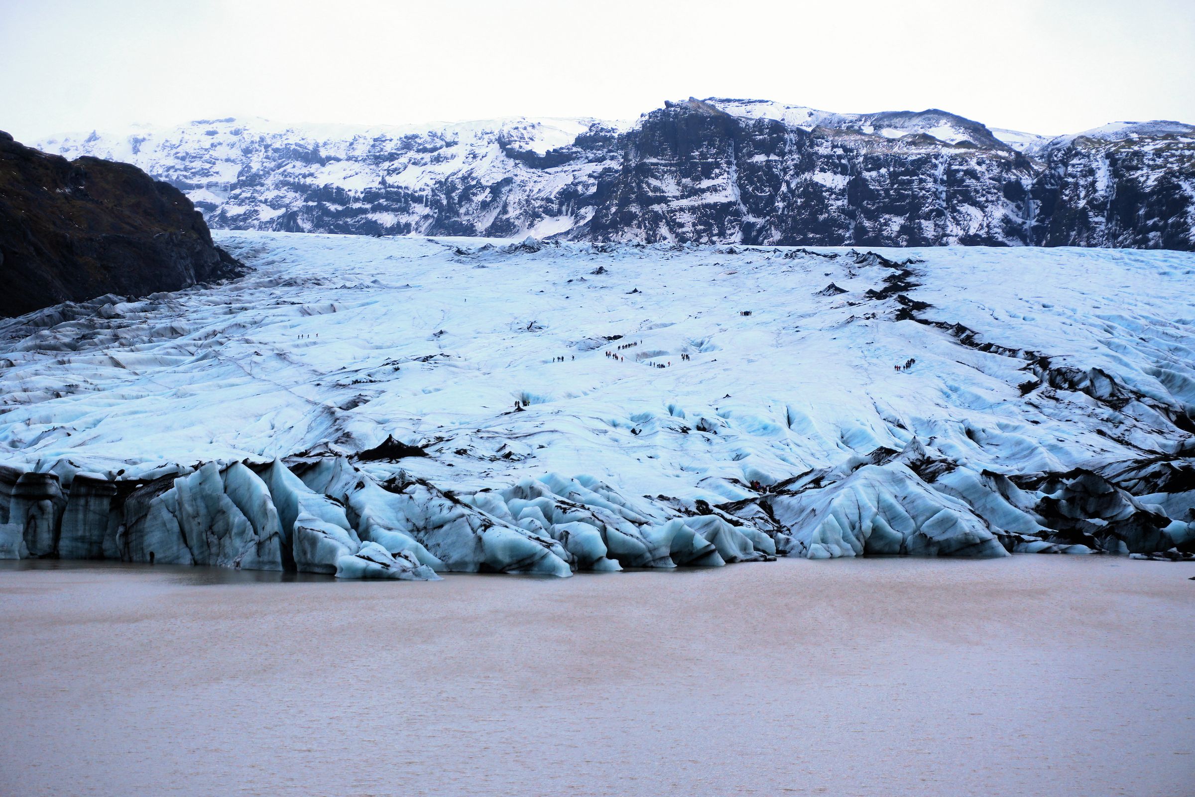
- The volcanic ash. Those black bands running through the ice are layers of tephra from eruptions over decades and centuries, carried downslope as the glacier moves. The contrast between blue ice and dark ash looks unlike anything you'll see at cleaner glaciers like Skaftafellsjökull.
- The retreat you can actually see. Old moraine ridges mark where the glacier used to sit. The exposed bedrock, the gap between the parking area and the current ice front, the growing lagoon at the terminus. When you're standing in front of it, you really get a sense of how much has changed.
- The lagoon. A lake has been forming at the glacier's front since around 2011 and is now roughly 60 metres deep in places. Floating ice fragments, the occasional calving sound, a waterline that keeps shifting. It's a different kind of landscape than most people expect.
- Everything in one place. Few spots in Iceland let you see glaciology, volcanic geology, and the effects of climate change all at once, within a short walk of a paved road.
Personally, I'd say the hike is what turns a decent stop into a genuinely good one. The viewpoint is interesting, but getting onto the ice with a guide and into the crevasse zone is a completely different experience.
Where Is Sólheimajökull?
Sólheimajökull sits on the southwestern edge of the Mýrdalsjökull ice cap, along one of the most traveled parts of Iceland's South Coast. The glacier descends from around 1,350 meters above sea level all the way down to about 100 meters, which is a big part of why it responds so strongly to temperature changes.
The glacier sits between the Eyjafjallajökull volcanic system to the west and the Katla volcanic system beneath Mýrdalsjökull to the east. To be clear, Sólheimajökull drains the southwestern part of Mýrdalsjökull, the ice cap that overlies Katla's central caldera. The visible glacier tongue isn't sitting directly above Katla, but it's very much part of the same landscape.
Driving Distances
These are approximate road distances to keep in mind when planning:
- From Reykjavík: about 190 km/118 miles (roughly 3 hours without stops)
- From Vík í Mýrdal: about 33 km/20.5 miles (40-minute drive)
- From Skógafoss: about 21 km/13 miles (33-minute drive)
- From Seljalandsfoss: about 50 km/31 miles (50-55-minute drive)
- From Keflavík International Airport: about 225 km/140 miles (3 hours and 10 minutes)
These are estimates. The South Coast road is easy to drive, but stops add up fast. Most people underestimate how long the day takes.

Relationship With Mýrdalsjökull and Katla
Think of Mýrdalsjökull as the reservoir and Sólheimajökull as one of the frozen rivers flowing out of it. Snow builds up on the high ice cap, slowly compresses into glacier ice, and gravity pulls it down through the Sólheimajökull valley toward the coast.
Underneath Mýrdalsjökull sits Katla, one of Iceland's most closely watched volcanoes. Here's what's worth knowing about it:
- Katla's last confirmed major eruption was in 1918
- It has erupted at least 21 times over the past roughly 1,100 years
- The Icelandic Meteorological Office monitors it constantly using seismic, geodetic, and hydrological instruments
- A Katla eruption can melt enormous volumes of ice and trigger a jökulhlaup, which is essentially a sudden glacial outburst flood
That's why the whole system gets taken seriously.
How to Get to Sólheimajökull
Getting here is one of the easier logistics on the South Coast. The access road is paved and doesn't need a 4x4 under normal conditions.
From Reykjavík
The drive takes roughly 2.5 hours in good conditions, following Route 1 east through Hveragerði, Selfoss, Hella, and Hvolsvöllur before you reach the turnoff. Most people combine it with stops at Seljalandsfoss and Skógafoss along the way, which adds significant time.
If I were you, I'd leave Reykjavík by 8 a.m. if you want any real chance of doing the glacier hike plus a couple of other South Coast stops without feeling rushed.
From Vík
From Vík it's a straightforward 25 to 30 km drive west on Route 1. The turnoff for Road 221 is clearly signed.
Parking and Final Approach
Turn onto Road 221 from Route 1 and follow it north for about 4 km to the parking area. The road is gravel in sections and can have potholes or standing water. A normal car handles it fine, but take it easy.
Parking is managed electronically through Parka using your vehicle's registration plate. You can pay up the 750 ISK fee up to 24 hours after your visit, but don't forget. Unpaid parking results in an extra charge.
From the parking area, the walk to the glacier viewpoint is typically 15 to 20 minutes each way. That distance has grown as the glacier retreats, so give yourself extra time.
Public Transport and Guided Tours
There's no direct public bus to Sólheimajökull. If you don't have a rental car, your best option is a guided day tour from Reykjavík that includes the glacier as part of a South Coast itinerary. These tours usually combine Seljalandsfoss, Skógafoss, and Sólheimajökull in one day.
Best Things to Do at Sólheimajökull
There's more to do here than most people expect from a glacier stop. Activities range from a simple viewpoint walk to a full guided adventure on the ice.
Take a Guided Glacier Hike
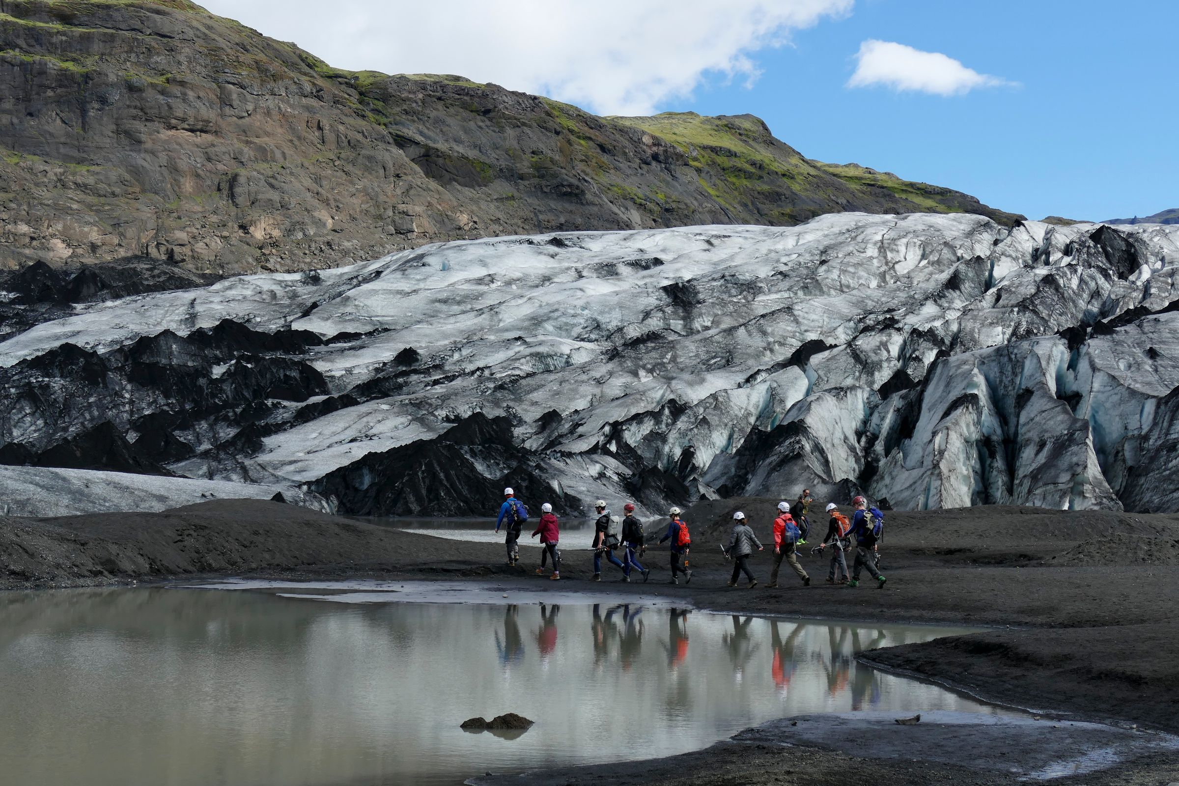
This is the highlight, and it's one of the best things you can do on Iceland's South Coast. A guided hike takes you onto the ice with crampons, a helmet, and an ice axe, with a certified glacier guide leading the group through ridges, crevasses, and ice formations.
Standard tours run about 2.5 to 4 hours in total, though only part of that time is spent on the glacier itself. The rest covers the approach, equipment fitting, safety briefing, and the walk back. Even a basic introductory hike gets you deep enough to see things you'd never reach on your own.
Try Ice Climbing
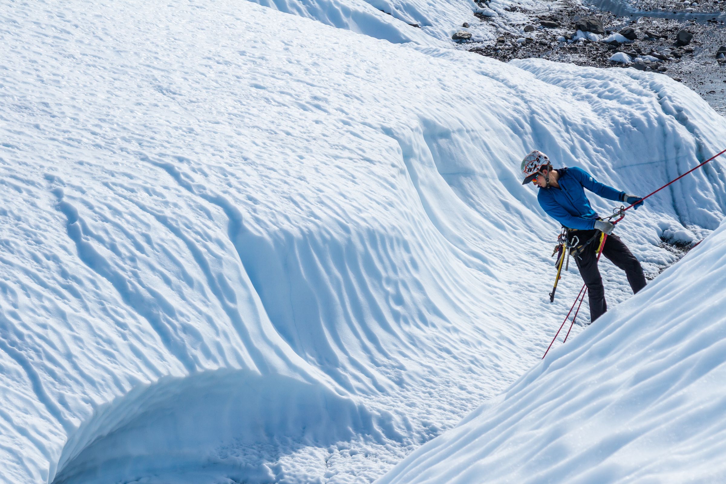
Some tours include an introductory ice climbing section where you learn to work your way up a wall of glacier ice using crampons and ice tools. It's more physically demanding than a standard walk, and operators often set a higher fitness or age requirement for this option.
If you've ever wanted to try ice climbing but felt put off by the commitment level, this is actually a good starting point. It's fully supervised, the walls are chosen by the guide, and no prior experience is needed.
Visit the Glacier Viewpoint
If a guided hike doesn't work for you, whether because of budget, fitness, or age, the walk to the viewpoint is still worth doing. You won't step onto the ice, but you'll get a clear look at the glacier tongue, the proglacial lagoon, and the moraine landscape left behind by decades of retreat.
Keep in mind that the viewpoint is further from the active ice than it used to be. The glacier has pulled back quite a bit, so go in with realistic expectations.
Photograph the Glacier
Sólheimajökull is one of the best glaciers in Iceland for photography, largely because of the volcanic ash. The contrast between blue glacier ice, black tephra bands, brown lagoon water, and the surrounding moraine gives you a mix of colors you won't find at most other glaciers.
Some of the best photo opportunities include the ash bands running through the ice, deep crevasses, meltwater streams, and the small lagoon dotted with floating ice. You'll also notice old moraine ridges that mark where the glacier once reached, offering a powerful visual reminder of how much it has retreated over the years.
Bring a telephoto lens. Some of the most interesting details, like ash bands, crevasse textures, and calving ice, are best captured from a distance rather than getting close to the unstable margin.
Join a Geology or Climate Tour
If you're interested in learning more about the glacier itself, some tours focus on the science behind the landscape rather than just the adventure. These guides explain how the glacier formed, how volcanic activity has shaped the area, and how climate change is affecting Sólheimajökull today. If that sounds like your kind of experience, look for a tour that highlights geology, glaciology, or climate science.
Best Glacier Tours
Most operators run tours from a meeting point near the glacier parking area. Here's a breakdown by traveler type to help you find the right fit.
Best for Beginners
A standard 3-hour glacier hike is the best choice if it's your first time on the ice. These tours usually include a safety briefing, equipment fitting, basic crampon instruction, and a guided walk across beginner-friendly terrain. No previous glacier hiking experience is required.
Before booking, check the minimum age (often 8–10 years old), footwear requirements (sturdy, waterproof hiking boots), and whether the tour operates year-round or only during certain seasons.
Best for Families
Family-friendly tours are typically shorter-paced and led by guides who are experienced in working with children. If you're traveling with younger kids, look for operators with a lower minimum age requirement, as this varies between tours.
Families with children who are too young to join a glacier hike can still enjoy the walk to the viewpoint, which offers impressive views of the glacier without stepping onto the ice.
Best for Adventure Travelers
For a longer and more immersive experience, choose a four- to six-hour tour or a private excursion. Many of these tours venture farther onto the glacier, explore more varied terrain, and may include introductory ice climbing. They provide a broader look at the glacier's features, including larger crevasses, ice formations, and volcanic ash layers.
Best for Photographers
A private tour offers the most flexibility if photography is your priority. You'll have more time to stop at interesting ice formations, compose your shots, and explore different viewpoints without feeling rushed. Early morning departures are often the best option for softer light and fewer people on the glacier.
Best Day Tours From Reykjavík
Many South Coast day tours from Reykjavík include a glacier hike at Sólheimajökull alongside stops at Seljalandsfoss, Skógafoss, and Reynisfjara. They're a convenient option if you're short on time, although the glacier hike is usually an introductory experience lasting around 2.5 to 3 hours rather than a longer or more specialized tour.
Can You Visit Without a Tour?
Yes. You can drive to the parking area and walk the marked approach path to the viewpoint without booking a glacier tour. The Katla UNESCO Global Geopark asks visitors to stay on the designated trail to protect the fragile glacial sediments and landforms, but there's no ticket required to walk the approach.
What you can't safely do is walk onto the ice without a qualified guide.
What's Safe to Do Independently
- Drive to the parking area on Road 221
- Walk the marked approach path to the viewpoint
- View the glacier tongue, lagoon, and moraine landscape from the designated area
- Take photos from the established approach
Why the Ice Itself Requires a Guide
The glacier surface looks more manageable than it is. Hidden hazards include:
- Crevasses covered by snow bridges that can hold your weight one moment and collapse the next
- Unstable ice margins where the boundary between solid ground and active glacier isn't easy to spot
- Meltwater shafts (moulins) that aren't visible until you're right on top of them
- Debris-covered ice that looks like ordinary ground but isn't
A route that looks flat and solid from the viewpoint can be genuinely dangerous a few metres in.
As of July 2026, even the approach to the glacier margin is affected by hazardous conditions. An unstable ice ridge, new lagoon development, and rockfall risk from the slope known as Jökulhaus are all factors right now. Check safetravel.is before you visit, and don't try to find your own way around closed sections.
What to Expect on a Glacier Hike
Here's how a standard guided glacier hike typically goes, from start to finish.
- Check-in: Arrive at the operator's meeting point near the parking area and check in with your booking confirmation.
- Equipment fitting: You'll be fitted with a helmet, crampons, and harness. The guide checks your boots for crampon compatibility. This is where people with soft trainers get turned away, so don't take that risk.
- Safety briefing: The guide runs through the basics: where to step, how to move, what to do if someone falls, how to use the ice axe for balance. It's short but worth paying attention to.
- Walk to the glacier: From the meeting point, you walk across the outwash plain and moraine toward the ice. This takes about 15 to 25 minutes depending on where the active glacier margin currently sits.
- Crampon instruction: Just before stepping onto the ice, the guide demonstrates technique: flat-footed steps, deliberate foot placement, how to use the axe for support.
- Glacier exploration: The route depends on current conditions, but you'll typically cross ridges, look into crevasses, walk along ash bands, and see the range of colors the ice takes. White at the surface, deep blue inside crevasses and fresh fractures.
- Return: The return follows roughly the same route back to the base.
Most standard tours give you about 1 to 1.5 hours on the ice itself. The terrain is uneven but manageable for most people with reasonable fitness. It takes more focus than a normal hike because you need to think about every step with crampons on, but it's not technically difficult.
What to Wear and Pack
This is where people most often get it wrong. The South Coast can feel mild when you're standing at Skógafoss, but the glacier is a very different environment.
Essential Clothing
- Waterproof and windproof outer jacket
- Waterproof trousers
- Warm insulating mid-layer (fleece or down)
- Moisture-wicking base layer
- Waterproof gloves
- Warm hat
- Wool or synthetic socks (avoid cotton)
- Sturdy, waterproof hiking boots with ankle support
The boots are the most important thing to get right. Tour operators need you to have stiff hiking boots for crampons to attach safely. Soft trainers, fashion boots, or rubber boots won't work. If you're not sure whether yours qualify, contact your operator before you go, not when you're already at the equipment station.
Useful Items
- Sunglasses (ice and snow reflect a lot of UV)
- Sunscreen
- Water bottle
- Small snack
- Waterproof bag or dry sack for your camera and phone
- Lens cloths (rain and spray are very common)
Equipment Provided
Your tour operator will provide: helmet, crampons, harness, ice axe, and ropes where needed. Some operators also rent hiking boots or waterproof trousers. Confirm when you book if you think you'll need these.
What Not to Wear
Skip the cotton layers. They hold moisture and lose warmth when wet. Avoid loose scarves and dangling straps that can catch on crampons. And leave the fashion boots at the hotel.
Best Time to Visit
There's no single best month. Sólheimajökull is technically accessible year-round, but each season has real tradeoffs.
Summer (June to August)
Summer is the most popular time for good reason. You get long daylight hours, milder temperatures, easier road conditions, and more tour departures per day.
The downside: summer also brings stronger surface melting, more meltwater, faster-changing ice conditions, and bigger crowds at the parking area. The July 2026 SafeTravel warning is a reminder that summer isn't automatically the safest time to be near the glacier margin.
Winter (November to February)
Winter can look spectacular, with snow-covered surroundings, low-angle light, and far fewer people around. But it also comes with real challenges: icy roads, short daylight windows, frequent storms, and snow that hides surface hazards on the glacier. Tour cancellations are more common in winter, and the approach can be slippery. It's worth considering only if you have flexible plans and can handle potential changes.
Spring and Autumn
Shoulder seasons offer a middle ground, with fewer visitors than summer and generally more stable conditions than winter. Weather is highly variable in both, though. You might get a clear day in October or you might get horizontal rain. Check the forecast carefully and have a backup plan.
Bottom line: the best time to visit is any day when the road is open, the forecast is reasonable, SafeTravel shows no active warnings, and a reputable operator confirms the route is safe.
How Much Time Do You Need?
How long you spend depends on what you're doing.
Quick Viewpoint Visit (1 to 1.5 Hours)
If you're just walking the approach and spending time at the viewpoint, budget about 15 to 20 minutes each way plus 20 to 40 minutes looking around. Add time for parking, photos, and the walk back. A realistic viewpoint stop is about an hour to an hour and a half in total.
Half-Day Glacier Hike (3 to 4 Hours)
A standard guided glacier hike, including driving in, checking in, equipment fitting, the approach walk, time on the ice, and the return, takes roughly 3 to 4 hours. This is the most common way to visit and the one worth doing if your schedule allows.
Full-Day South Coast Itinerary (8 to 10 Hours)
If you're doing Sólheimajökull as part of a South Coast day trip from Reykjavík, budget the full day. Combining the glacier with Seljalandsfoss, Skógafoss, Reynisfjara, and a stop in Vík is very doable but leaves little margin for delays. Adding a glacier hike to that itinerary means you should realistically drop at least one other major stop.
Safety at Sólheimajökull
Don't skip this section. Sólheimajökull has real hazards that photos and parking-area views don't show.
Here are the main risks and why each one matters.
- Crevasses: Open or snow-covered fractures in the ice can be deep enough to be fatal. Some are hidden under snow bridges that look completely solid from above. This is the main reason you should never walk on the ice without a guide.
- Calving ice: Blocks of ice can break from the glacier front without any warning, including falling into the lagoon. Standing near the water's edge puts you in range of both falling ice and the waves calving can create.
- Rockfall: The slope known as Jökulhaus above the glacier is losing material as the ice that used to support it retreats. Rockfall risk goes up during heavy rain and rapid temperature changes, and it was specifically called out in the July 2026 SafeTravel warning.
- Proglacial lagoons: The lagoon is cold, deep (reportedly around 60 metres in places), and edged by unstable ice and water-saturated sediment. Don't approach the water's edge without knowing exactly where you're standing.
- Meltwater channels: Streams can widen and deepen quickly during warm afternoons. What looks like a small trickle in the morning can be a serious flow by midday.
- Hypothermia: Wind and wet clothing cool you much faster than the air temperature suggests. A temperature a few degrees above freezing with strong wind and rain can cause serious cold stress surprisingly quickly.
- Crampon injuries: Poor technique can result in trips, ankle injuries, or cuts. Follow your guide's instructions during fitting and while on the ice.
- Weather changes: Fog, rain, and snow can move in fast and drop visibility close to zero. A good forecast in the morning doesn't guarantee safe conditions on the glacier by midday.
[callout] Check safetravel.is and vedur.is on the morning of your visit, not just the night before. Conditions at Sólheimajökull can change faster than a 24-hour forecast covers. [/callout]
Nearby Attractions
Sólheimajökull is right in the middle of the South Coast's busiest stretch of road, so pairing it with other stops is easy.
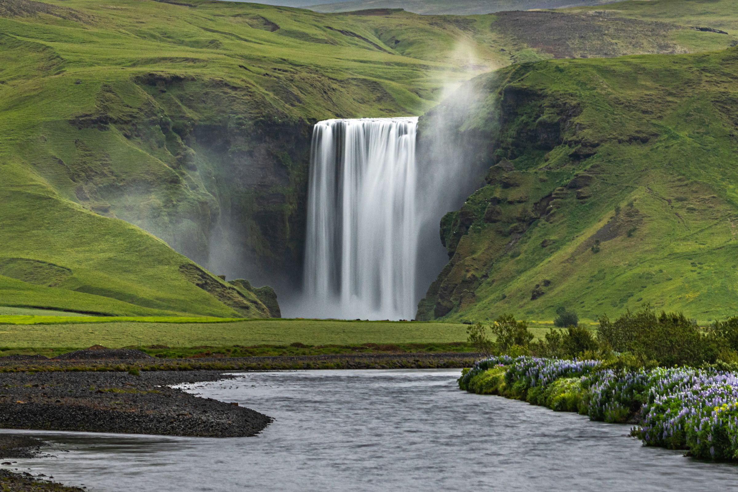
- Skógafoss is the closest major stop, about 25 to 30 km from Sólheimajökull. It's one of Iceland's most impressive waterfalls, dropping 60 metres into a wide pool. Most people combine the two in the same half-day.
- Kvernufoss is a narrower waterfall in a gorge near Skógar, much quieter than Skógafoss.
- Seljalandsfoss is about 55 to 60 km west. It's known for a path that may let you walk behind the falling water when conditions allow. It gets slippery in wet weather, so bring waterproof footwear.
- Gljúfrabúi sits just a few minutes from Seljalandsfoss, partly tucked inside a gorge. The approach involves getting wet and watching your footing, but it's worth the few extra minutes if you're already at Seljalandsfoss.
- Reynisfjara is a black-sand beach near Vík, known for its basalt columns and sea stacks. It's also genuinely dangerous because of unpredictable sneaker waves. Stay well back from the waterline regardless of how calm it looks, and pay attention to all warning systems on site.
- Dyrhólaey is a coastal promontory with good views and a natural arch. Seasonal closures may apply to protect nesting seabirds.
- Vík í Mýrdal is the main nearby village for food, fuel, and accommodation. It's a good base if you're spending more than one day on this part of the South Coast.
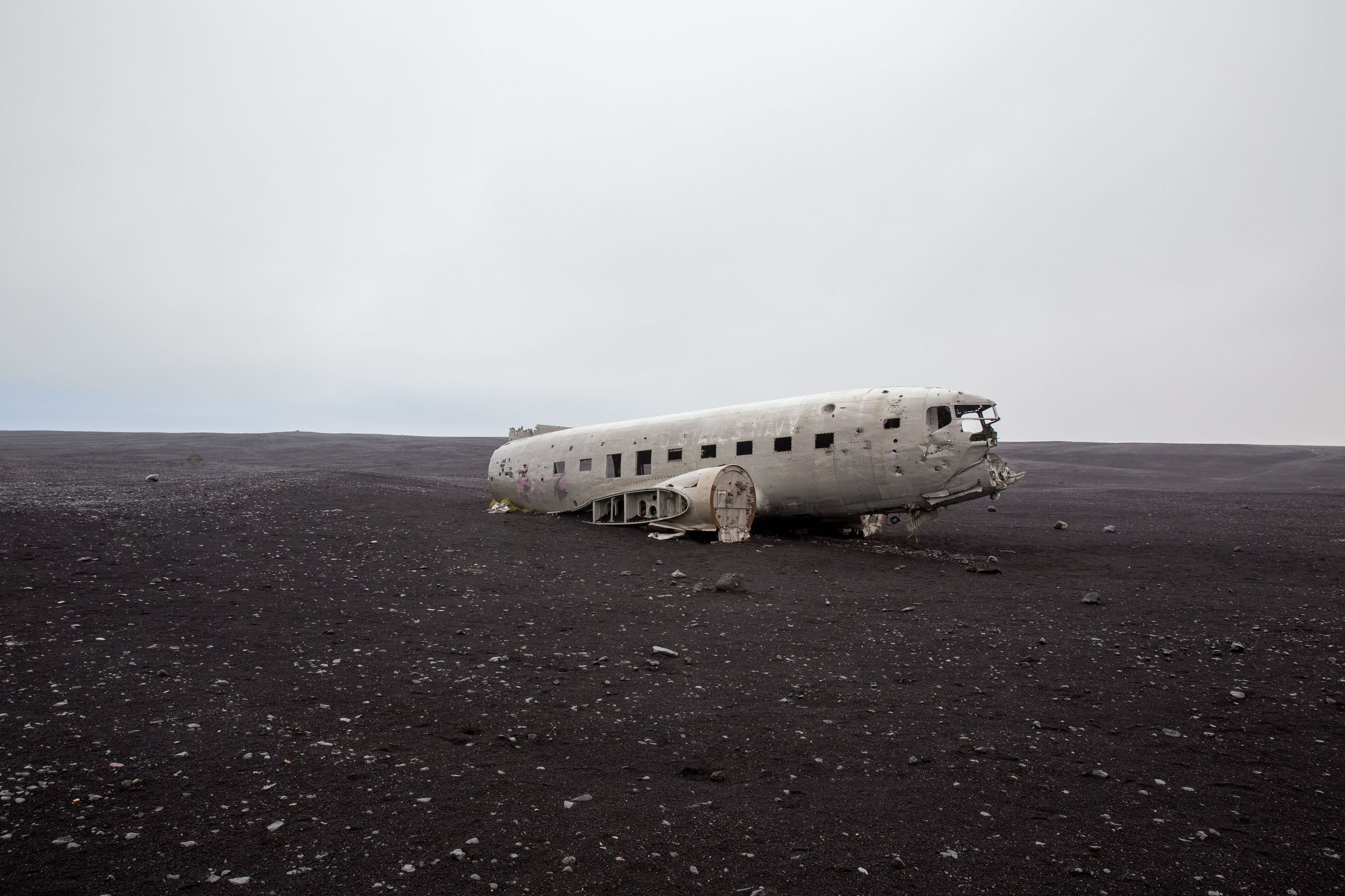
- Sólheimasandur Plane Wreck is a DC-3 aircraft sitting on the black sand outwash plain south of the glacier. It's a long, exposed walk from the official car park, about 4 km each way.
- Eyjafjallajökull is visible to the west. This is the ice-capped volcano whose 2010 eruption disrupted European air travel. It's a separate volcanic system from Katla, though geographically close.
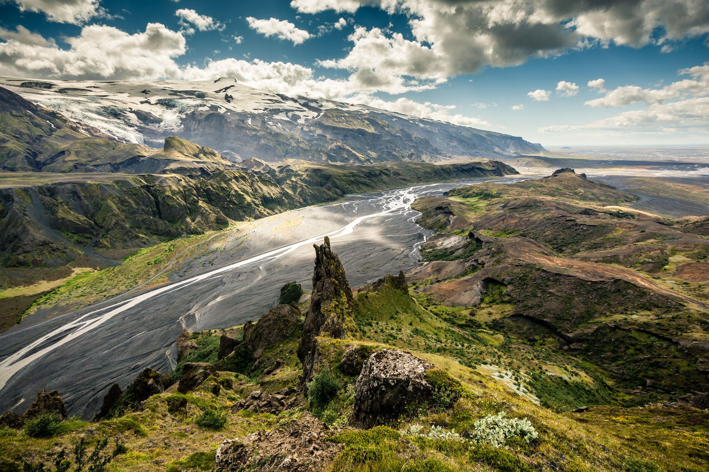
- Þórsmörk is a highland valley north of Eyjafjallajökull. It's a good destination but requires high-clearance transport and river-crossing experience. Don't treat it as a casual detour from the Ring Road.


Practical Travel Tips
Here's a quick checklist of the most important things to sort before and during your visit.
- Booking tours: Book glacier hikes in advance, especially in summer. Popular departure times fill up fast, and last-minute bookings can leave you with limited options or no availability at all.
- Meeting points: Confirm your tour's meeting point before you go. Some operators meet at the parking area, others at a nearby base. Don't assume they're the same place.
- Weather: Check vedur.is the morning of your visit. South Iceland weather changes quickly, and a forecast from the night before isn't reliable for glacier conditions.
- Road conditions: Check road.is for the current state of Road 221. It's normally fine for a regular car, but ice, snow, or flooding can change that.
- Clothing: Bring waterproof everything. Even in summer, South Iceland can turn wet and windy with little notice.
- Parking: Pay via Parka using your vehicle's registration plate. The lot is gravel and can get muddy in wet weather.
- Photography: Waterproof protection for your gear matters here. Rain and spray are common, and lens cloths are worth having in your pocket rather than your bag.
- Safety: Check safetravel.is on the day of your visit. Don't enter any areas blocked by barriers, and don't approach the lagoon's edge on your own.
- Combining with nearby attractions: If you're doing a full South Coast day, plan your stops in order from east to west or west to east to avoid backtracking. The glacier hike takes 3 to 4 hours, so build your day around it rather than treating it as a quick add-on.
- Official alerts: The Icelandic Meteorological Office (vedur.is) and SafeTravel (safetravel.is) are your two most important sources. Check both on the day, not just when you book.
Conclusion
Sólheimajökull is one of the most accessible glacier experiences in Iceland, but accessible doesn't mean simple. The glacier sits in an active volcanic landscape, is retreating faster than it has in decades, and as of mid-2026, its margin is genuinely unsafe because of lagoon expansion, rockfall, and unstable ice.
If you go with a qualified guide, the right gear, and up-to-date safety information, it's a genuinely good experience. The blue ice, the volcanic ash layers, the visible retreat, the South Coast setting. It's one of those places where you come away actually understanding something about Iceland rather than just seeing it through a car window.
Frequently Asked Questions About Sólheimajökull