
The Hvítá River: Golden's Circle Famous River
The Hvítá River starts at a glacier and ends up carving one of Iceland's most photographed landscapes on its way south.
Here's everything you need to know about the river itself, plus Gullfoss, Brúarhlöð, and the gorge it's cut through in South Iceland.
About the Hvítá River
If you've driven the Golden Circle, you've already seen the Hvítá, even if nobody told you what it was called. It's the glacial river running through South Iceland that feeds Gullfoss, and it's the reason behind one of the most striking landscapes in the country.
Hvítá means "White River" in Icelandic, and that makes sense once you actually see it. The water starts out at a glacial lake, picks up fine rock particles on its way down, and ends up with that pale, milky look that gives the river its name.
As it heads south, the river does a bunch of different things along the way:
- It flows out of Hvítárvatn, a glacial lake fed by Langjökull
- It builds up a lot of force before dropping over Gullfoss
- It cuts through a long gorge below the falls
- It squeezes and twists through Brúarhlöð, a few kilometers downstream
- It settles down further along, in the stretches used for rafting
All of this is really just one river doing different things at different points. Most tour buses stop at Gullfoss for maybe 20 minutes and then leave, which is fine if all you want is a photo, but it skips pretty much everything else the river's been up to for thousands of years.

Brúarhlöð and Gullfoss Canyon
As the Hvítá moves south, it cuts through two different sections of the gorge that people mix up a lot. They're connected, but they're not in the same place, so it helps to know which is which before you plan your stops.
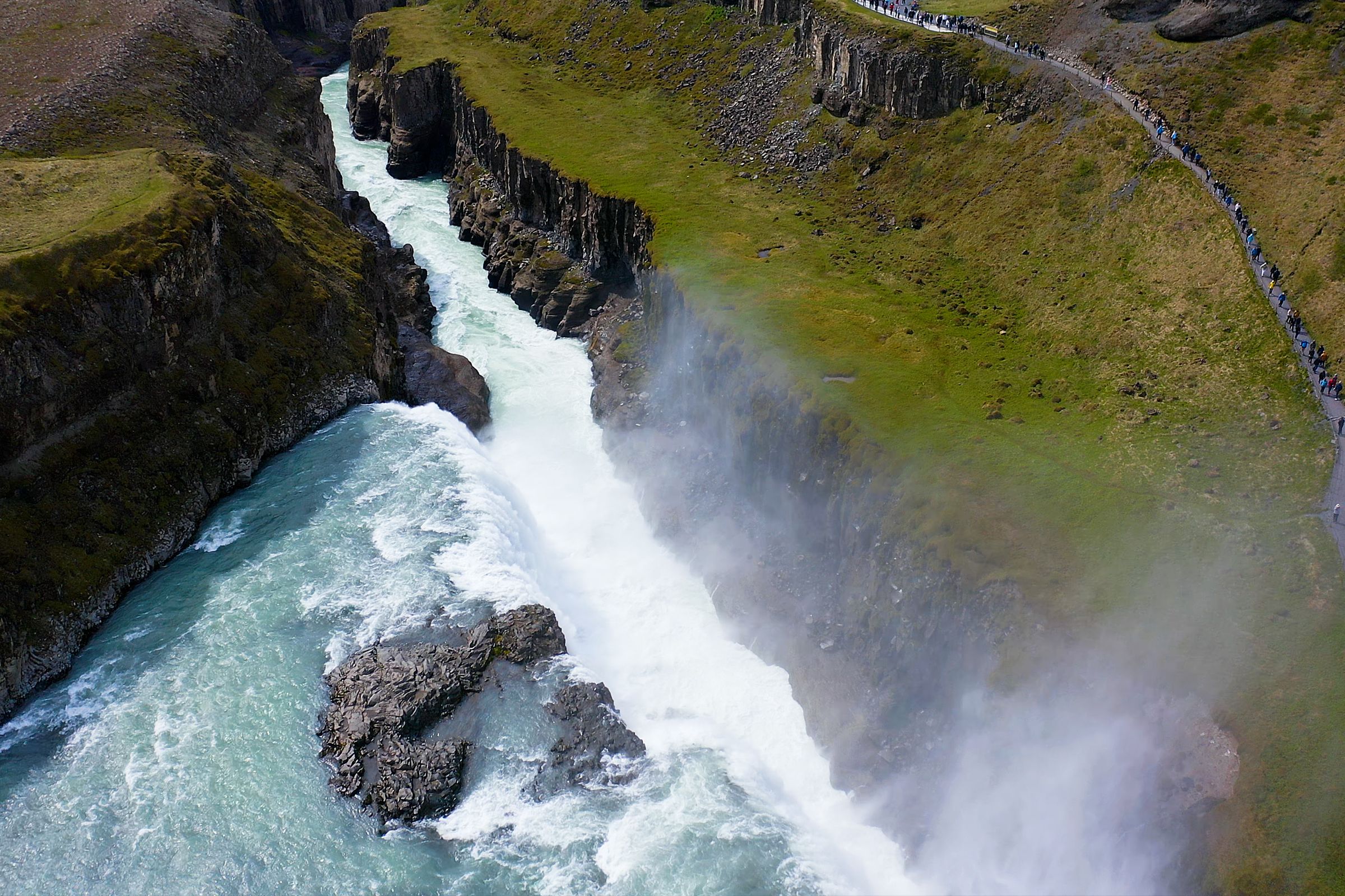
- Gullfossgljúfur: the gorge the river carves right below the waterfall, about 2.5 kilometers long and up to 70 meters deep. What makes this part so dramatic is what the river actually does here. Hvítá runs across open, pretty flat ground above the falls, then suddenly drops into this narrow, dark crack in the earth.
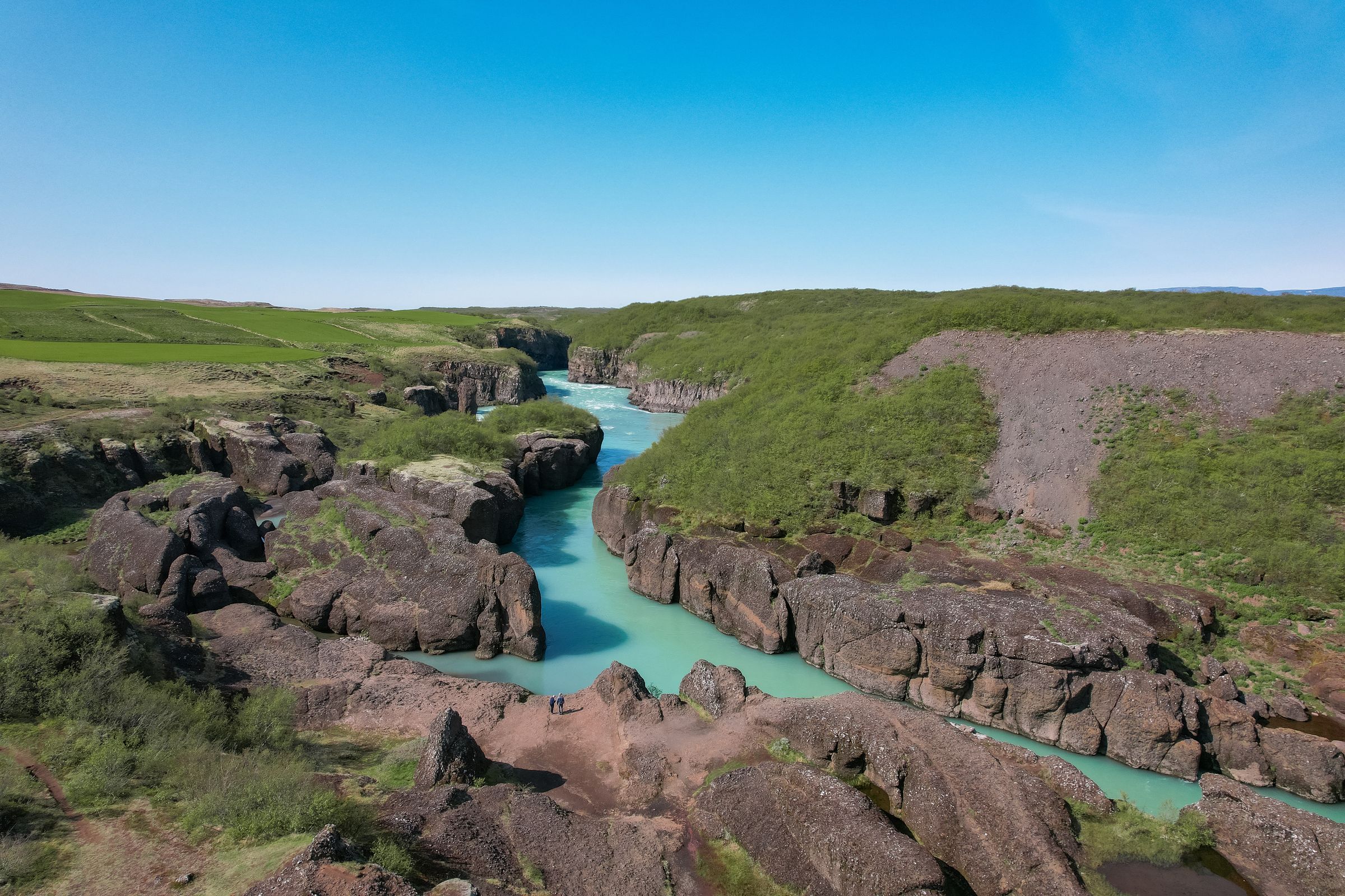
- Brúarhlöð: where the river narrows again, about three kilometers south of Gullfoss, marking the start of a longer gorge, closer to 10 kilometers, shaped more by carved rock than by any single drop. Instead of one big waterfall, the river pushes through pillars, hollowed-out pockets, and tight channels with a lot of force.
So if someone mentions the "Hvítá River Canyon," it's worth checking which stretch they actually mean. Gullfossgljúfur is the one everybody's seen in photos. Brúarhlöð is the quieter, stranger bend in the same river, just down the road. Neither one is officially part of the Golden Circle route, but both are close enough to squeeze into the same day.
Location
The Hvítá runs through South Iceland, through the upper part of the Árnessýsla region and into Bláskógabyggð municipality. Along the way, it crosses the point where farmland turns into highland, which is a big part of why the scenery changes so much as you drive north from Reykjavík. Green fields turn into an open, treeless plateau in a pretty short stretch of road, and the river's right there the whole time.
You'll find the Gullfoss section of the river:
- About 10 kilometers northeast of the Geysir geothermal area
- Roughly 115-120 kilometers from Reykjavík by road
- South of the Kjölur highland route, which follows the river further north into the interior
- Southeast of the Langjökull glacier, where the river's water comes from in the first place
It sits at the far end of the classic Golden Circle loop, so it's easy to pair with Þingvellir and Geysir in one day. Because of its location, most self-drive trips make Gullfoss the last stop before heading back toward Reykjavík or moving on to somewhere else.
Getting There
Most people reach the river by car, either driving themselves or on a Golden Circle tour, since public transport doesn't really cover this area.
From Reykjavík
The usual route is Route 1 east, then Route 35 north through Selfoss and past Geysir before you get to Gullfoss, where the river makes its big drop. Some people go through Þingvellir first on Route 36, then join Route 35 later on. Either way, plan on about two hours each way with no stops, longer in winter or if you're stopping at Þingvellir and Geysir along the way.
Reaching Brúarhlöð
Brúarhlöð needs its own little detour near Road 30. It's close to Gullfoss if you're measuring in a straight line, but the road doesn't follow the river, so you can't just drive or walk there from the Gullfoss parking lot. I'd add an extra 15 to 20 minutes of driving if you're planning to see both in one day.
Do you need a 4x4?
Not really, not for a regular summer visit to see the river at Gullfoss. Route 35 is paved and kept in good shape all the way to the visitor area. Winter's a different story, though. Ice, wind, and closures that pop up out of nowhere matter a lot more than what's under your hood, so check conditions before heading out instead of just trusting whatever car you rented.
One more thing worth knowing: Route 35 continues north along the river past Gullfoss into the Kjölur highland route. That's a totally different kind of road, gravel, seasonal, closed most of the year. Just because you got to Gullfoss safely doesn't mean the road further on is open, or that your car can handle it.

Geology and Formation
The Hvítá hasn't always run through the same channel, and the landscape it's carved through today comes down to volcanic rock colliding with a glacier, then being worn away by moving water for something like 10,000 years. And it's still going on right now.
Here's the short version of how it all happened:
- Volcanic rock came first. Eruptions under ice or water shattered lava into fragments, which turned into hyaloclastite and volcanic breccia, the rock you see today along the river at Brúarhlöð. In Icelandic, it's sometimes called þursaberg.
- Glaciers shaped the land around it. During the last Ice Age, moving ice and meltwater carved out the wider terrain the river would later run through.
- The river found its path. Around the end of the Ice Age, Hvítá started flowing where it does now. Old, abandoned channels east of Gullfoss show that the river once ran elsewhere before it shifted west into the path it takes today.
- Erosion did the rest. Fast water, sediment, and repeated flooding kept cutting the river's gorge deeper over time, through a few different things:
- Water pressure pushing into cracks
- Sand and gravel scraping against the riverbed
- Softer rock wearing away faster than the harder stuff above it
- Water freezing in cracks, expanding, and slowly breaking rock apart
That mix is why the gorge isn't smooth or even. It's rough, with ledges, pillars, and collapsed chunks of rock scattered along it, since different layers wear down at different speeds. At Brúarhlöð, stones spinning around in the current have actually carved round hollows into the rock, sometimes called potholes or giant's kettles.
And the river's not done yet. Every flood moves a bit more sediment, wears away a bit more rock, and pushes things a little further along the path it's followed for thousands of years.
Gullfoss and the Hvítá River
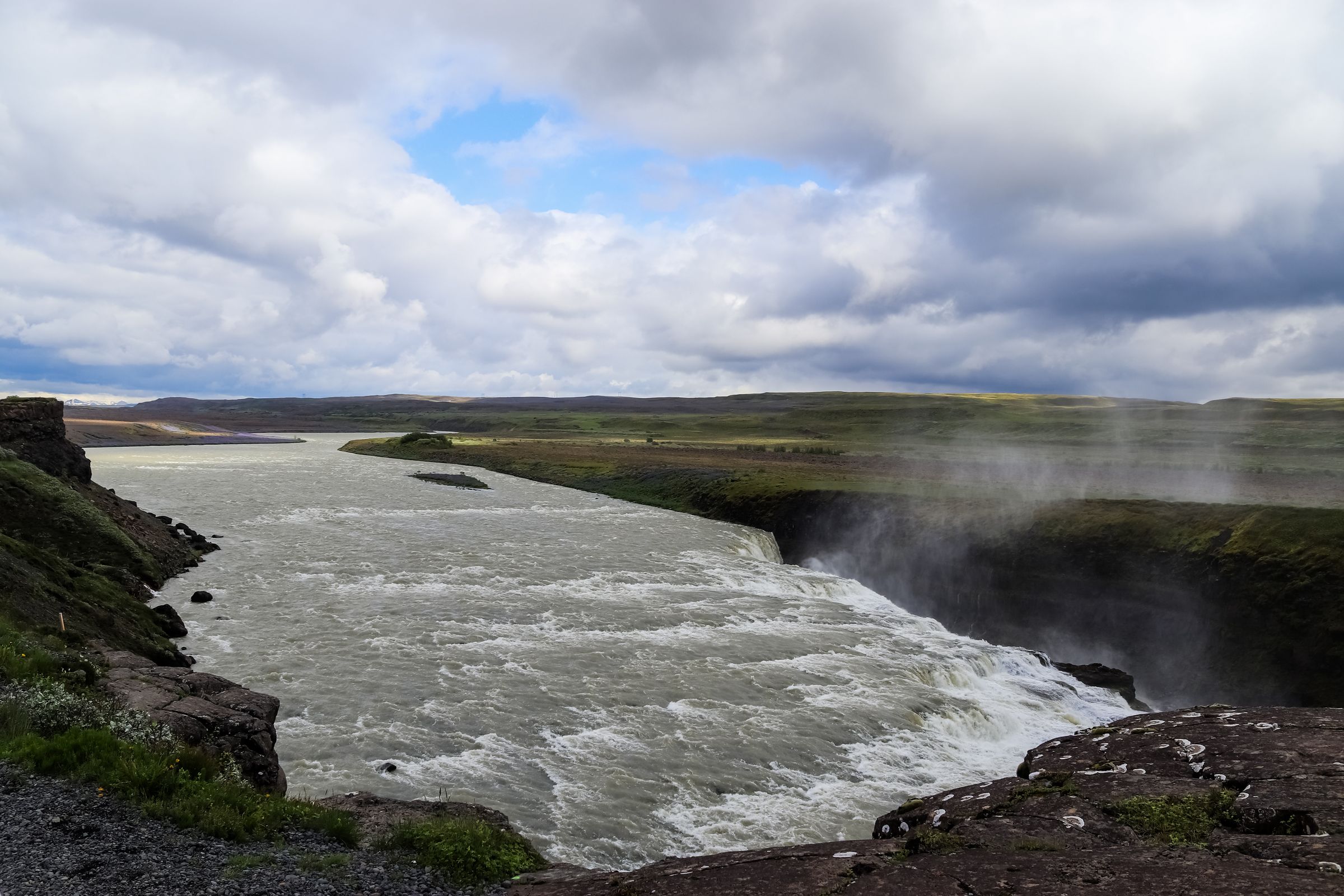
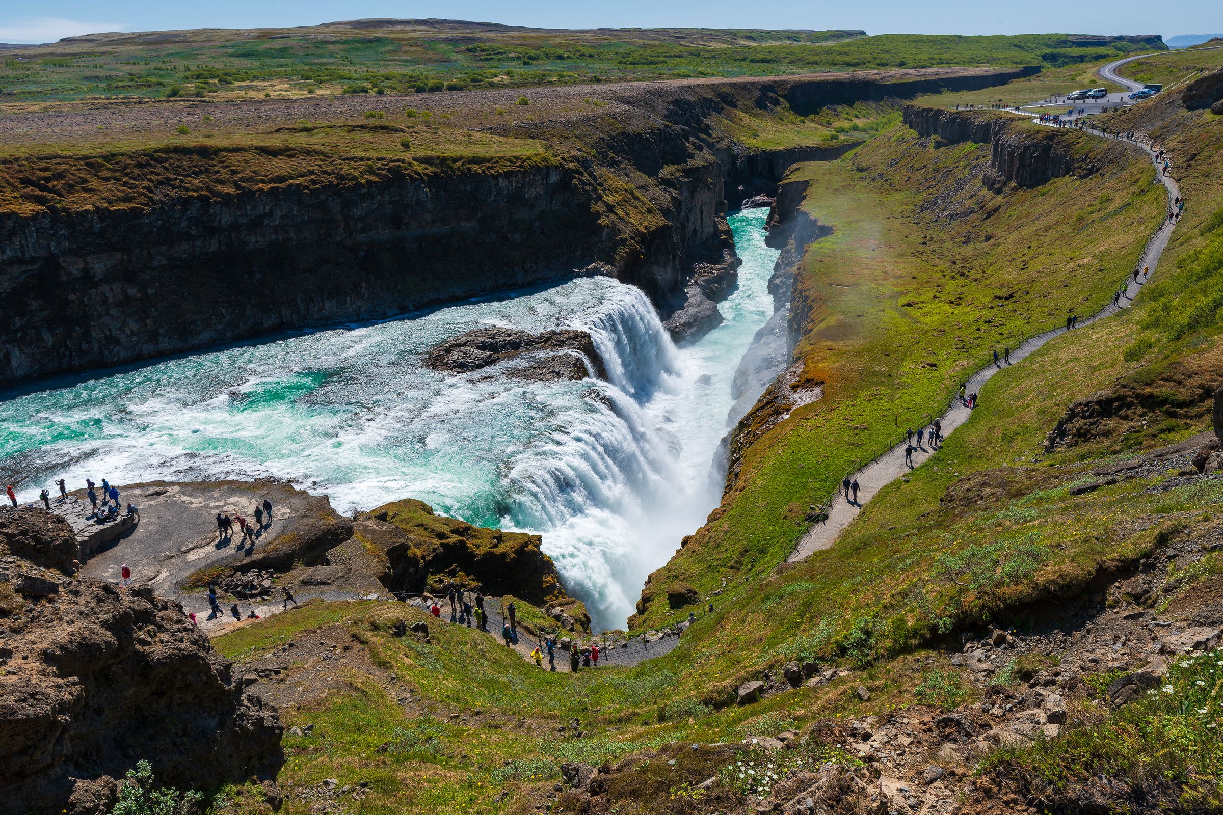
Gullfoss isn't some separate attraction from the river, it's the river's biggest moment. The Hvítá starts at Hvítárvatn, a glacial lake fed by Langjökull, then flows south for around 30 kilometers before it reaches the falls.
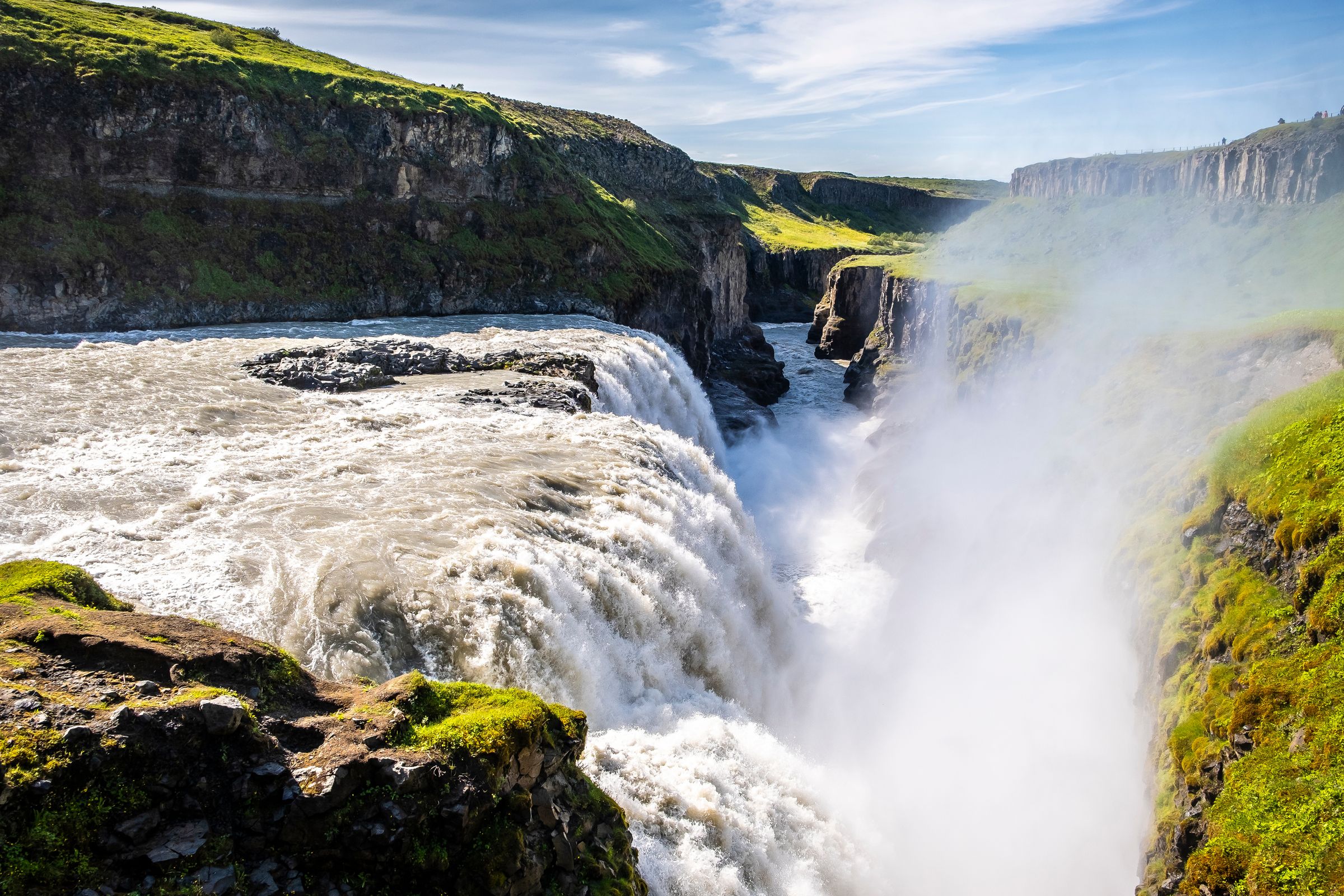
At Gullfoss, the river comes down in two stages:
- An upper drop of about 11 meters
- A lower drop of about 20 meters
- A combined descent of around 31 meters, before the river squeezes into the narrow gorge below
That two-stage drop is a big reason it looks so different from a regular single-drop waterfall. From certain angles, the river genuinely looks like it's just disappearing into the ground.
That pale, milky color you see running through the whole river isn't a trick of the light. It comes from glacial flour, tiny bits of rock ground up as the glacier scrapes against bedrock upstream. Depending on the sunlight and time of year, the river can look:
- Grey under cloudy skies
- Pale blue in softer light
- Turquoise when the sun's out and strong
Further downstream, the river keeps wearing away weaker layers of sediment under the harder rock, which is part of why the falls have slowly moved upstream over a long time. It's slow on a human timescale, but the river hasn't stopped working at it.
Brúarhlöð Bridge and King's Road
The river at Brúarhlöð isn't just about the rocks, it's tied to a real piece of Icelandic history too.
- A wooden bridge first went up over the river here in 1906, built to get ready for the 1907 visit of King Frederik VIII of Denmark.
- The road built for that trip became known as Kóngsvegur, the King's Road, and it was a pretty ambitious project for its time.
- That first bridge didn't last long. Floods on the river took out two later versions, one in 1929 and another in 1930.
- The bridge standing there today went up in 1959, and it's still the one crossing the Hvítá at Brúarhlöð.
Standing there now, you're looking at a spot where the river has actually wrecked infrastructure more than once. That alone tells you how much force the water carries through this narrow stretch when it's running high.
It's also a good reminder that this isn't just scenery to look at. This river shaped how people got around this part of Iceland long before anyone showed up with a camera.
Best Viewpoints and Walks
Where you stand really changes what you get out of watching the river here, so it's worth picking your spots based on what you want to see and how much time you've got.
Gullfoss viewpoints
The upper viewpoint gives you the whole waterfall and the river's canyon in one shot, and it's the easiest one to reach from the parking area. The lower path gets you closer to the spray and the first big drop, when it's open, though it can get wet, slippery, or closed off depending on conditions.
The Brattholt trail
A marked path runs about 3 kilometers each way along the river between Gullfoss and Brattholt, so around 6 kilometers if you do the round trip. It's considered an easy walk in decent weather, and it gives you a different angle looking back over the river's gorge than the main viewpoints do. Wind, mud, or ice can make it feel a lot harder than the distance suggests, though.
Brúarhlöð
This one's more of a short scenic stop than an actual hike. You get up close to the rock pillars locals call Karl and Kerling, "the old man and woman," plus the turquoise water forcing its way through the narrow gorge. There's less infrastructure here than at Gullfoss, so watch your footing near the edges, since the ground's a bit rougher.
Photography notes
Early morning and evening give you softer light and fewer people in your shots. At Gullfoss, a polarizing filter can help cut the glare off the water and bring out more of the river's color. If you're using a longer exposure to smooth out the water, be careful you don't go so long that the photo loses all sense of how much force is actually behind that river.
Rafting and Outdoor Activities
If you'd rather feel the river than just look at it from up on the rim, rafting's the way to go. Commercial trips cover about 7 kilometers of the Hvítá, mixing calm stretches with real rapids, so you get a completely different feel for the same river you'd otherwise only see from above.
A decent outfitter should give you:
- A helmet and life jacket
- A wetsuit or dry protection depending on the season
- A safety briefing before you get on the water
- A guide who actually knows what the river's doing that day
Don't try to kayak or float this river on your own. It's really not the place to freelance, even if you've done whitewater somewhere else, since water levels and hazards here can change fast depending on the weather and glacial melt.
Outside of rafting, the river corridor is also good for photography, birdwatching along the calmer stretches, and just walking along the rim. If you're making a full day of it, pairing a morning rafting trip with an afternoon at Gullfoss and Brúarhlöð makes good use of the drive out here.
Best Time to Visit
Every season shows off the river a bit differently, so it really comes down to what you want and how flexible your plans are.
- Summer (June to August): Long daylight, easier roads, and the river running strong from glacier melt, but also the busiest crowds at Gullfoss, especially around midday.
- Autumn (September to October): Fewer people and nice low light for photos, but days get shorter fast and you can start seeing ice on the river by October.
- Winter (November to March): Some pretty dramatic ice building up along the river and a decent shot at the northern lights on clear nights, but you're dealing with short daylight, icy paths, and the chance of road closures.
- Spring (April to May): The river runs strong with meltwater and the light keeps changing, but you'll also get mud, leftover ice, and freeze-thaw conditions that mess with your footing.
If it's your first time and you just want an easy day, June through September is the simplest window. If you're after the dramatic winter look, go in with flexible plans, good boots, and get in the habit of checking the forecast each morning instead of trusting whatever you saw the night before.
Practical Information
A few things worth knowing before you show up, since they can shape the rest of your day.
- Facilities: There's food and shopping near the upper Gullfoss parking area, right where the river drops. Don't expect the same at Brúarhlöð, which barely has any infrastructure.
- Entrance fee: Just seeing the river and the falls at Gullfoss is free, but parking and services can change at any point, so keep an eye.
- Time needed: Around 60 to 90 minutes for the main Gullfoss viewpoints, or half a day if you're adding Brúarhlöð or the Brattholt walk.
- Mobile coverage: Usually fine near the main sites along the river, less reliable if you wander further into the countryside.
- Accessibility: The upper Gullfoss area is a lot easier to get around than the lower path or Brúarhlöð, which has rougher ground and fewer barriers.
- Toilets: Available near the main Gullfoss visitor area, but not at Brúarhlöð.
Travel Tips
A few small choices can make your visit to the river go a lot smoother, especially if you're squeezing this into a bigger Golden Circle day.
- Go early morning or evening if you want fewer crowds and better light, especially at Gullfoss.
- Bring a waterproof jacket even in summer. The spray off the river at Gullfoss reaches a lot further than you'd think.
- If you're going in winter, get proper boots with grip, and think about slip-on traction for icy paths.
- Check the weather and roads the morning you leave, not just the night before, since things change fast around here.
- Want to fly a drone over the river? Sort out the permit for the protected area ahead of time instead of figuring it out at the parking lot.
- If you're doing Gullfoss, Þingvellir, and Geysir all in one day, I'd hit the river at Gullfoss either first or last so you're not backtracking.
Safety and Conservation
The Hvítá looks calm from far away, but the river and the ground around it both deserve real respect. Most of the risks here aren't obvious until you're already standing near them.
- Stay back from the edges. The rock near the river's rim can be undercut, wet, or hide ice under a surface that looks completely dry. Don't step past barriers just to get a better shot.
- Treat the river as dangerous, always. Hvítá is cold, fast, and full of hidden current, even in spots that look calm on top. Swimming or wading isn't worth it, no matter how nice it looks on a warm day.
- Watch out for wind. Open, exposed viewpoints along the river can get hit with strong gusts that mess with your balance more than you'd expect, especially near unprotected edges.
- Respect the protected status. Gullfoss and Hvítárgljúfur at Brattholt, both part of the river's course, have been protected since 1979, covering close to 155 hectares. That means sticking to marked paths, not picking up rocks, and leaving the moss and plants alone, since it can take years, sometimes decades, for that stuff to bounce back after being trampled.
- Save the emergency number. It's 112 anywhere in Iceland, and I'd save it before you go rather than looking it up after something's already gone wrong. If someone falls into the river, call for help right away instead of going in after them yourself.
Nearby Golden Circle Sights
Since you're already out here following the river, it's worth adding a few more stops to the trip.
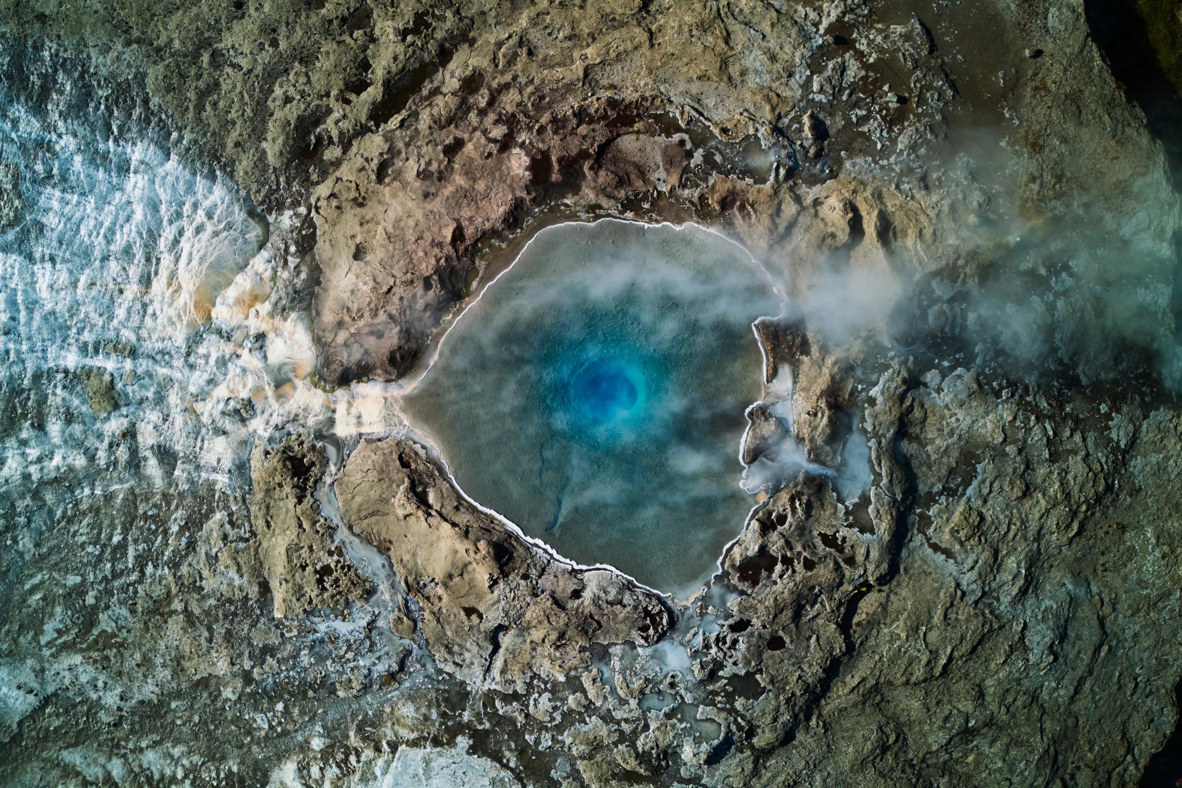
- Geysir: Home to Strokkur, which erupts every few minutes, just 10 kilometers from Gullfoss and one of the easiest geothermal stops in the country.
- Þingvellir National Park: A UNESCO World Heritage Site where you can walk between two tectonic plates, and home to Iceland's historic parliament site.
- Kerið: A volcanic crater with a striking blue-green lake inside, usually a quick 15 to 20-minute stop.
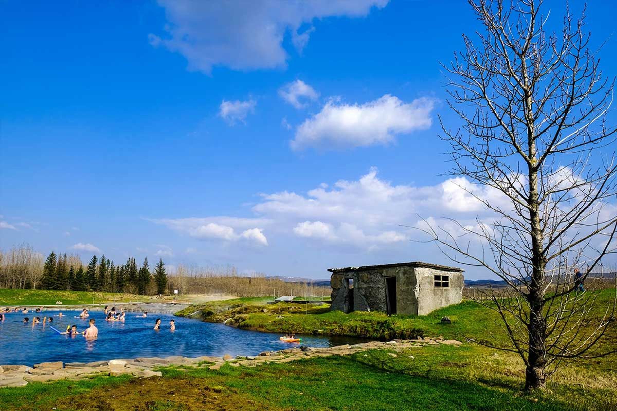
- Secret Lagoon: A geothermal bathing spot near Flúðir, good for warming up after a day out in the wind.
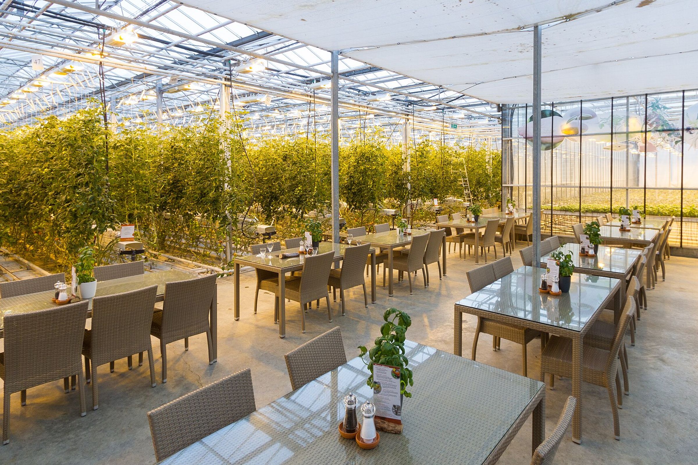
- Friðheimar: A greenhouse farm known for tomato soup served right where the tomatoes grow. Worth booking ahead for lunch.
- Faxi: A smaller, wider waterfall on a different river, a good short stop if you want a break from the crowds at Gullfoss.
Most of these fit easily into a single Golden Circle day if you start early and don't linger too long at any stop.



Conclusion
The Hvítá is much more than just the river that feeds Gullfoss. It starts at a glacial lake fed by Langjökull, picks up speed on its way south, drops in two dramatic stages at Gullfoss, then keeps carving through gorges at Brúarhlöð and beyond, through a landscape it's been shaping for around 10,000 years.
If you can, give yourself time to see more than just the waterfall. Between the drop at Gullfoss, the history at the Brúarhlöð bridge, and the rock formations the river's carved further downstream, there's a lot more to this river than most people expect. If I were you, I'd slow down for half a day instead of rushing through in twenty minutes.
Frequently Asked Questions About the Hvítá River