
Kleifarvatn Geothermal Lake: Travel Guide in 2026
Kleifarvatn is a stark volcanic lake on Iceland's Reykjanes Peninsula, sitting between the Sveifluháls ridge and the Krýsuvík geothermal fields. It's not a warm bathing lagoon like the Blue Lagoon. It's a quiet, moody stretch of water surrounded by black sand, lava, and steam, and it's a great add-on to a Reykjanes road trip. Give it 20 minutes if you just want a quick look, or a half day if you want to hike and check out Seltún right next door.
Key Takeaways
- Kleifarvatn is one of the Reykjanes Peninsula's best free scenic stops, located about 35–40 minutes from Reykjavík, with dramatic volcanic landscapes, black-sand shores, and easy access from Route 42.
- Pair Kleifarvatn with the nearby Seltún Geothermal Area for the best experience, combining a volcanic lake, steaming vents, bubbling mud pots, and short walks in a single half-day trip.
- A standard 2WD rental car is usually sufficient, but check road, weather, and volcanic activity updates before visiting, especially in winter or when traveling near Grindavík.
- The lake is ideal for photography, hiking, and sightseeing—not swimming, with highlights including shoreline viewpoints, the Sveifluháls ridge hikes, and seasonal northern lights opportunities.
- Expect limited facilities and changing weather, so bring waterproof layers, sturdy footwear, food and water, and stay on marked paths to protect fragile geothermal areas and moss-covered landscapes.
Kleifarvatn at a Glance
Here's the short version if you're just trying to figure out whether this fits your trip.
- Location: Reykjanes Peninsula, southwest Iceland
- Main access road: Route 42, Krýsuvíkurvegur
- Driving distance from Reykjavík: around 35 to 40 minutes
- Recommended visit length: 20 minutes to a half day
- Admission cost: free to view
- Parking: small roadside pull-offs, more formal parking at Seltún
- Toilets: limited at the lake, available at Seltún
- Best season: summer for easy access, winter for the northern lights
- Typical activities: driving, short walks, hiking, photography
- Swimming: not a good idea
- Accessibility: uneven ground, tough for wheelchairs and strollers
- Closest major attraction: Seltún geothermal area
Is Kleifarvatn Worth Visiting?
Yes, if you like your scenery a bit rough around the edges instead of polished and full of people.
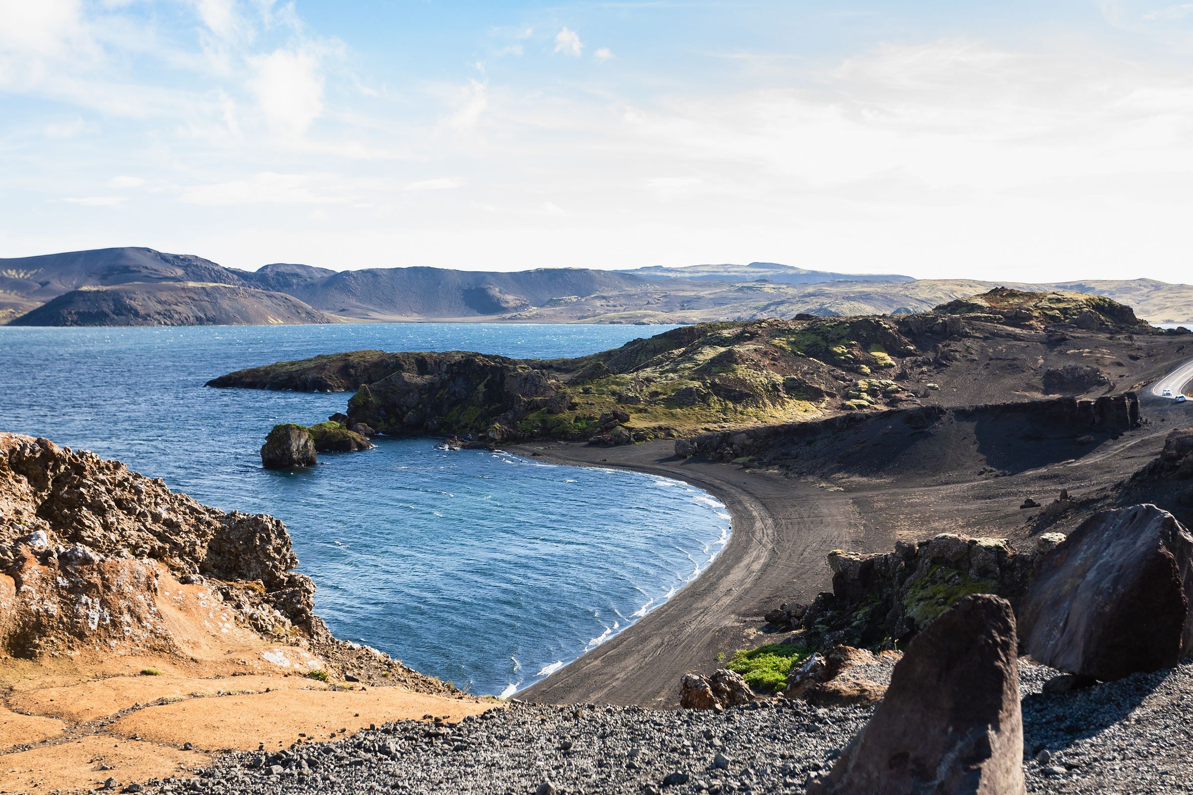
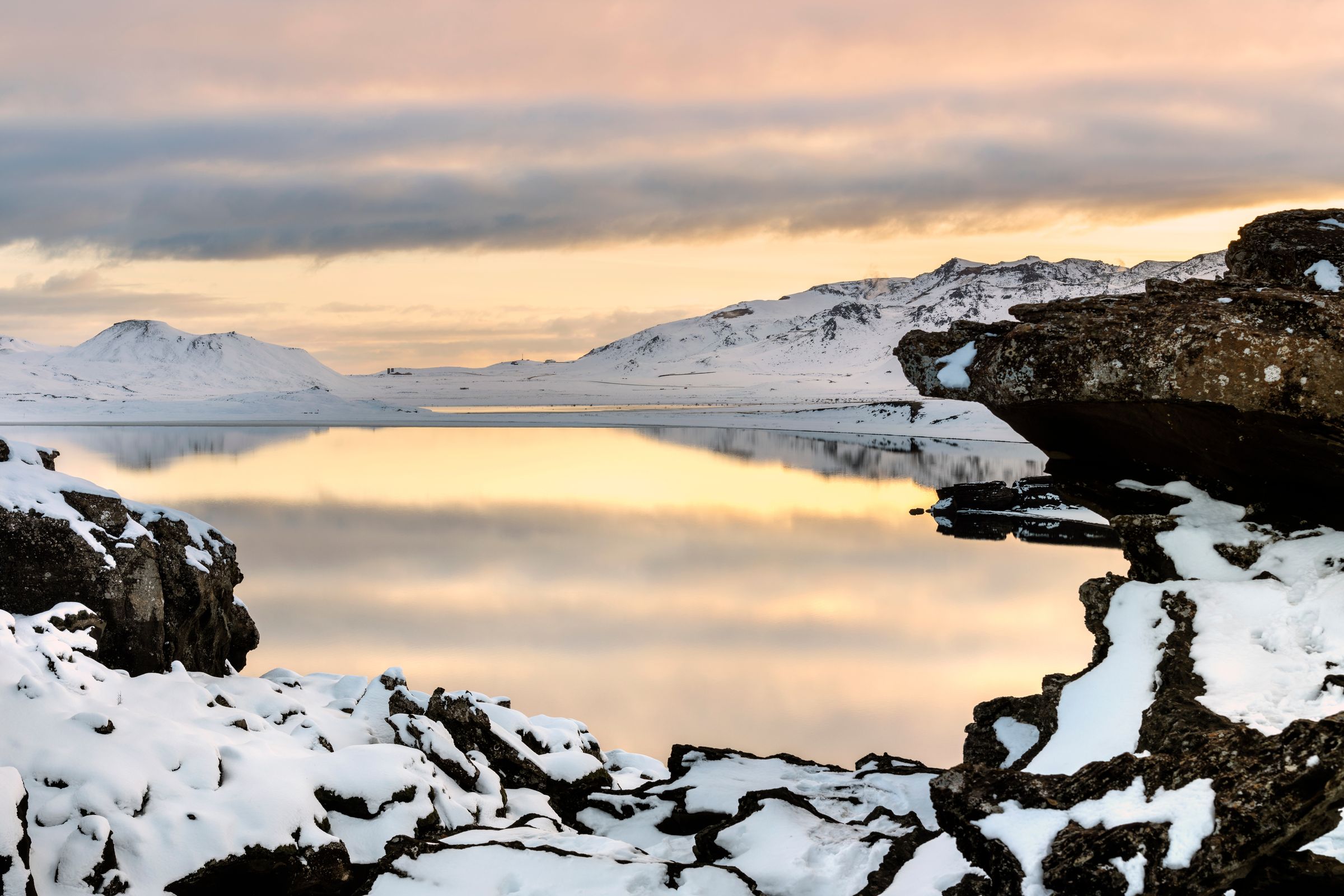
The lake sits in a volcanic basin with black-sand shores, dark ridges, and views of Sveifluháls. It's one of the calmer stops on Reykjanes, especially compared to the busier Blue Lagoon, and it's close enough to Seltún that you can do both in one trip with little extra driving.
- Landscape photographers: you'll like the reflections and the volcanic textures
- Geology fans: this is basically a front-row seat to an active fault zone
- Road-trippers: fits nicely into a Reykjanes loop
- Hikers: Sveifluháls gives you a real climb to work with
- Anyone sick of crowds: this isn't a tour bus stop
One thing to know before you go: there's not much here in the way of restaurants, shops or bathrooms. This is a place to look at the landscape, not a place to grab a coffee.
Where Is Kleifarvatn?
Kleifarvatn sits inside the Krýsuvík volcanic area on the Reykjanes Peninsula, in southwest Iceland.
It runs along Route 42, with Sveifluháls to the west and Vatnshlíð to the east. Seltún is just down the road, and the whole area is part of the Reykjanes UNESCO Global Geopark.
Kleifarvatn isn't on the Golden Circle and it's not on the Ring Road either, so you'll need a separate Reykjanes stop or detour to see it.
How to Get to Kleifarvatn
There are a few ways to reach the lake, depending on where you're coming from.
From Reykjavík
Drive south through Hafnarfjörður and get on Route 42 toward Krýsuvík. It takes about 45 to 60 minutes when conditions are decent, and a normal rental car handles it fine as long as the road is clear. Some stretches get windier once you're up in the volcanic interior, so hold onto the wheel if it's gusty out.
From Keflavík Airport
Kleifarvatn works well on an arrival or departure day since it's part of the Reykjanes Peninsula loop. Just keep in mind you'll probably have luggage in the car, and check the forecast, since wind and rain can make roadside stops less fun.
From Grindavík or the South Coast of Reykjanes
Access can shift here because of volcanic activity and road closures. Check the current road status before heading this way, since things can change without much warning.
Public Transportation
There's no regular bus that gets you straight to the lake. A rental car, guided tour or private transfer is really your only option.

Road Conditions and Rental-Car Requirements
Route 42 is paved, and a two-wheel-drive car is usually fine in summer, but winter is a different story. Here's what to keep in mind:
- Snow, ice, and wind can make the drive harder in winter
- Some rental companies won't let you take a two-wheel-drive car out during the winter months
- Four-wheel-drive helps with grip, but it doesn't turn a genuinely bad road into a safe one
- Always check current road conditions before you go
- Don't drive onto the beach or any unmarked track
Parking, Facilities, and Accessibility
Don't expect much in the way of infrastructure right at the lake. You’ll find:
- Small pull-offs and roadside parking spots at the lake, with a proper setup at Seltún nearby
- Toilets, cafés, and shops are basically nonexistent at the lake itself
- Ground is uneven gravel and volcanic rock, tough for wheelchairs, strollers or anyone who has trouble with mobility
- Some of the best views are right from the roadside, no hiking needed
- Park all the way off the road
Best Viewpoints Around Kleifarvatn
Where you stop really depends on how much effort you're up for.
Roadside Lake Views
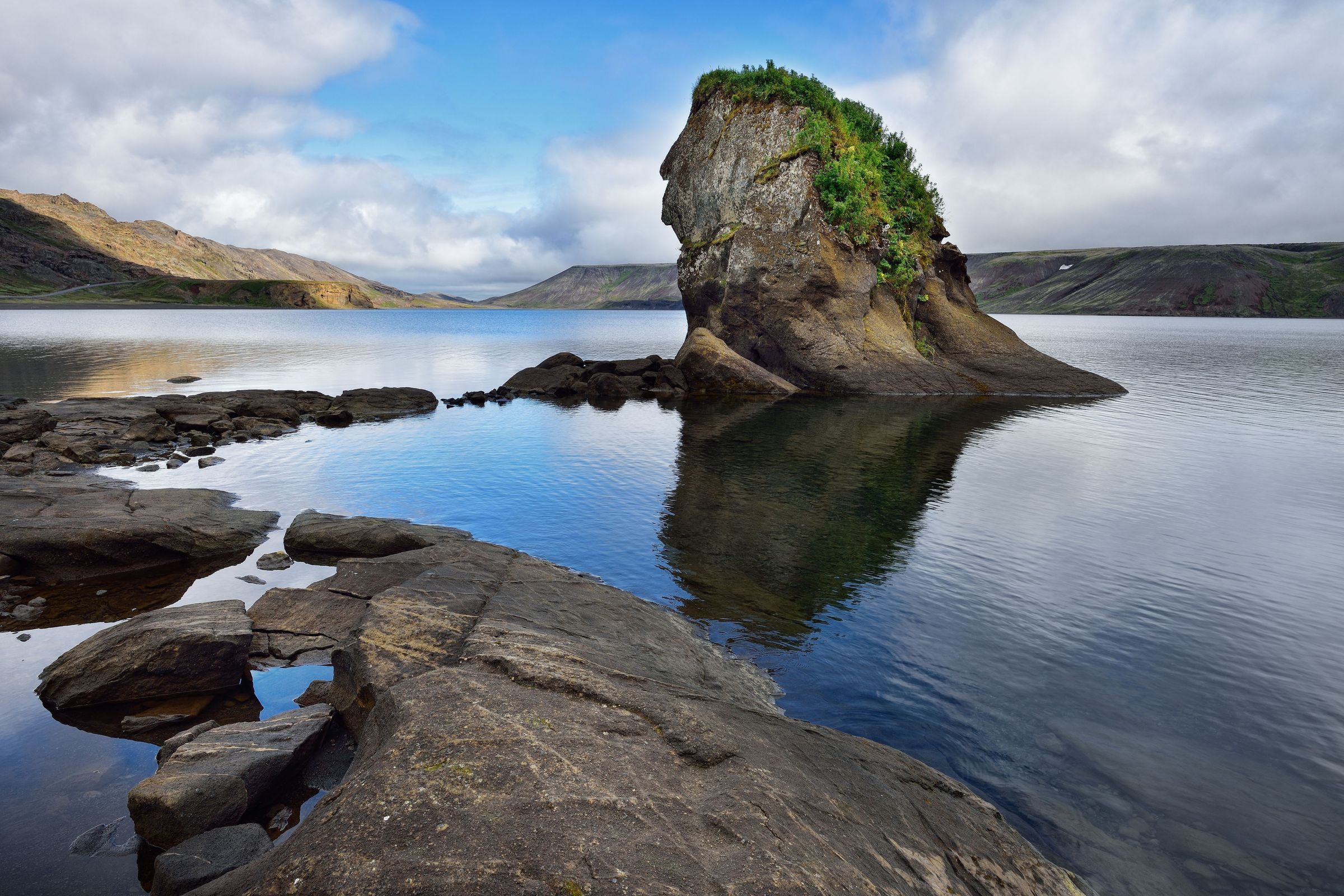
Great for a short stop. Pull off somewhere safe, get out of the car, and you've already got a solid view without much walking.
Black-Sand Shoreline Views
Good if you want close-up shots of texture and reflections, though the footing can get uneven and slippery in spots.
Elevated Views from Sveifluháls
This one means an actual hike, but you get wide views over the whole lake and the ridges around it in return.
Southern Lake Viewpoints
These combine the lake with the geothermal scenery near Krýsuvík, so you get two different landscapes in one stop.
Don't stop anywhere without a safe pull-off, even if the view looks worth it.
How Long Should You Spend at Kleifarvatn?
Depends how deep you want to get into it.
- Quick stop, 20 to 30 minutes: roadside views, a short walk, a few photos
- Standard visit, 1 to 2 hours: a few viewpoints, some time on the shoreline, plus Seltún
- Half day: a real hike, more serious photography, and time for other geothermal stops nearby
Weather and road conditions can stretch any of these out, so leave yourself some extra time.
Best Things to Do at Kleifarvatn
The lake itself is the main event, but there are a few ways to make the most of a visit beyond just driving past it.
- Enjoy the drive: Route 42 is part of the experience, cutting straight through raw volcanic terrain
- Walk the shoreline: short, casual walks work in some spots, just steer clear of the fragile plants and loose slopes
- Visit Seltún: this is the most worthwhile companion stop, right down the road
- Hike Sveifluháls: the ridge west of the lake gives you tougher terrain and big views
- Photograph the landscape: reflections, black sand, and shifting light all make for good shots
- Watch for birds: keep your expectations modest here, since it depends a lot on the season
- Learn the earthquake history: the shoreline you're looking at tells the story of the 2000 water level drop
Hiking Around Kleifarvatn
There's a real difference between a casual walk along the shore and an actual hike here. The options go from easy shoreline strolls to demanding ridge routes, so it's worth knowing what you're getting into before you head out.
Short Walks and Shoreline Access
A few informal paths run from pull-offs along Route 42 down toward the water. Nothing technical, no special gear needed. That said, there's no continuous trail around the lake. The shoreline keeps getting broken up by cliffs, loose ground, and spots where it just drops steeply into the water. Don't go in assuming you can follow the edge all the way around, because you can't.
Stapatindar and Miðdegishnúkar
Both summits are on Sveifluháls, the volcanic ridge directly west of the lake.
- Stapatindar: About 2 to 3 km from the parking area near the lake, around 330 meters of elevation gain, summit at about 401 meters. Moderate difficulty. Go early if you can, before the wind picks up and cloud starts coming in.
- Miðdegishnúkar: You reach it from a gravel turnoff along Route 42 and climb straight up onto the ridge.
I'd recommend both if you want more than just a view from the road. From up there you get a real feel for the shape of the lake and how the whole landscape fits together around it.
Longer Routes on Sveifluháls
These are a completely different thing from the short summit hikes and will take most of a day. Here's what you're dealing with:
- Loose scree and volcanic rock pretty much the whole way
- Exposed ridgelines with nowhere to shelter
- Fog that can come in fast and cut visibility quickly
- Very few ways off once you're up on the ridge
- No water anywhere out there
If you're going for one of the longer routes, download offline maps before you leave, tell someone where you're going, and be honest with yourself about turning back if the weather shifts. Check the Icelandic Meteorological Office forecast the morning you go, not the night before.
Best Time to Visit Kleifarvatn
Every season here brings something different, and honestly there's no single "best" time, just a trade-off between easy access and more dramatic scenery.
Summer
Easiest driving, long days and the best conditions for hiking.
Autumn
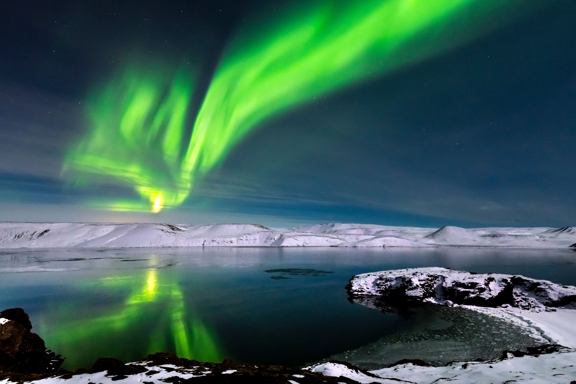
Lower light, fewer visitors, and a decent shot at the northern lights.
Winter
Great for snowy scenery and aurora photos, but you're dealing with short days, ice, possible closures, and strong wind.
Spring
Daylight is growing again, but melting snow can leave trails muddy or icy, and the weather stays pretty unpredictable.
Summer's the easiest choice overall. Autumn and winter are better for travelers ready to deal with changing conditions.
Weather and What to Wear
The lake sits out in the open, so it often feels colder here than in Reykjavík thanks to the wind. Here's what to bring:
- A waterproof outer layer
- A windproof jacket
- Something warm underneath
- Sturdy shoes or hiking boots
- A hat and gloves if you're visiting outside summer
- Traction aids if conditions call for them
- A fully charged phone
- An offline map
- Food and water if you're planning to stay a while
Safety at Kleifarvatn
The weather can change quickly here, and strong winds are pretty normal. A few things to keep in mind before you go:
- Cold, deep water with no one watching over it
- Slippery shorelines in spots
- Loose volcanic rock underfoot
- Fog that can roll in fast on the hiking routes
- Real hazards near Seltún's steam vents and mud pots
- Earthquakes and temporary road closures, which are just part of life in this area
Check these before you head out:
- Weather forecasts
- Road conditions
- SafeTravel Iceland notices
- Icelandic Meteorological Office alerts
- Any police or civil protection closures
Can You Swim in Kleifarvatn?
No, this isn't a spot for swimming, and it shouldn't be treated like one.
The water's cold, the lake is deep, and there's no one keeping watch. Shore access is uneven and the weather can flip fast. The geothermal activity nearby doesn't warm up the whole lake, so don't mix this up with the Blue Lagoon, Sky Lagoon or any of Iceland's heated pools.
Can You Fish at Kleifarvatn?
Trout have been reported in the lake, but you'll need to sort out permits and fishing rights before you cast a line. Rules around seasons, catch limits and gear can vary, so don't assume fishing here is free or unregulated.
Wildlife and Nature
You might spot some waterbirds depending on the time of year, along with fish under the surface and patches of moss and heathland around the shore. Changing water levels have shaped the ecosystem here over time.
A few ground rules:
- Don't disturb nesting birds
- Keep your distance from any wildlife you see
- Stay off the fragile moss
- Carry out your trash
- Don't move rocks or step into geothermal areas
Seltún Geothermal Area
Seltún is just down the road from Kleifarvatn, and it gives you the geothermal drama the lake itself doesn't really show off.
Expect bubbling mud pots, fumaroles, steaming vents and brightly colored mineral deposits, all viewable from marked boardwalks. A visit usually takes 30 to 60 minutes, and there's proper parking here. Stick to the paths, since the ground near the active spots can be thin and unstable.
Why Is Kleifarvatn Called a Geothermal Lake?
It sits inside the Krýsuvík high-temperature geothermal area, and some parts of the lake do have localized geothermal activity. That said, the whole lake isn't warm. Heated groundwater moves through cracked volcanic rock underneath, but if you actually want to see geothermal features up close, Seltún is where that happens.
The Story Behind the Landscape
The lake sits in a basin shaped by faulting and volcanic activity, part of the bigger Krýsuvík volcanic system. This whole area sits where the North American and Eurasian plates are slowly pulling apart, and that stretching is what creates the cracks, ridges, and black sand you see around the lake.
The 2000 Earthquakes and the Falling Lake Level
This is Kleifarvatn's most popular story. Earthquakes in 2000 opened up cracks in the rock under and around the lake, letting water drain underground faster than normal. The water level dropped a lot, exposing shoreline that had been underwater for years. The lake has kept fluctuating since then, so its shoreline looks a bit different depending on when you show up.
Nearby Reykjanes Attractions
Kleifarvatn works best as one stop on a bigger Reykjanes loop, and there's plenty nearby worth building your day around. Here's how the closest attractions stack up, grouped by how far you'll need to drive.
Closest Stops
These are all just a few minutes from Kleifarvatn and easy to fit into the same trip.
- Seltún: the closest and most rewarding pairing with Kleifarvatn, just down Route 42. Expect bubbling mud pots, steam vents, and boardwalks, and plan for 30 to 60 minutes here
- Grænavatn: a small, strikingly green crater lake a short drive south. The color comes from minerals and the way light hits the water, and it's worth a quick five minute stop rather than a long visit
- Krýsuvík: the wider volcanic and geothermal area that contains both Kleifarvatn and Seltún, plus some old farm remains that show this empty looking landscape once had people living on it
- Sveifluháls: the ridge west of the lake, for hikers who want elevated views. These routes involve real elevation gain, so plan on one to two hours if you're climbing it


Southern and Western Reykjanes
A bit further west, these spots make sense if you've got a half day or more to spend on the peninsula.
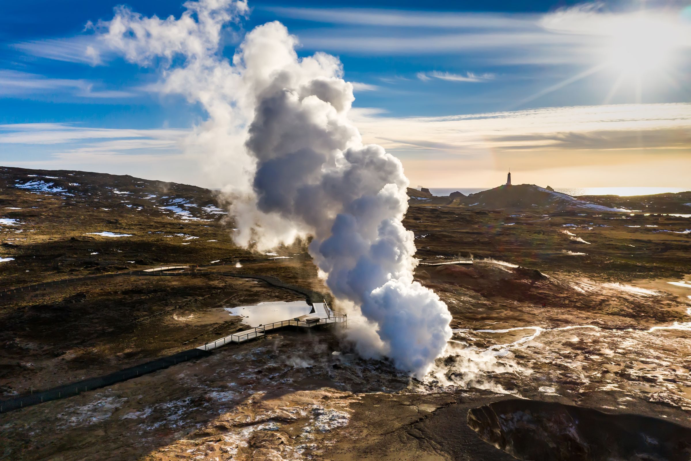
- Gunnuhver: a powerful geothermal area farther west, known for its steam vents and a folktale about a ghost named Gunna. Boardwalks keep you a safe distance from the hottest ground
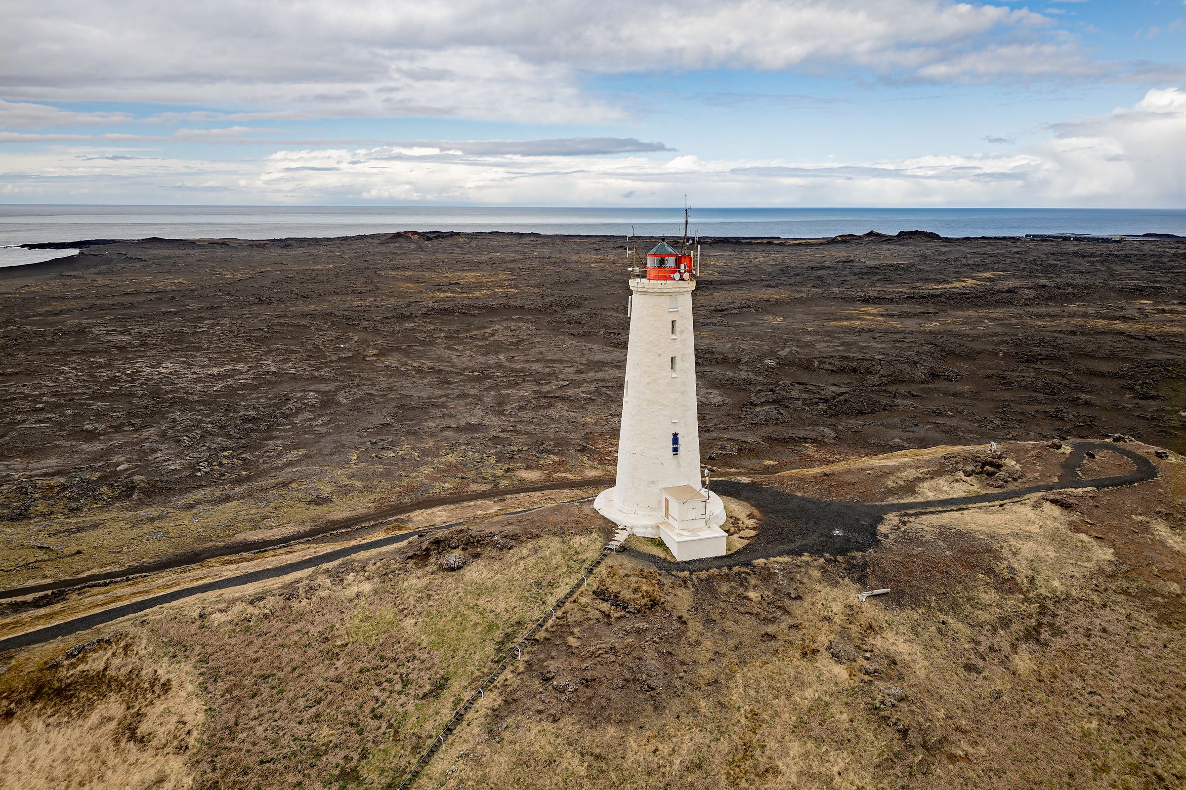
- Reykjanes Lighthouse: pairs well with Gunnuhver since they're just a few minutes apart. It's Iceland's oldest lighthouse site, sitting above dramatic sea cliffs
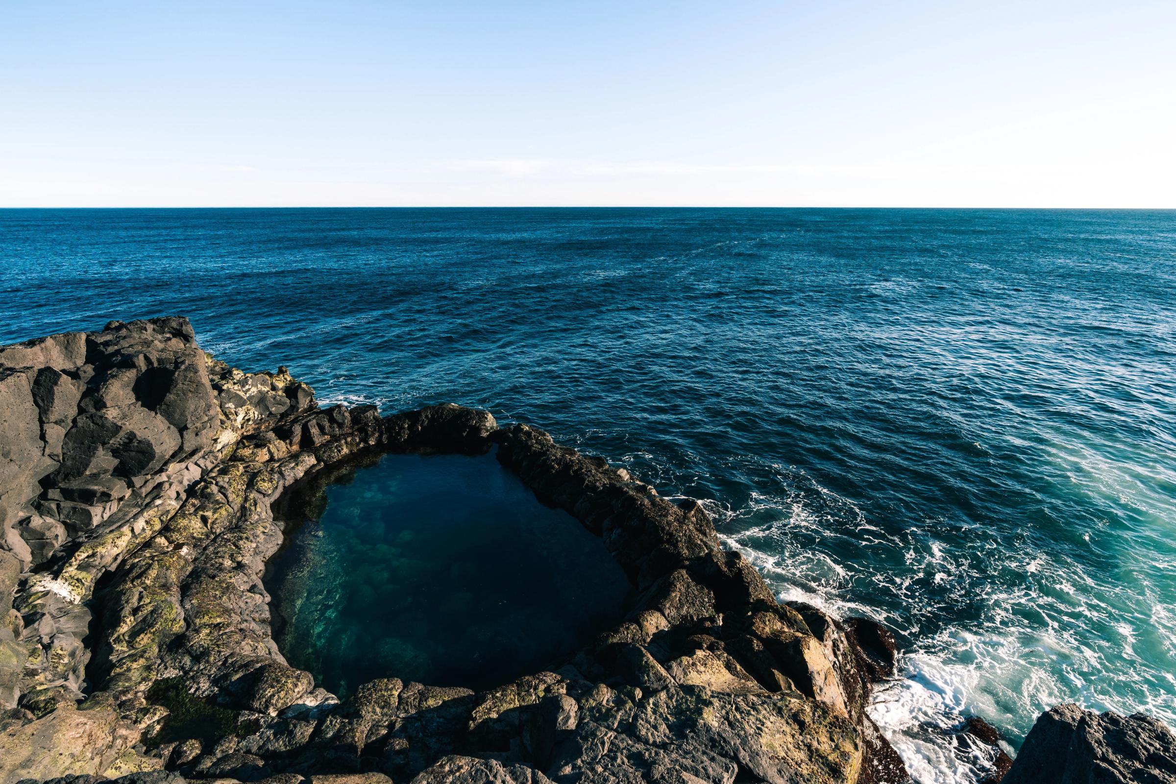
- Brimketill: a wave-carved rock pool that's dramatic to look at but not safe to swim in. Waves can crash right over the platform in rough weather, so keep your distance instead of climbing down
- Bridge Between Continents: a symbolic footbridge over a fissure that's said to mark the gap between the North American and Eurasian plates. Good for a quick photo, not really a destination on its own
Spa and Relaxation
If you want a break from the raw, undeveloped scenery around Kleifarvatn, this is where to find it.
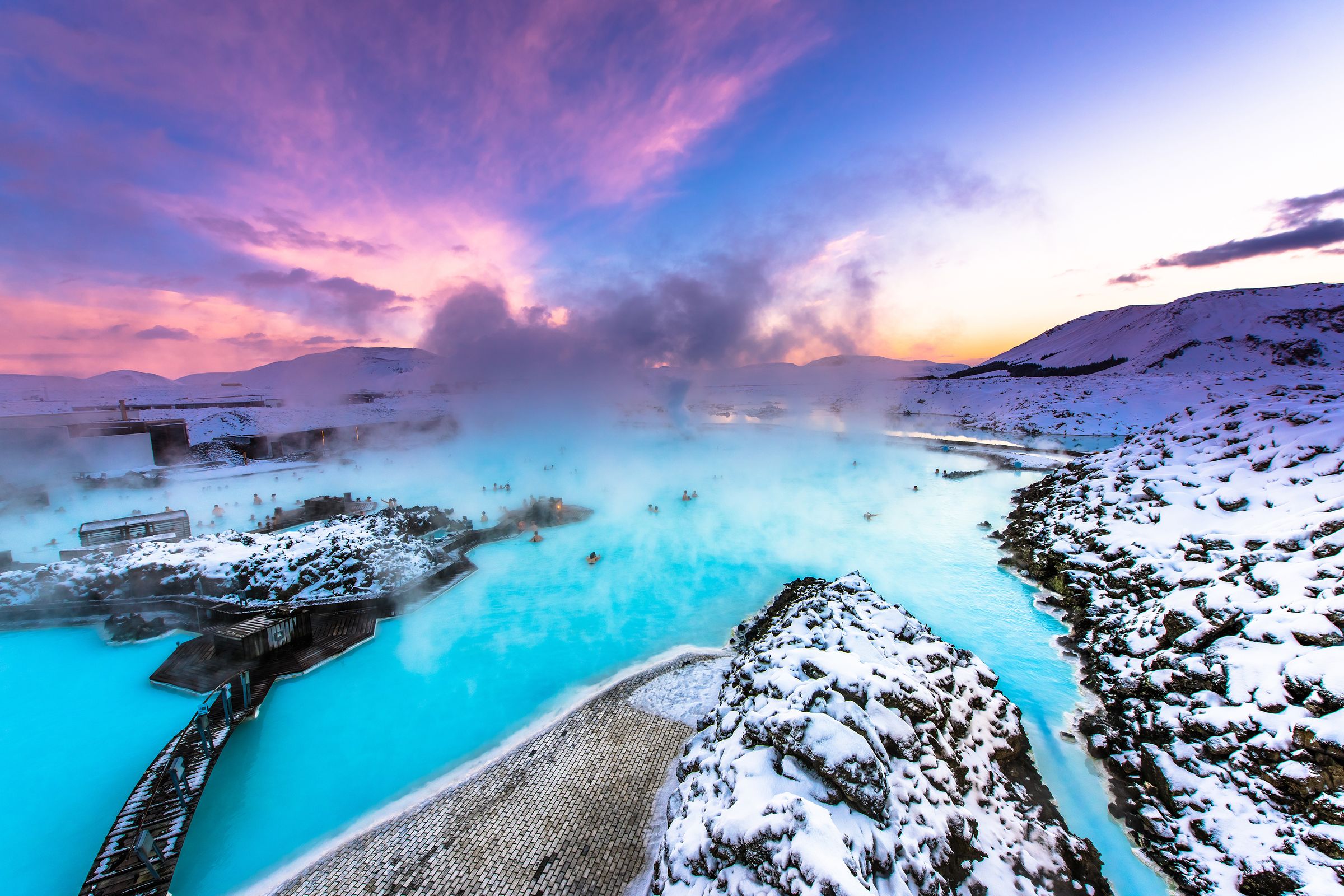
- Blue Lagoon: a nice contrast to the rough landscape here. It's a developed, heated bathing lagoon in a totally different part of the peninsula, and booking ahead is a good idea.
Towns and Services
For fuel, food or a place to sleep, these towns anchor the Reykjanes area.
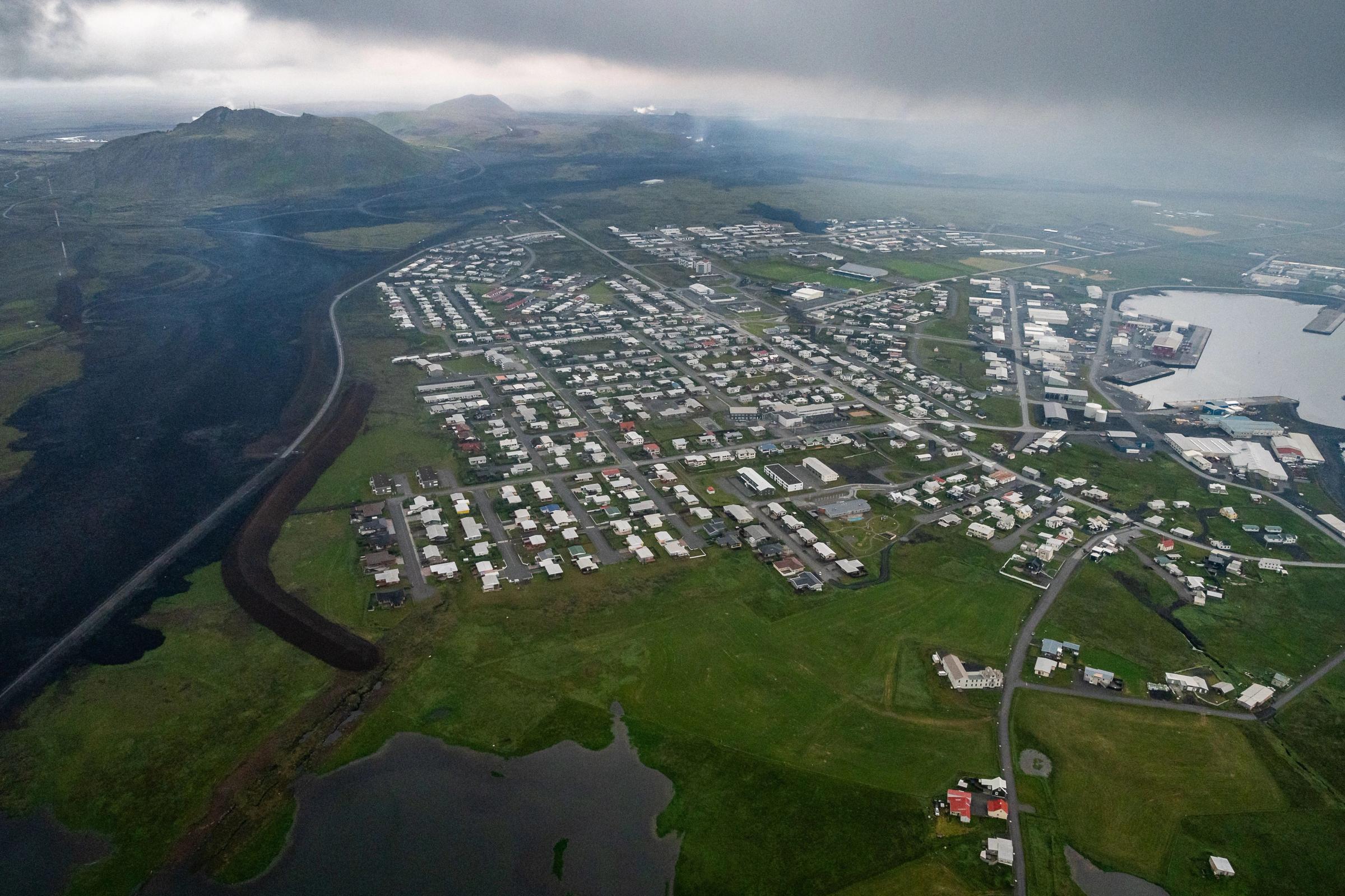
- Grindavík: check the current access situation before building it into your plans, since road status and services here can change
- Hafnarfjörður: a solid base with more to offer, including restaurants, supermarkets, and more accommodation choices than you'll find right on the peninsula

Where to Eat and Stay Nearby
Don't expect any food service at the lake itself. Here's what you should know before heading out:
- Nearest towns: cafés, fuel, and supermarkets are available in Hafnarfjörður and other towns close by
- Accommodation: Reykjavík, Keflavík, and the wider Reykjanes Peninsula all have plenty of options
- Day trip or overnight: most people treat Kleifarvatn as a day trip rather than somewhere to stay
- What to bring: snacks and water, since there's nothing to buy at the lake
- Grindavík: check its current status before counting on it for supplies
Responsible Travel
A few small habits go a long way toward keeping this place intact for whoever visits after you:
- Stay on marked paths at geothermal sites
- Don't drive off-road
- Don't park on vegetation
- Protect the moss
- Carry out your rubbish
- Use toilets where they're available
- Avoid disturbing birds
- Follow any posted closures
- Never step into steaming pools or mud pots
- Skip building stone cairns
- Respect private land and fishing rights
Kleifarvatn Folklore
There's an old story about a creature living in Kleifarvatn, sometimes described as a big, dark, whale-like shape moving through the water. There's no real evidence behind it, but the story adds some atmosphere to a lake that already looks a little mysterious. It even inspired Arnaldur Indriðason's crime novel, published in English as The Draining Lake.
Conclusion
Kleifarvatn won't give you a warm soak or a busy visitor center, and that's kind of the point. It's a quiet, dramatic stop that rewards you for getting out of the car, taking in the volcanic scenery and maybe squeezing in a short hike. Pair it with Seltún, check the weather before you go, and you've got one of the more memorable stops on the whole Reykjanes Peninsula.
Frequently Asked Questions About Kleifarvatn