Exploring Leirhnjúkur Lava Fields: Iceland's Steaming Mars-like Landscape
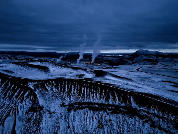
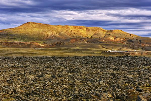
Iceland has many natural wonders, but few places show the Earth's power like Leirhnjúkur. This geothermal area in North Iceland lets you walk through steaming lava fields, see bubbling mud pots, and explore a landscape that looks more like Mars than Earth.
If you like geology, photography, or just seeing unique natural places, Leirhnjúkur belongs on your Iceland trip plan.
Key Takeaways
- Leirhnjúkur lets you walk through an active geothermal area with steaming lava fields
- The black lava is mostly from eruptions during 1975-1984
- Stay on marked trails as the ground is still hot
- Best to visit in summer (June-August) for easier access and milder weather
- Can be paired with nearby Lake Mývatn sites for a full day
What Are the Leirhnjúkur Lava Fields?
Leirhnjúkur sits in the Krafla volcanic system in North Iceland, about 24 km from Lake Mývatn. It's part of a larger area where the Earth's crust is pulling apart, creating a landscape of lava, steam, and colorful mineral deposits.
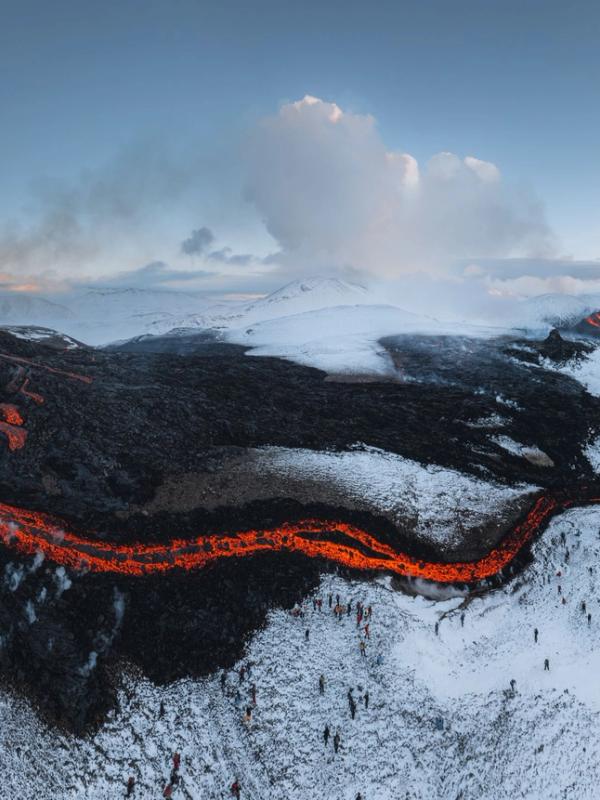
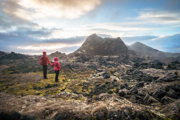
The name means "Clay Peak" in Icelandic, referring to the rhyolite hill at the center that's been changed by heat into clay. What makes this place special isn't just how it looks; it's that you're walking on ground that's quite young in geological terms. Most of the lava fields formed during eruptions between 1975 and 1984, known as the Krafla Fires.
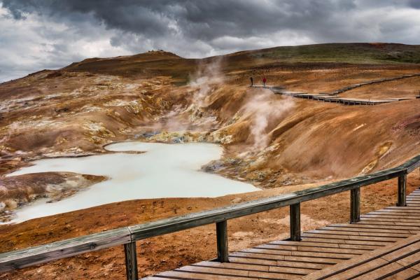
While there's no flowing lava today, the area remains active. Steam rises from vents, mud pots bubble, and in some spots, the ground is hot enough to melt shoe soles if you step off the path.
Formation, Geology & Activity
The Leirhnjúkur lava fields sit within the Krafla caldera, a 10 km wide volcanic basin formed by earlier eruptions. This area marks where the North American and Eurasian tectonic plates are pulling apart at a rate of approximately 2 cm per year.
The main volcanic activity that shaped what you see today happened during two major eruption periods:
- Mývatn Fires (1724-1729): This eruption sequence began with an explosive blast that formed the nearby Víti crater. Lava flowed toward inhabited areas, even threatening the local church at Reykjahlíð.
- Krafla Fires (1975-1984): A series of nine eruptions over nine years created most of the black lava field visible today. The largest eruption occurred in September 1984, and in total, about 36 km² of new lava was produced.
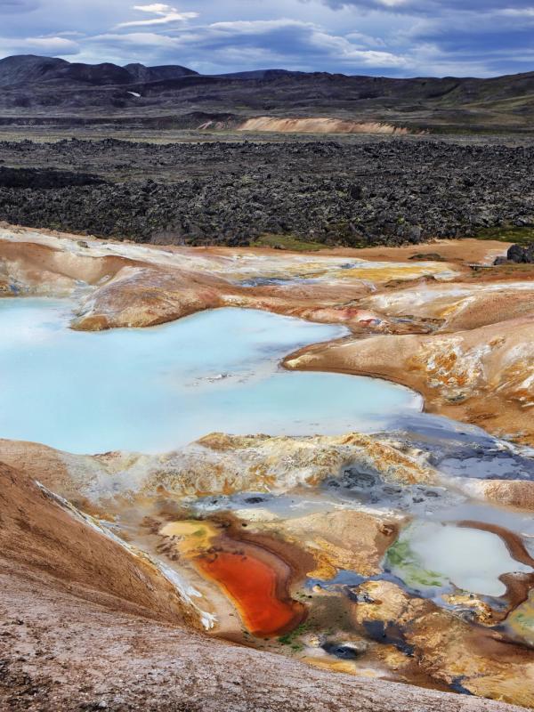
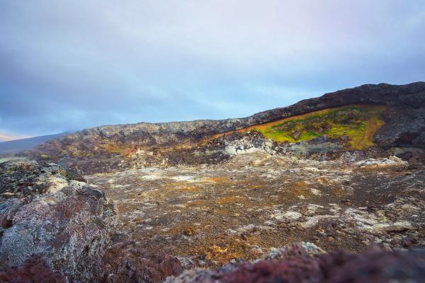
The lava here is mostly pahoehoe, a smooth, ropy type of lava. As you walk the trails, you'll notice different colors in the landscape:
- Black: Fresh basalt lava from the 1980s eruptions
- Red and yellow: Iron oxide and sulfur deposits from geothermal activity
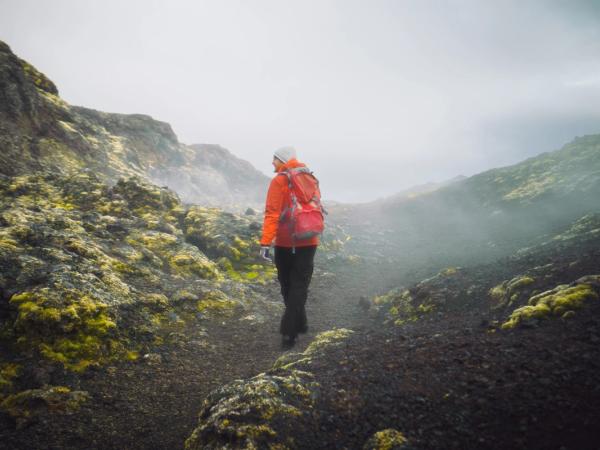
- Green: Moss beginning to grow on older, cooler areas of lava
- Gray: Clay-like rhyolite that makes up the central hill
What's interesting is that despite being 40+ years since the last eruption, the ground beneath remains hot. A shallow magma chamber about 3 km below the surface continues to heat groundwater, creating the steam vents and mud pots that make Leirhnjúkur feel alive and active.
Location & How to Get There
Leirhnjúkur is located in North Iceland, roughly a 5-hour drive from Reykjavík or about 1.5 hours from Akureyri, Iceland's second-largest metropolis.
The easiest way to reach Leirhnjúkur is by car:
- From Akureyri, drive east on Ring Road (Route 1)
- Turn north onto Road 863, following signs for "Krafla/Víti"
- After passing the Krafla Power Station, you'll see the parking lot on your right
- The drive from Reykjahlíð takes about 20-30 minutes
If you don't have a rental car, several tour companies offer day trips to Krafla/Leirhnjúkur from Mývatn or Akureyri. These often include other attractions in the area as part of a "Diamond Circle" route.
Seasonal Access: The road to Leirhnjúkur (863) is generally accessible to standard 2WD vehicles during the summer months (June-August). In winter (November-March), the road may be closed or require a 4x4 vehicle due to snow and ice. Always check road conditions at road.is before setting out, especially in spring and fall.
The parking lot has basic facilities, including information boards and simple toilets. There are no shops or restaurants on site, so please bring your own water and snacks.
Things to Do at Leirhnjúkur
From hiking through steaming lava fields to taking photos of colored mineral deposits, Leirhnjúkur offers several unique experiences for visitors.
Hike the Leirhnjúkur Loop Trail
The main activity here is hiking the marked trail through the lava fields. You have two options:
- Short Loop (1 km, 30-45 minutes): An easy walk focusing on the geothermal features near the parking area. This flat trail includes wooden boardwalks over fragile or hot areas and works for most visitors, including families with children.
- Full Loop (4.7 km, 1-1.5 hours): A moderate hike circling the entire lava field with more varied terrain. This route includes the short loop plus extensions to more distant parts of the field, offering wider views and a more complete experience. There's about 334 feet (102 meters) of elevation gain, mostly gentle.
The trails are marked with stakes and ropes, and in some areas, wooden boardwalks protect both visitors and the delicate landscape. Information signs along the way explain the geological features and eruption history.
As you hike, you'll see:
- Steaming fissures and vents
- Bubbling mud pots
- Colorful mineral deposits
- Fresh black lava flows
- Areas where moss has begun to grow
Visit Víti Crater
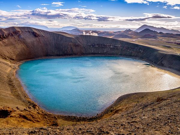
Just a short walk from the Leirhnjúkur parking area is Víti (meaning "Hell"), a large explosion crater formed during the 1724 eruption. This dramatic crater contains a blue-green lake that makes for incredible photos.
A path leads around the crater rim, offering different views of both the crater itself and the surrounding landscape. The bright blue water against the reddish crater rim creates one of the area's most photogenic spots.
Note: Unlike some other hot springs in Iceland, the water in Víti is not suitable for bathing - it can be near boiling in spots, and the crater sides are steep and dangerous.
Photography
Leirhnjúkur is great for photography. The contrast between black lava, colorful minerals, white steam, and blue sky creates striking images. Some good photo opportunities include:
- Steam rising from fissures in the lava field, especially backlit in the morning or evening
- The bright blue-green of Víti crater
- Close-ups of yellow sulfur crystals and red iron oxide deposits
- Wide landscape shots showing the contrast between fresh lava and older terrain
The best light for photography is typically early morning or evening when the low sun creates long shadows and adds texture to the lava field. Overcast days can also be good for photography here, as they allow the colors to stand out without harsh shadows.
Geological Observation
For geology fans, Leirhnjúkur is like an open-air classroom. You can observe:
- Different types of lava formations, including ropy pahoehoe and blocky a'a lava
- Tectonic fissures related to the spreading of the Earth's crust
- Active geothermal features showing the interaction between magma and groundwater
- Early ecological succession, as moss and lichens begin to grow on the lava
The signs along the trail help identify these features, making it interesting even to those without a geology background.
Practical Information for Visitors
Before setting out to explore this volcanic area, here are some key details to help you plan your visit and make the most of your experience.
Weather
The weather at Leirhnjúkur can be unpredictable and change quickly. The area is exposed, and its elevation (about 590 meters above sea level) means it's often windier and colder than nearby Mývatn.
- Summer (June-August): Temperatures typically range from 5 to 15°C (41 to 59°F). Even on warm days, the wind can make it feel cold.
- Winter (November-March): Temperatures range from -10 to 0°C (14 to 32°F), with snow cover ordinary and shorter daylight hours.
- Wind: Always a factor to consider. Strong winds can blow steam across paths or make walking difficult in exposed areas.
- Precipitation: Rain showers can occur at any time of year. In winter, snow and ice make the trails more challenging and potentially dangerous.
Best Time to Visit
The ideal time to visit Leirhnjúkur is during the summer months (June through August) when:
- Trails are free of snow and ice
- Daylight hours are long (nearly 24 hours in June/July)
- Temperatures are mild, making hiking comfortable
- Road access is reliable for all vehicle types
If you prefer fewer crowds, consider late May or early September when the weather is still relatively good but there are fewer tourists. The landscape looks different in different seasons:
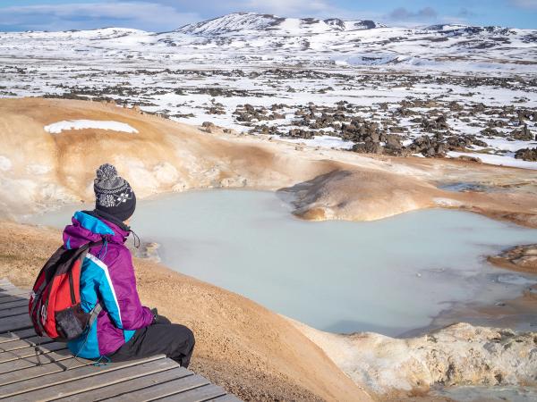
- Spring: Patches of snow may still be visible against the black lava, creating striking contrasts
- Summer: Longest days and best trail conditions
- Fall: Lower light angles create dramatic shadows and lighting on the lava field
- Winter: Snow-covered lava with steam melting holes through the white blanket offers an actual "fire and ice" experience, though access is more difficult
For photography, early morning or evening offers the best light, especially in summer when the low sun angle brings out textures in the lava field.
What to Bring
To ensure a comfortable and safe visit to Leirhnjúkur, bring:
- Sturdy hiking boots: The ground can be sharp, uneven, and in some places hot. Thin-soled shoes aren't recommended.
- Layered clothing: Weather can change quickly, so have options to add or remove layers.
- Waterproof/windproof jacket: Essential in Iceland, regardless of season.
- Hat and gloves: Useful even in summer due to wind and sometimes cold temperatures.
- Water and snacks: There are no facilities at the site beyond basic toilets located at the trailhead.
- Sunglasses and sunscreen: The UV reflection off black lava can be intense, even on cloudy days.
- Camera: You'll want to capture the unusual landscape.
- Map or trail guide: Although trails are well-marked, having an overview can be helpful.
Optional but useful:
- Hiking poles: Helpful for the longer trail, especially on uneven terrain
- Scarf or mask: Can protect from occasional sulfur odors near vents
Things to Do & Places to Visit Nearby
The Leirhnjúkur lava fields are just one highlight in a region full of natural wonders. Make the most of your journey north by exploring these nearby attractions.
Námafjall Hverir
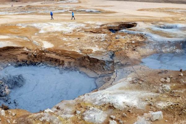
Just 9 km (5.6 miles) from Leirhnjúkur, this geothermal area features large mud pots, steam vents, and fumaroles. The landscape is unusual, with colorful mineral deposits and a strong sulfur smell. The terrain is flatter and more accessible than Leirhnjúkur, making it a good complement.
Lake Mývatn
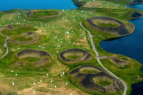
A 24 km (15 miles) drive from Leirhnjúkur, this shallow lake and its surroundings offer a completely different ecosystem. The area is known for:
- Unique volcanic formations called pseudocraters
- Rich birdlife, especially waterfowl
- Lava formations at Dimmuborgir ("Dark Castles")
- Grjótagjá, a small lava cave with a hot spring inside
Mývatn Nature Baths
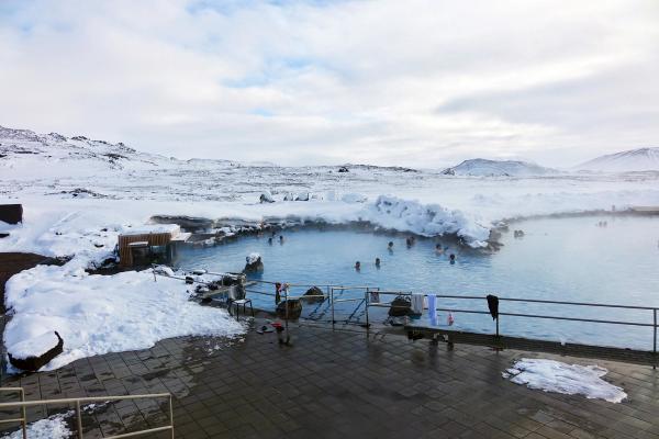
After hiking through volcanic terrain, these geothermal baths offer a perfect place to relax. Less crowded and less expensive than the Blue Lagoon near Reykjavík, the milky blue waters are rich in minerals and naturally heated by the same volcanic system you explored at Leirhnjúkur.
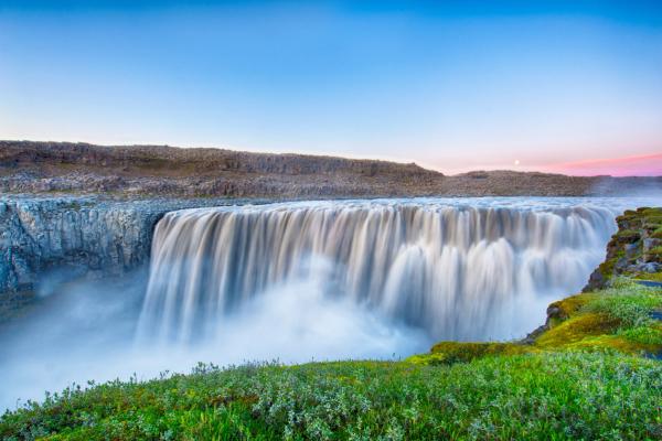
Dettifoss Waterfall
About an hour's drive from Leirhnjúkur, Dettifoss is Europe's second most powerful waterfall. The massive volume of water crashing down creates an impressive display of nature's force, offering a stark contrast to the volcanic landscapes you've explored.
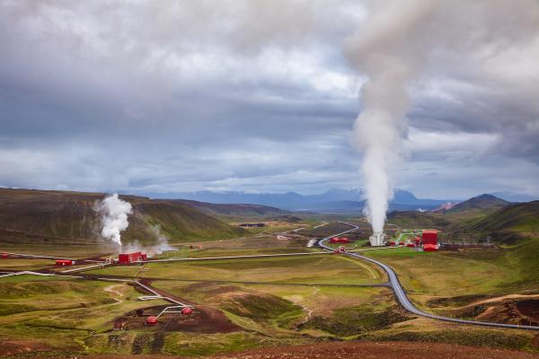
Krafla Power Station
Just before reaching Leirhnjúkur, you'll pass this geothermal power plant. While not typically open for tours, it shows how Iceland uses its volcanic activity for clean energy. Information boards outside explain how the plant works.
Most visitors combine Leirhnjúkur with at least one or two other attractions in the area, creating a full-day itinerary. A popular route is:
- Morning: Leirhnjúkur hike
- Lunch in Reykjahlíð
- Afternoon: Námafjall Hverir and Dimmuborgir
- Evening: Relax at Mývatn Nature Baths
Safety at Leirhnjúkur
While Leirhnjúkur offers an accessible window into volcanic processes, it's important to remember that this is an active geothermal area with real hazards:
- Stay on marked trails: The ground off-trail may be thin crust over hot mud or water. People have been severely burned by breaking through seemingly solid ground.
- Watch for steam vents: Keep a safe distance from fumaroles and steam vents. The steam is scalding hot and may contain sulfur gases that can irritate your lungs.
- Dress appropriately: The weather changes quickly, and exposure can be hazardous. Proper footwear is essential; the ground is not only uneven but can be hot enough to melt thin-soled shoes in some spots.
- Mind the wind: Strong gusts can blow scalding steam across paths or make it difficult to maintain balance on exposed sections.
- Respect closures: If certain areas are roped off or marked as closed, there's a good reason - perhaps new thermal activity or unstable ground.
- Bring water: There are no services at the site, and the sulfur smell can be dehydrating.
The trails are well-designed to keep visitors safe while still offering close-up views of geothermal features. As long as you follow the marked paths and heed warning signs, you can explore this fascinating landscape safely.
Is Leirhnjúkur Worth Visiting?
With so many natural wonders competing for your time in Iceland, you might wonder if Leirhnjúkur deserves a spot on your itinerary. The answer depends on what you're looking for, but for most travelers, it's a clear yes.
If you're in North Iceland, Leirhnjúkur offers a rare opportunity to walk through an active volcanic landscape. Unlike many geothermal areas that are fenced off or viewable only from a distance, here you can get close to steaming vents and fresh lava flows (though always from the safety of the trail).
What makes Leirhnjúkur special compared to other volcanic sites in Iceland is the combination of recent volcanic activity, vibrant colors, and accessibility. The lava here is young enough that it hasn't been fully covered by vegetation, giving you a clear view of the raw geological processes.
It's also less crowded than many of Iceland's southern attractions, so you can experience this unusual landscape without the tour bus crowds that gather at spots closer to Reykjavík.
Conclusion
Leirhnjúkur Lava Fields offers a window into Earth's raw power that few other places can match. Walking among steaming vents, across fresh lava flows, and beside colorful mineral deposits creates an experience that feels both ancient and alien. The landscape tells a story of our planet's ongoing creation; not as distant history, but as a process continuing right beneath your feet.

