Stuðlagil Canyon: Iceland's Hidden Basalt Wonderland
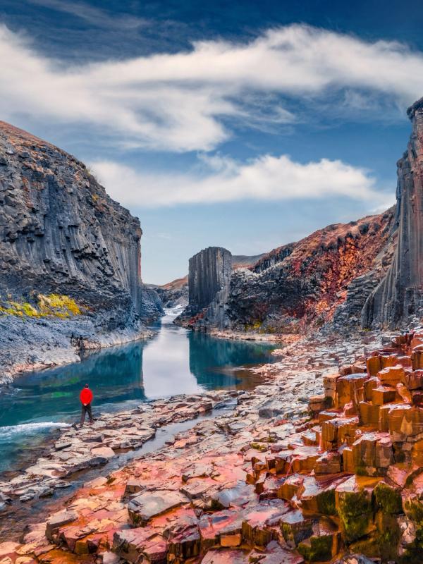
In the remote eastern region of Iceland sits a geological marvel that stayed hidden for centuries. Stuðlagil Canyon, with its tall hexagonal basalt columns and bright blue waters, has become one of Iceland's most stunning natural sights. Though more people know about it now, this relatively new find still feels less crowded compared to Iceland's famous spots.
Key Takeaways
- Stuðlagil Canyon was accidentally revealed in 2006-2009 when the Kárahnjúkar hydropower project diverted the Jökla River, resulting in a 7-8 meter drop in water levels.
- The canyon features Iceland's largest concentration of hexagonal basalt columns, rising up to 30 meters high.
- There are two access points: the east side (longer hike, more immersive) and the west side (quick access to viewing platforms).
- Best visited from May to September, with the bluest water typically seen from March through July.
- Icelandic photographer Einar Páll Svavarsson named and publicized the canyon in 2017, putting it on the tourism map.
What's Stuðlagil Canyon?
Unlike most of Iceland's well-known attractions that people have visited for hundreds of years, Stuðlagil Canyon only recently appeared on the tourism map after a hydroelectric project changed a river's path. It's an unusual case where human building work accidentally revealed an amazing natural site.
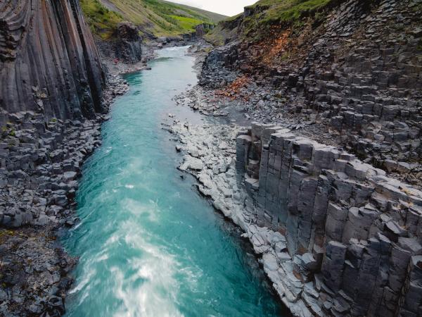
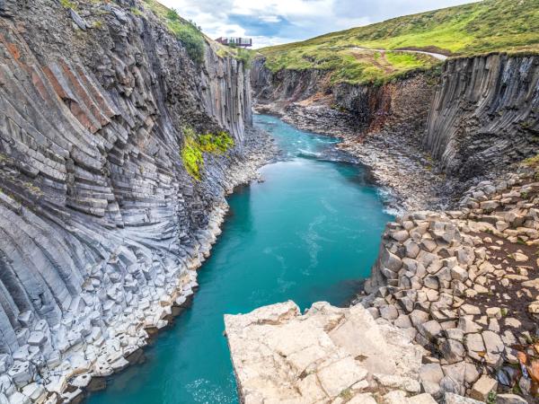
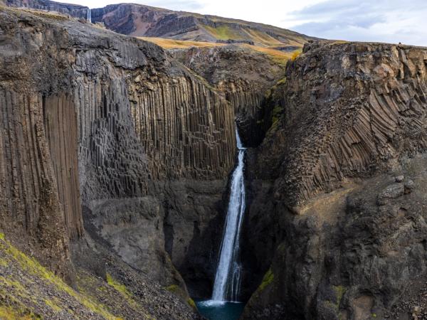
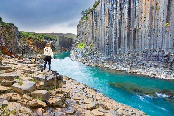
Stuðlagil Canyon contains Iceland's largest collection of hexagonal basalt columns, which stand up to 30 meters high along the Jökla River banks. These regular rock formations look like giant organ pipes or a throne room from a fantasy world.
The name "Stuðlagil" means "basalt column gorge" in Icelandic, which perfectly describes what makes this place special. Found in the Jökuldalur Valley of East Iceland, about 70 km west of Egilsstaðir, the canyon stretches roughly 500 meters, though the whole valley runs much further.
Recent Discovery
What makes this place unique is that it was discovered relatively recently. For centuries, the basalt columns stayed hidden under the rushing waters of the mighty Jökla River. This changed between 2006 and 2009 when the Kárahnjúkar hydropower project redirected much of the river's flow to create the Hálslón Reservoir (one of Europe's largest dam at 193 meters high). This project unexpectedly lowered water levels by 7-8 meters, showing the amazing rock formations that had been underwater for thousands of years.
However, the canyon's shoot to fame is largely thanks to Icelandic photographer Einar Páll Svavarsson, who first documented and named the site after local sheep farmers discovered it around 2016. His photographs in WOW Air's in-flight magazine in 2017 sparked a lot of interest internationally, and Iceland's Minister of Tourism later recognized his work. Without his initiative, this natural wonder might have remained relatively unknown.
Formation & Geology
The earth's fiery past and icy present meet at Stuðlagil, showing the geological processes that shaped much of Iceland's dramatic landscape. Visiting Iceland’s natural wonders is like attending a cool geology class.
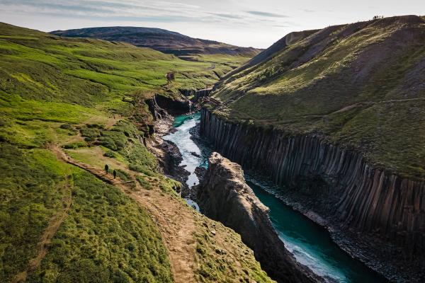
The basalt columns of Stuðlagil formed over 2 million years ago during the Ice Age, through a process called “columnar jointing”. When basalt lava rich in magnesium and iron cooled slowly, it contracted and cracked into remarkably regular hexagonal patterns. Some columns formed perfectly straight up and down, while others look jagged or are partly covered with moss.
The Jökla River
The Jökla River, which starts from Vatnajökull Glacier, carved this valley over thousands of years. Before the hydroelectric project, the river carried about 120 tons of sediment every hour, making it look murky. Now, with reduced flow and less sediment, the river often shows a bright blue color, especially during spring and early summer.
Before the dam was built, the Jökla was one of Iceland's most dangerous rivers. Full of sediment, it was a strong, unpredictable force that made the valley hard to cross and kept the basalt columns hidden.
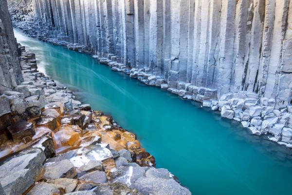
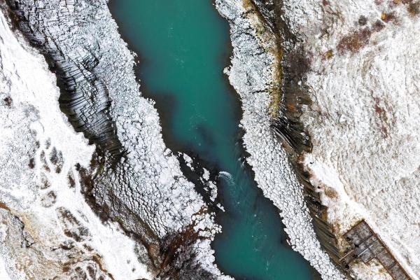
The water color changes with the seasons. From March through July, you'll likely see the bright blue-green shade caused by silica-rich glacial melt with minimal sediment. In fall and winter, or after heavy rain, the water may turn gray-brown due to increased glacial silt.
Location & How to Get to Stuðlagil
Reaching this hidden gem requires some effort, but the journey through East Iceland's dramatic landscapes is part of the adventure and well worth it. For me, the remoteness of Stuðlagil makes it even more appealing and helps keep the experience pristine despite growing visitor numbers.
Stuðlagil Canyon is located in the eastern part of Iceland, in the upper Jökuldalur Valley. The nearest town is Egilsstaðir, about 70 km east. Getting there requires some planning, as it's in a remote area with limited facilities.
By car, the journey from Reykjavík takes about 7-8 hours (nearly 600 km), making it too far for a day trip from the capital. From Egilsstaðir, it's a more manageable 1-hour drive. Head west on the Ring Road (Route 1) for about 52 km, then turn south onto Road 923 (a gravel road) at Skjöldólfsstaðir farm.
There are two access points to the canyon, about 5 km apart by car:
East Side (Klaustursel Farm)
This side offers the most immersive experience and is recommended for those who want to get close to the basalt columns.
- From Route 1, drive about 14 km on Road 923 to the Klaustursel farm signs.
- Turn left and cross the small bridge over the river.
- You have two parking options: Park at the free lot A before the pedestrian bridge for a longer hike (9.6 km round-trip, 2-3 hours), or if you have a 4WD vehicle in dry conditions, continue 2 km on rough gravel to paid lot Klaustursel (1000 ISK fee, shorter 5.6 km round-trip hike).
- The trail is relatively flat with some gentle hills. You'll pass Stuðlafoss Waterfall about 1.5 km in, and eventually descend via ropes to the riverbed (which can be slippery when wet).
West Side (Grund Farm)
This option provides quick access to viewing platforms with panoramic views.
- Continue on Road 923 for about 19 km from Route 1 to Grund farm.
- Park in the free lot and walk about 250 meters to the elevated viewing platforms.
- From here, 239 metal stairs lead down closer to the canyon, though not all the way to the floor.
- Facilities include toilets (250 ISK), a seasonal food truck, and a small gift shop.
Public transport to the canyon is limited. In the summer, a bus (route 56) runs a few times a week from Akureyri to the Skjöldólfsstaðir area, but you'd still need to arrange transport for the final stretch.
For those who prefer not to drive, guided tours from Egilsstaðir or nearby towns combine Stuðlagil with other local attractions such as the Vök Baths or Hengifoss Waterfall. Multi-day Ring Road tours from Reykjavík sometimes include Stuðlagil as part of an East Iceland detour.
Hiking to Stuðlagil Canyon
The path to beauty often takes effort but gives the best rewards. Stuðlagil's trails offer a range of experiences, from casual viewpoints to immersive journeys among the basalt columns, allowing visitors of different abilities to enjoy this natural wonder.
The east side trail offers the most rewarding experience. From parking lot Klaustursel, it's about a 50-60 minute hike (2.5 km one way) along the river and above the canyon rim to reach the main basalt column area.
The path is unpaved but well-worn, with some uneven ground and potentially muddy sections if it rains. Sturdy shoes are essential. Along the way, you'll pass Stuðlafoss waterfall, a smaller cascade framed by basalt columns that gives a preview of what's to come.
When you reach the canyon's entrance, ropes help you descend a steep bank to the riverbed. This allows you to stand among the columns at water level, which is an unforgettable perspective. Be very careful on the rocks by the water, especially if you climb onto the basalt formations in the middle of the river. These stones can be very slippery, and there are no safety railings.
The west side offers a much shorter walk: just 5-10 minutes from the car to the viewing platform. While you won't get the immersive experience of being at water level, the aerial view provides an excellent perspective of the canyon's scale and symmetry.
Things to Do at Stuðlagil Canyon
From taking the perfect photo to simply taking in the atmosphere, Stuðlagil offers more than just a quick picture opportunity. The canyon and surrounding valley reward those who take time to explore and appreciate the unique geological features and natural environment.
Photography
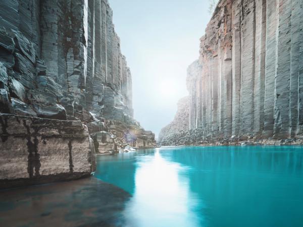
Stuðlagil is a photographer's paradise. The most iconic shots are taken from river level on the east side, where the basalt walls form a perfect, symmetrical corridor around the blue stream. Use a wide-angle lens to capture the full height of the columns and the breadth of the canyon in one frame.
For the best light, plan your shoot during the early morning or late evening when the sunlight is soft and warm, which improves the texture of the hexagonal columns.
Hiking and Exploration
Beyond the main viewing areas, the surrounding valley offers additional hiking opportunities. From the east side, you can extend your walk upstream toward Stuðlafoss or explore more of the basalt formations along the riverbed. The entire valley is a geological playground worth exploring.
Wildlife Watching
The Jökuldalur Valley supports various highland bird species. In May and June, pink-footed geese nest along the gorge, migrating from Greenland and Canada. You might also spot whimbrels, golden plovers, and common snipes. Iceland's only wild reindeer herds occasionally graze in the area during winter. If you’re lucky, you might even see an Arctic fox looking for prey.
Keep your distance from nesting birds, especially during breeding season, and stay on marked paths to avoid disturbing wildlife.
Geology Study
For geology enthusiasts, Stuðlagil offers a textbook example of columnar jointing. You can observe how the basalt columns vary in size, orientation, and pattern, creating a natural laboratory for understanding volcanic processes.
Simply Taking in the View
Sometimes the best activity is just to sit quietly and absorb the landscape. Find a safe spot, perhaps on one of the larger basalt platforms away from the edge, and simply appreciate the geometric precision of nature and the contrast of dark rock against the colored water.
Practical Information for Visitors
Planning makes a big difference when visiting remote natural sites. Knowing when to go, what to expect, and how to prepare ensures you'll have the best possible experience at Stuðlagil while staying safe.
Weather
East Iceland's weather can change rapidly. Even in summer, a sunny day can quickly turn windy and cold in the valley. Always check the forecast (vedur.is) before heading out and dress in layers. The canyon area is exposed with no shelter from rain or wind.
In winter, extreme cold, snow, and white-out conditions are possible. Road 923 receives minimal winter maintenance and may become impassable after heavy snow. Always check road conditions (road.is) if you’re traveling outside of summer.
Best Time to Visit
Late spring through early autumn (May to September) is generally the best time to visit Stuðlagil. During this period, the weather in East Iceland is milder, days are long, and trails are usually snow-free.
The summer months (June-August) are ideal: temperatures are relatively comfortable (15°C on good days), and the river often displays its famous turquoise-blue color. This is also when most facilities and services operate.
For the bluest water, aim for March through early July. By late summer, the river may turn silty gray as glacial melt increases or when the dam releases overflow water.
To avoid crowds, consider visiting early in the morning or late in the evening, particularly during the high season (July-August). The Midnight Sun of June/July allows for visits at unusual hours when the canyon is quieter.
What to Bring
- Sturdy hiking boots with good traction (the terrain is uneven and can be slippery)
- Waterproof jacket and pants (Icelandic weather is unpredictable)
- Layered clothing (temperatures can vary significantly throughout the day)
- Water and snacks (no shops or restaurants along the trail)
- Camera and tripod for photography enthusiasts
- Binoculars for wildlife watching
- Map or GPS device (cell coverage can be spotty)
- Cash for parking and toilet fees (credit cards may not be accepted at all facilities)
- First aid kit for minor injuries
Best Things to Do & Places to Visit Nearby
East Iceland offers many hidden treasures beyond Stuðlagil. Extending your trip to include these nearby attractions will give you a more complete experience of this lesser-visited region, allowing you to discover landscapes and cultural sites that many travelers to Iceland miss.
Stuðlafoss Waterfall
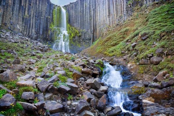
Located just 1.5 km along the east side trail, this waterfall is framed by basalt columns, offering a preview of the geological features of the canyon. It's a natural stop on your hike to Stuðlagil.
Rjúkandafoss Waterfall
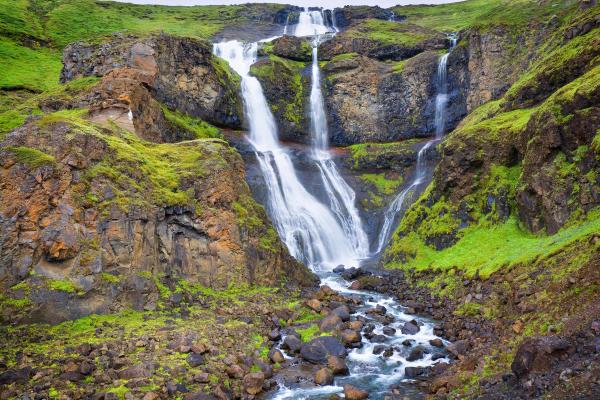
About 20 km east of Stuðlagil on Route 1, you can see this 100-meter waterfall just by pulling off the roadside and walking 5 minutes.
Vök Baths
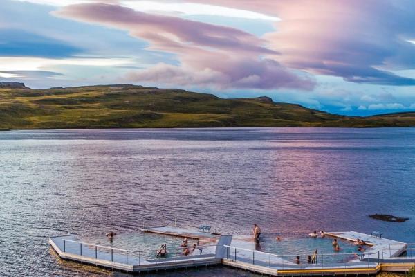
After hiking, soothe your tired muscles at this geothermal spa near Egilsstaðir (about 65 km east of the canyon). Vök features three floating geothermal pools in Lake Urriðavatn, along with saunas and a bistro. Entry costs approximately $61, and many tours bundle Stuðlagil with a stop here. I really recommend this place.
Hengifoss and Litlanesfoss
Located approximately 35 km south of Egilsstaðir, Hengifoss is one of Iceland's tallest waterfalls, standing at 128 meters high. The trail also passes Litlanesfoss, a gorgeous waterfall framed by basalt columns. It's a moderately challenging hike (2+ hours round trip) but offers another spectacular display of basalt formations.
Möðrudalur Farm & Highland Center
About an hour's drive north of Stuðlagil lies Möðrudalur, the highest inhabited farm in Iceland at 469 meters elevation. This family-run farm features a rustic guesthouse, a small church, and a café known for its lamb soup and waffles. The surrounding tundra landscapes provide panoramic views of the distant mountains.
Sænautasel Turf House Farm
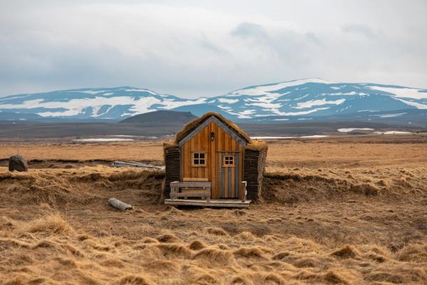
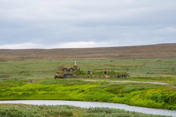
Step back in time at this restored traditional farmstead located on a remote highland prairie near road F907. Sænautasel features old turf-roofed houses that showcase how Icelandic farm life was back in the 19th century. In summer, a small café serves coffee and pancakes in the atmospheric turf huts.
Conclusion
Stuðlagil Canyon represents one of Iceland's most striking examples of how nature and human intervention can sometimes create unexpected beauty. From the dark basalt columns to the colored waters of the Jökla River, every element combines to form a landscape that seems almost designed rather than naturally formed.
Whether you're a geology enthusiast, photographer, hiker, or simply a traveler seeking Iceland's hidden treasures, Stuðlagil Canyon offers a glimpse into the Earth's remarkable architecture. It's a masterpiece of nature.

