

2-Day Diamond Circle Itinerary: Relaxed Route, Best Stops, Overnight Plan & Winter Travel Tips
The Diamond Circle is a 250 km (155-mile) driving loop in North Iceland. It connects five places that are genuinely hard to beat: the Waterfall of the Gods, a volcanic lake ringed by geothermal fields, Europe's most powerful waterfall, a horseshoe canyon tied to Norse mythology, and a coastal town where whale watching is the main event.
You can do it in one day. But you'll be racing daylight, skipping soaks, and arriving at Dettifoss already tired. The 2-day version exists so you're not just checking boxes.
This guide covers everything you need to plan a realistic 2-day Diamond Circle self-drive: a day-by-day route with drive times and stop durations, which roads to take in winter, must-see vs. optional add-ons, where to stay and refuel, and how to fit in the Mývatn Nature Baths or whale watching without feeling rushed.
Quick Facts About the Diamond Circle
Before diving into the days, here's what you need to know about the route at a glance.
- Total distance: ~250 km (155 miles)
- Non-stop drive time: ~5–6 hours
- With stops (2 days): 4–6 hours driving per day
- Start point: Akureyri (most common gateway)
- Overnight base: Reykjahlíð / Lake Mývatn area
- Main roads: The Ring Road (Route 1), Route 85, Route 862/864, Route 87
- Best season: May–September (full access); October–April (4x4 required)
- 4x4 required?: Not always in summer; yes in winter
The Diamond Circle sits in Norðurland eystra (Northeast Iceland), about 30 km east of Akureyri along the Ring Road. Compared to the Golden Circle in the south, it's rawer, quieter, and harder to rush. That's the point.
Map & Route Overview
Most drivers go clockwise from Akureyri, and it works well. You start with easier, more accessible stops and save the remote stretch for Day 2 when you're already comfortable with the roads.
Day 1 Roads
Akureyri → the Ring Road (Route 1) east → Goðafoss → Route 1/848 → Mývatn cluster (base: Reykjahlíð)
Day 2 Roads
Reykjahlíð → Route 862 (Dettifoss west side, paved, winter-friendly) → Route 85 → Ásbyrgi → Húsavík → Route 85/1 back to Akureyri
On the Dettifoss road question: Route 862 (west side) is paved and the sensible default. Better infrastructure, more reliable in winter. Route 864 (east side) is gravel, rougher, and really more of a summer-only option for 4x4 drivers. Unless you have a good reason to take the east side, go with 862.
One more thing: download offline maps before leaving Reykjahlíð. Cell service disappears between Mývatn and Ásbyrgi. You don't want to find that out at the Dettifoss parking lot.

2-Day Diamond Circle Itinerary
Day 1 covers Goðafoss and the Mývatn cluster. Day 2 handles the remote stretch: Dettifoss, Ásbyrgi, and Húsavík. You overnight in Reykjahlíð, which sits right in the middle of the loop and keeps both driving days manageable.
Day 1: Akureyri → Goðafoss → Lake Mývatn Highlights → Overnight in Reykjahlíð
The goal for Day 1 is to keep all the geothermal and lava stops together so you're not constantly re-packing the car. Goðafoss is a quick but genuinely impressive opener, and the Mývatn area has enough variety to fill a full afternoon without feeling like a slog.
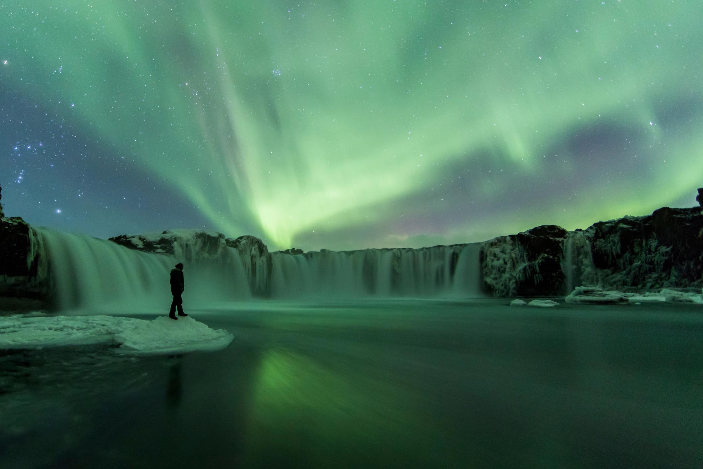
Morning: Goðafoss
Time at stop: 45 minutes
Goðafoss is about 35 km east of Akureyri, right off the Ring Road (Route 1). It's one of the easiest big waterfalls in Iceland to reach. The cascade is roughly 30 meters (98 feet) wide with a 12-meter (39-foot) drop, curving in a wide arc on the Skjálfandafljót River.
Walk both sides. The east bank has a café and restrooms. The west side is quieter and gives you a broader view. A bridge upstream connects them, so it's easy to do both.
The historical context is worth knowing: around the year 1000 AD, the lawspeaker Þorgeir Ljósvetningagoði threw pagan idols into these falls after Iceland's national assembly, the Alþingi, adopted Christianity. That's where the name "Waterfall of the Gods" comes from. It's one of the few waterfalls in the world tied to an actual turning point in a country's history.
In winter, the paths get icy. Microspikes or crampons make a real difference here. And start earlier than you think you need to. Daylight in Iceland moves fast.

Late Morning to Afternoon: The Mývatn Cluster
Drive from Goðafoss: ~45 minutes via Route 1/848
The Lake Mývatn area is where Day 1 earns its keep. The lake was formed about 2,300 years ago when a massive basaltic fissure eruption sent lava across the landscape. Where that lava met wetland water, steam explosions created the pseudocraters (rootless cones) you'll see dotted around the area. The whole zone sits on an active volcanic system connected to the Krafla caldera, right on the Mid-Atlantic Ridge where the North American and Eurasian tectonic plates are slowly pulling apart.
Pick 2-4 stops based on your energy and the weather. Here's the best order for flow:
Hverir / Námaskarð — 15-25 minutes
Hverir is one of the most visually intense spots on the Diamond Circle. The ground is orange, red, and yellow from sulfur and iron deposits. Mud pots bubble constantly, and steam vents hiss. Stay on the marked wooden paths. The crust can be thin, and the mud underneath is hot enough to burn.
The sulfur smell is strong. That's part of the deal.
Dimmuborgir — 20-45 minutes
Dimmuborgir means "Dark Castles." It's a lava field full of jagged pillars, arches, and caverns that formed when pooled lava collapsed thousands of years ago. In winter, snow sitting on black rock makes it look genuinely otherworldly.
The Church Circle loop takes about 30 minutes and is the most rewarding route. If you have the time, skip the short loop and do the fuller trail instead.
Skútustaðagígar Pseudocraters — 10-25 minutes (optional)
These rootless cones are textbook examples of what happens when lava flows over wet ground. Interesting from a geology angle, but if time is tight, this is the most skippable stop in the cluster.
Optional add-ons (pick one if conditions allow):
- Grjótagjá Cave (10-20 min): A lava cave with a hot spring inside. You can't bathe anymore due to temperature fluctuations, but it's atmospheric, especially in the snow.
- Krafla / Leirhnjúkur + Viti Crater (1-2+ hours): Krafla last erupted in the 1980s, and the landscape still looks fresh. Leirhnjúkur is a hike across steaming lava fields; Viti is a circular explosion crater filled with blue water. Only do this if the weather and roads are solid. It adds significant time.


Lunch and Fuel: Reykjahlíð
Grab lunch in Reykjahlíð, the small town on the north shore of Lake Mývatn. There's a grocery store, a café, and an N1 fuel station. Fill up here. There's nothing near Dettifoss or Ásbyrgi, and you really don't want to find that out mid-drive.
This is also a good moment to check road conditions for the next day.
Evening: Mývatn Nature Baths
A 2-day itinerary gives you something a single-day run doesn't: time for a proper soak. The Mývatn Nature Baths (Earth Lagoon Mývatn) are geothermal pools with views across the volcanic landscape. In winter, sitting in hot water while snow falls around you is genuinely something else.
Plan for 60-90 minutes including changing time. The basic ticket for adults costs 7,900 ISK ($65)
Overnight: Reykjahlíð / Lake Mývatn Area
Staying near Mývatn keeps Day 2 driving manageable. It also means you can check road conditions twice before heading to Dettifoss: the evening before and again first thing in the morning.
Options in the area include guesthouses, farm stays, and campsites in summer. Book ahead in peak season.

Day 2: Mývatn → Dettifoss and Selfoss → Ásbyrgi Canyon → Húsavík → Akureyri
Day 2 goes deeper. You're heading into Vatnajökull National Park, through the Jökulsárgljúfur canyon system, and out to the coast at Húsavík. Leave Mývatn early. Wind at Dettifoss is your biggest variable, and mornings tend to be calmer.
Before you go, check road conditions on road.is or call 1777. Also look up wind forecasts on vedur.is (Icelandic Meteorological Office). Dettifoss spray in high wind is not fun.
Morning: Dettifoss and Selfoss (Vatnajökull National Park)
Drive from Mývatn: ~45-60 minutes via Route 862 Time at stop: 60-90 minutes total
Dettifoss is the most powerful waterfall in Europe by volume. It's 44 meters (144 feet) high and 100 meters (330 feet) wide, fed by the glacial river Jökulsá á Fjöllum, which comes from the Vatnajökull glacier. The water runs grayish-white from glacial sediment, which is different from the turquoise you see at most Icelandic waterfalls. The ground vibrates when you stand near it. Bring a waterproof jacket.
Dettifoss sits inside the Jökulsárgljúfur canyon system, one of the most geologically dramatic areas in Iceland, shaped over thousands of years by catastrophic glacial floods known as jökulhlaups.
Before you leave, walk upstream to Selfoss. It's about 10 minutes from Dettifoss, and most people skip it, which means you'll often have it almost to yourself. Selfoss is wider and more graceful than Dettifoss, with a curved curtain of water that's actually easier to photograph.
If the path to Selfoss looks icy or the spray is heavy, don't push it. Dettifoss alone is absolutely worth the drive.


Late Morning / Optional: Hljóðaklettar
Time: 45-90 minutes if you go
Hljóðaklettar (Echo Rocks) is a detour off Route 862 into the Vesturdalur area of Jökulsárgljúfur. The basalt formations here are genuinely unusual. Columns twisted into spirals and geometric shapes, formed by a volcanic eruption around 8,000-9,000 years ago, with glacial floods stripping away the loose material and leaving the cores standing.
The acoustics are the standout feature: sound bounces around the cave formations in ways that feel strange. Great for photography and geology fans. Skip it if weather is turning or you're already behind schedule.
Afternoon: Ásbyrgi Canyon
Drive from Dettifoss: ~35 minutes via Route 85 Time at stop: 45-90 minutes
Ásbyrgi is a horseshoe-shaped canyon about 3.5 km (2.2 miles) long, with cliff walls up to 100 meters high. It's part of Vatnajökull National Park, carved by the same glacial flood system that shaped Jökulsárgljúfur. Norse mythology has a different take: that it's the hoofprint of Sleipnir, Odin's eight-legged horse. Both stories are worth knowing.
In a 2-day plan, Ásbyrgi gets proper time and it deserves it. The canyon is surprisingly green compared to the surrounding landscape, with birch trees, wildflowers, and calm ponds. It feels like a completely different world from Dettifoss.
Start with the short walk to Botnstjörn, a quiet pond inside the canyon with birdlife and forest paths. If you have energy, the rim trail gives you the full horseshoe view from above, one of the best perspectives on the entire Diamond Circle.
The Gljúfrastofa visitor centre has maps and exhibits if it's open.

Late Afternoon: Húsavík
Drive from Ásbyrgi: ~50 minutes via Route 85 Time at stop: 1-3 hours, depending on what you do
Húsavík sits on Skjálfandi Bay and is genuinely Iceland's best spot for whale watching. The bay regularly has humpback whales, minke whales, and occasionally blue whales and orcas. Tours run 2-3 hours with multiple departures daily in summer. Tour prices are around $130, but they are 100% worth it.
In summer, whale watching is the obvious choice. In winter, it's more limited, so check with North Sailing for current departures before you commit.
Option A (experience first): Whale watching tour
Best for summer and shoulder season. Because Day 2 isn't overloaded, you actually have time to do this properly.
Option B (relax first): GeoSea
The GeoSea sea baths are geothermal pools on the cliffs above the bay. On clear days you can see across the water toward the mountains. It's a natural way to close out a big day of driving and walking. Entry prices are ISK 7,490 ($61)
If you're skipping both, the harbor walk and Húsavík Whale Museum take about 30-60 minutes and give you a good feel for the town.

Evening: Drive Back to Akureyri
Distance: ~75 km / ~46.6 miles Drive time: ~1 hour in good conditions
In winter, add extra time and check vedur.is before leaving Húsavík. If the weather gets rough, wait it out over coffee rather than driving into it.
Practical Travel Tips
These are the things that actually matter when you're out there.
Road Conditions and Weather
Check these every morning, and again before the Dettifoss and Ásbyrgi segment on Day 2.
- road.is or call 1777 for live road conditions and closures
- umferdin.is for real-time traffic and road cameras
- vedur.is (Icelandic Meteorological Office) for weather forecasts and wind warnings
- safetravel.is (ICE-SAR) for safety alerts — you can also register your travel plan here
Because you're overnight near Mývatn, you get two chances to check conditions before committing to Day 2's remote roads: the evening before and again first thing in the morning. If Day 2 looks rough, flip the order. Do Húsavík and GeoSea first, and treat Dettifoss as a conditional stop.
Fuel and Food
Fill up at these three points: Akureyri, Reykjahlíð (N1 station near Mývatn), and Húsavík. There's nothing near Dettifoss or Ásbyrgi. Top off whenever you're below half a tank on the remote legs.
Packing List
- Waterproof jacket and pants (Dettifoss spray is real)
- Microspikes or crampons in winter, especially at Goðafoss and Dettifoss
- Offline maps downloaded before leaving Reykjahlíð
- Backup battery pack (cold drains phone batteries fast)
- Headlamp if you're going in winter
- Emergency basics: blanket, snacks, charger, and 112 saved in your phone
Vehicle
A standard 2WD works on the main loop in summer. In winter, a 4x4 with studded tires is not optional. Make sure your rental includes gravel protection since Route 862 can kick up stones.


Best Time to Visit
Summer (May-September)
Daylight runs up to 24 hours in June, which means you can add extra stops without worrying about time. Route 864 opens up, whale watching runs full schedules, and the Mývatn trails are fully accessible. One note: midges around the lake peak in warm months. Pack a head net if you're bothered by insects.
Winter (October-April)
Fewer people, slower pace, and northern lights if you're lucky. Route 862 stays more reliably open than 864. In February you're working with around 8-9 hours of daylight, so starting early matters. The Mývatn Nature Baths in the snow are genuinely worth it. Build flexibility into your plan and have a backup for every major stop.


Is 2 Days Worth It?
One day is doable, especially in summer. But it's a sprint. You're racing daylight, skipping the baths, and doing the math on the next drive while you're still at the current stop.
Two days changes the feel of the whole thing. You have time for the Mývatn Nature Baths or GeoSea. You can actually do a whale watching tour. You have buffer if Dettifoss is brutal on Day 2. And you go to sleep once instead of arriving back in Akureyri at 10 PM wondering where the day went.
Three days is even better if you have the time. A third day opens up longer Krafla hikes, the full Ásbyrgi rim trail, Tjörnes Peninsula, and Hljóðaklettar without cutting anything short. But two days is the sweet spot. All five core stops, done at a pace that actually feels like a trip.

Final Thoughts on the Diamond Circle in 2 Days
North Iceland doesn't reward rushing. The Diamond Circle packs in Europe's most powerful waterfall, active geothermal fields, a canyon carved by glacial floods, and one of the world's best whale watching bays, all within a 250 km loop. Trying to squeeze that into a single day means trading depth for distance.
Two days gives you the route and the experience. You sleep in the middle of a volcanic landscape, wake up with the easier driving already behind you, and finish at the coast. That's the version worth doing.
Frequently Asked Questions About Iceland's Diamond Circle Itinerary


